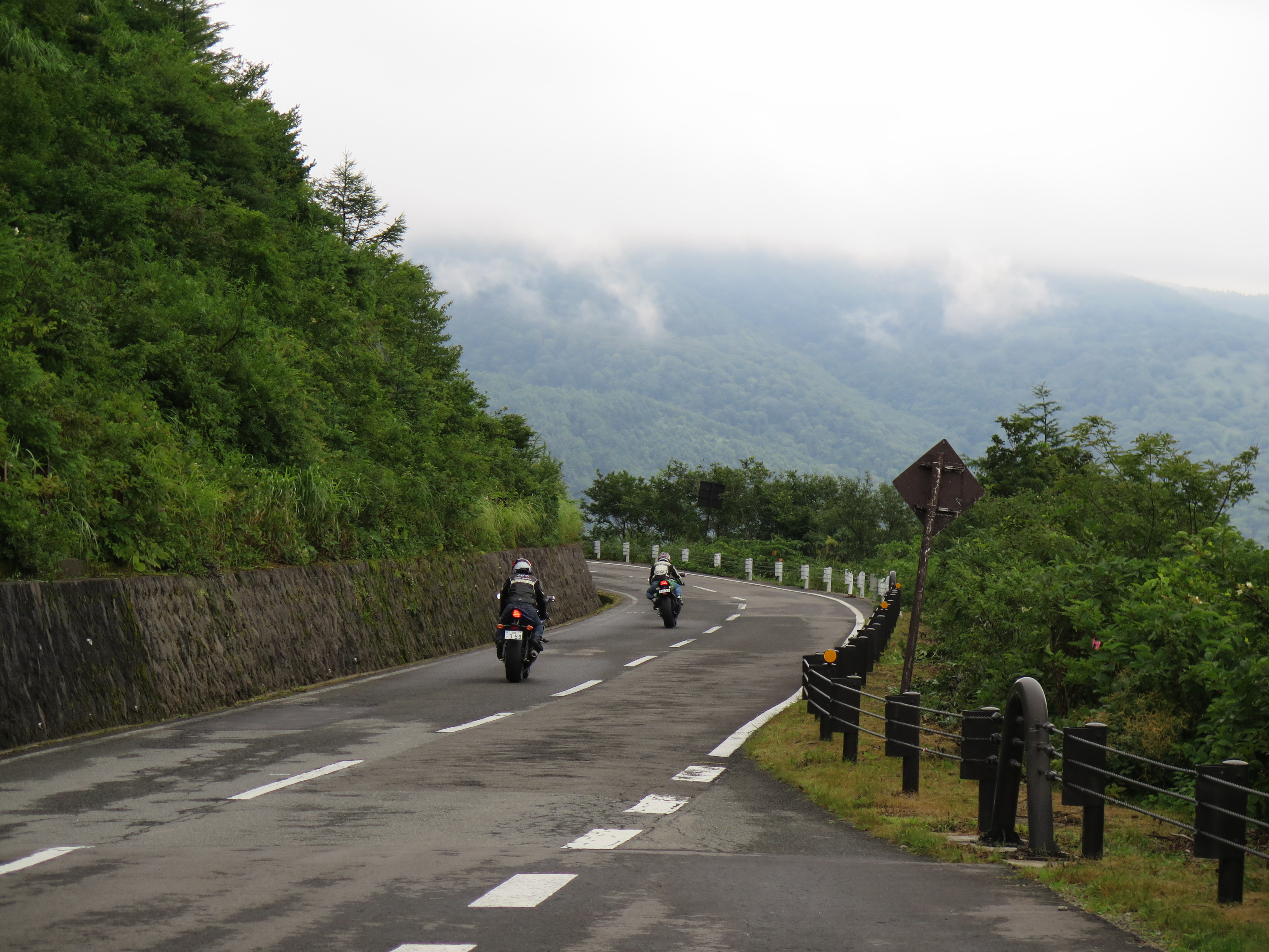
Bandai-Azuma Roadway
The road just vanishes into the sky. At 1,350 meters average elevation, the Bandai-Azuma Skyline spends most of its 29 kilometers above the cloud line, threading through a volcanic landscape so barren and sulfurous that it looks like it belongs on another planet entirely. Opened in 1959 to give the public access to the Azuma Mountain Range within Bandai-Asahi National Park, this stretch of asphalt climbs from the steaming waters of Takayu Hot Springs near Fukushima City to the highland plateau, topping out at 1,622 meters. The Japanese Ministry of Construction named it one of the top 100 roads in Japan -- not for its engineering, but for the sheer scale of what it reveals.
A Road Built for Spectacle
The Bandai-Azuma Roadway was born from a postwar push to open Japan's wild interior to tourism. When it was completed in November 1959, it connected Takayu Hot Springs on its eastern end to the Bandai Highland plateau across 28.7 kilometers of mountain terrain. The project was part of a broader campaign to make Bandai-Asahi National Park -- one of Japan's largest national parks, spanning parts of Fukushima, Yamagata, and Niigata prefectures -- accessible to ordinary visitors. For decades it operated as a toll road, but in July 2013 the toll was permanently lifted, opening this alpine corridor to anyone willing to make the climb. The road now draws motorcyclists, autumn leaf-peepers, and photographers chasing the perfect shot of volcanic terrain against open sky.
Where the Earth Breathes Sulfur
The centerpiece of the drive is Jododaira, a sub-alpine plateau wedged between Mount Issaikyo and Mount Azuma-Kofuji at the road's highest point. The road passes directly beside the crater of Mount Azuma, and visitors can park at the Jododaira Visitor Center and hike a short trail to the crater rim itself. The landscape here is otherworldly -- volcanic gases seep from fissures in bare rock, vegetation thins to nothing, and the ground takes on the muted grays and ochres of a place still being shaped by geothermal forces. Mount Azuma-Kofuji's symmetrical crater bowl, often ringed by wisps of steam, is one of the most photographed volcanic features in the Tohoku region. It is an active volcano, and the Japan Meteorological Agency monitors it continuously.
Walls of White
The Azuma Mountains receive enormous snowfall, and each year the Bandai-Azuma Skyline closes from mid-November through early April. But the reopening is an event in itself. When snowplows cut through the drifts each spring, they carve a narrow corridor between towering walls of packed snow that can reach several meters high on either side of the road. This 'snow corridor' draws visitors who come specifically to drive between those white walls while spring sunshine warms the air above. It is a surreal juxtaposition -- cherry blossoms blooming in the valleys below while winter still grips the mountaintops. By late spring the walls melt away, the alpine marshes of Jododaira fill with wildflowers, and the road takes on its summer character: open, windswept, and endlessly scenic.
Autumn Fire on the Mountainside
The Azuma range sits at the perfect latitude and elevation for vivid autumn color, and the Bandai-Azuma Skyline is one of the premier leaf-viewing drives in all of Tohoku. Because the road spans such a dramatic range of elevations -- from the hot spring valleys near Fukushima City up to the volcanic highlands -- the fall foliage season stretches over several weeks as color moves down the mountainside. At the highest elevations, the sparse alpine vegetation turns gold and rust by late September. Lower down, dense forests of beech, maple, and oak blaze red and orange well into October. Drivers on a clear autumn day see the entire gradient at once: bare volcanic rock above, a band of golden alpine scrub, and then wave after wave of crimson forest descending toward the plains.
From the Air
Located at 37.73N, 140.26E in the Azuma Mountain Range, Fukushima Prefecture. The road climbs to 1,622 meters at Jododaira plateau and is visible from the air as a thin line threading through volcanic terrain on the western flank of Fukushima City. Look for the barren, light-colored volcanic landscape around Mount Azuma-Kofuji's distinctive crater. The road is closed mid-November through early April due to snow. Nearest airport: Fukushima Airport (RJSF) approximately 50nm south-southeast. Sendai Airport (RJSS) lies approximately 70nm to the northeast. Mountain turbulence and cloud cover are common around the Azuma range, especially in afternoon hours. Best aerial views in clear autumn weather when the mountainside foliage is at peak color.