Banning State Park
The rapids have names that sound like chapters from a pulp adventure novel: Blueberry Slide, Mother's Delight, Dragon's Tooth, Little Banning, Hell's Gate. Each spring, kayakers and canoeists line up to run them, and spectators crowd the sandstone bluffs above to watch. But the real story at Banning State Park is not the whitewater. It is the rock itself -- Precambrian sandstone laid down over a billion years ago, exposed by the Kettle River as it carved a narrow gorge through Pine County, Minnesota. That same rock drew hundreds of quarry workers here in the 1890s, built a town, and then abandoned it all within two decades. Today the park stretches along the river near the town of Sandstone, and the ruins of that brief industrial chapter sit quietly among birch and aspen, slowly returning to the landscape that created them.
A Billion Years of Patience
The geology at Banning is ancient and dramatic. The Kettle River flows through a shallow, narrow valley where the topsoil is so thin that the river has cut straight down through the Hinckley Formation -- Precambrian sandstone more than a billion years old -- and into the bedrock below. The result is a gorge that rises up to 40 feet at Hell's Gate, with a mile and a half of continuous rapids churning through it. Giant potholes, smoothed by centuries of swirling water and sediment, dot the exposed rock along the riverbank. Wolf Creek Falls tumbles into the river from a side ravine. Robinson Ice Cave holds pockets of ice well into summer. The Kettle River was designated Minnesota's first Wild and Scenic River in 1975, and the stretch through Banning is the reason why.
The Quarry That Built a Town
In 1892, after the St. Paul and Duluth Railroad laid a spur line to the exposed sandstone outcrop along the Kettle River, quarrying began in earnest. The durable, pink-hued stone was ideal construction material, and by the late 1890s some 500 workers were chiseling massive blocks from the gorge walls. A town sprang up just outside the quarry, named Banning after the president of the railroad whose tracks carried the stone to St. Paul, Duluth, and beyond. The Great Hinckley Fire of September 1, 1894 -- which killed at least 418 people and destroyed nearby Sandstone -- was a devastating setback, but the quarry recovered. By the turn of the century Banning was an incorporated town of about 300 residents. Then the easily extractable high-quality stone ran out, and a nationwide shift from stone to structural steel sealed the quarry's fate. Operations wound down by 1905. An asphalt company lingered until 1912, and when it closed, so did Banning. The railroad pulled up its tracks. The town vanished.
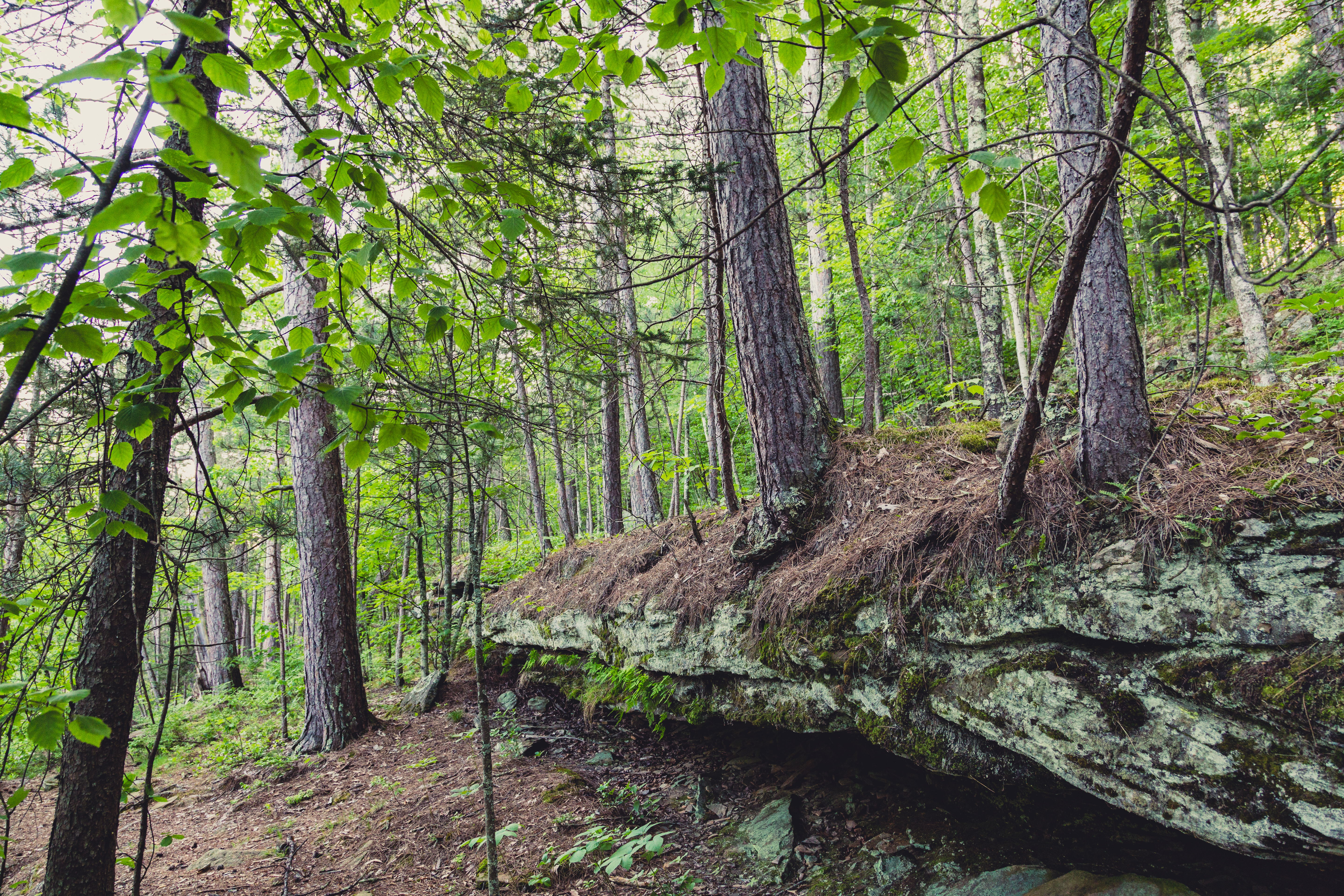
Rebirth from Ruin
The Minnesota Legislature established Banning State Park in 1963, reclaiming the ghost town and its surroundings as public land. Today hikers walk trails that thread past the stone foundations and crumbling walls of the old quarry buildings. The ruins have a particular beauty -- massive cut-stone blocks softened by moss and lichen, half-swallowed by the forest that has reclaimed the stripped ground. The vegetation in this part of the Mille Lacs Uplands is still in recovery from 19th-century logging and fire. Birch and aspen dominate where Norway and eastern white pines once stood, the forest working through its successional stages. In 1995 a dam at the park's southern tip was removed, restoring a waterfall and another series of rapids that the quarry era had silenced. The river, patient as the sandstone it carves, simply picked up where it left off.
Running the Gauntlet
The whitewater season at Banning peaks with spring snowmelt, when the Kettle River swells and the rapids escalate to Class IV. Blueberry Slide opens the run -- a fast, relatively forgiving chute that lets paddlers warm up before the river gets serious. Mother's Delight and Dragon's Tooth demand precise maneuvering through narrow channels and around exposed rock. Little Banning offers a brief reprieve. Then comes Hell's Gate, where the gorge narrows and the river drops through its most technical passage, the 40-foot walls amplifying the roar of the water. Spectators gather on the bluffs above, and the park's campground -- 33 drive-in sites, four canoe campsites along the river, and a camper cabin -- fills quickly on spring weekends. The Kettle River also holds state-record sturgeon, a quieter draw for anglers who prefer their excitement measured in pounds rather than rapids class.
From the Air
Located at 46.165°N, 92.854°W in Pine County, Minnesota, directly adjacent to Interstate 35. The Kettle River gorge is visible as a narrow wooded cut through otherwise flat terrain. The park sits about 100 miles north of Minneapolis. Nearest airports include Sandstone Municipal Airport (local strip), Moose Lake Carlton County Airport (KMZH, 20 miles northwest), and Duluth International Airport (KDLH, 67 miles northeast). Best viewed at 3,000-5,000 feet AGL to appreciate the river gorge cutting through the sandstone. The I-35 corridor provides a clear navigation reference running north-south past the park.