Barabati Fort
A heron jumped on a hawk. That, according to the Madalapanji - the chronicle of the Jagannatha temple at Puri - is why Barabati Fort exists. King Anangabhima Deva III of the Eastern Ganga dynasty was crossing the Mahanadi River sometime between 1211 and 1238 CE when he witnessed this improbable act of avian aggression near the village of Barabati. Reading it as an omen of dominance, he laid the fort's foundation on an auspicious day, moved his capital from Chaudwar, and named the settlement Barabati Cuttack. The story is charming and almost certainly apocryphal - other scholars trace the fort's origins to 987 CE, when Somavamshi ruler Maharaja Markata Keshari built stone embankments to protect the settlement called Kataka from the rivers that both sustained and threatened it. What is not in dispute is the location's strategic logic. Barabati Fort sits at the apex of a delta, the Mahanadi flowing north and its distributary the Kathajodi flowing south, a triangle of land that controlled river traffic, flood management, and military access to the entire Odishan coastal plain.
Every Conqueror's Prize
The fort's ownership reads like a roll call of eastern Indian power. The Somavamshi dynasty built it. The Eastern Gangas expanded it and made Cuttack their capital. In 1568, the Karrani dynasty of Bengal seized it, ending Odisha's medieval independence. The Mughals took it in 1576. The Marathas claimed it in 1741. When the British arrived in October 1803, they found a fort that had changed hands half a dozen times across eight centuries and had never been willingly surrendered - only taken by forces whose empires were, at that moment, stronger than whoever held the walls. Under British control, Barabati's function inverted. What had been the seat of rulers became a prison for them. The Raja of Kujanga was confined here in 1800, the Raja of Surgaja and his family in 1818. The British also intensified the dismantling of the fort itself, a pattern of colonial vandalism that treated indigenous architecture as quarry stone rather than heritage.
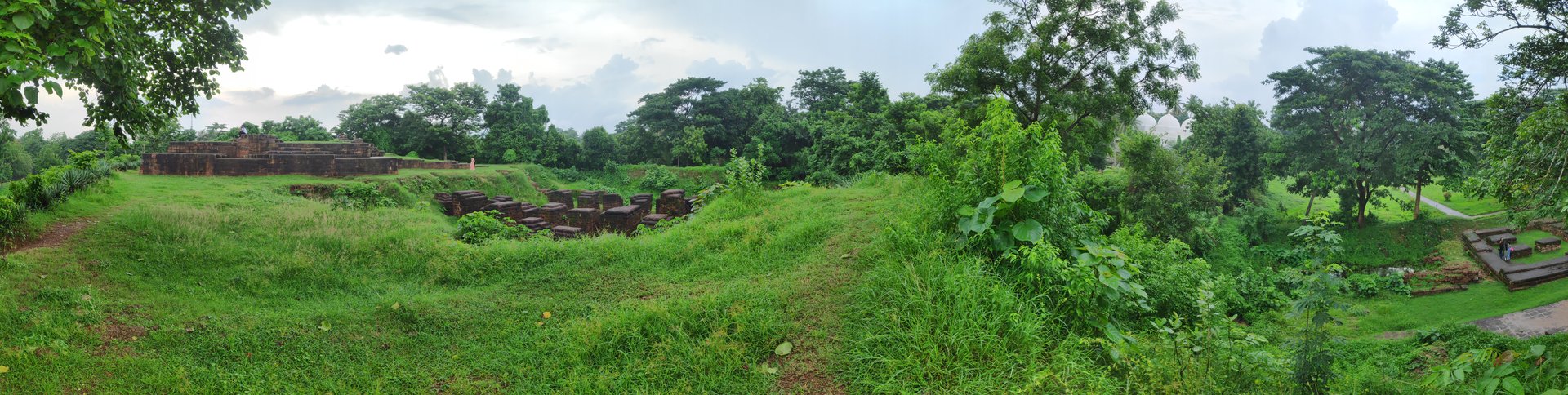
The Nine-Storied Mound
Today, Barabati Fort is mostly absence. The walls that once enclosed 102 acres are gone except for a single arched gateway, the kind of fragment that makes imagination work harder than sight. What survives is the moat - stone-paved, 10 meters wide on the northern and western sides, 20 meters on the eastern and southern - and a high central mound where a nine-storied palace once stood. The palace itself has been reduced to earthen contours and foundation lines. Excavations by the Archaeological Survey of India beginning on December 1, 1989, revealed a square structure built of khondalite stone, set on a foundation meticulously prepared with five meters of sand and lime mixture. Thirty-two laterite pillars were unearthed on the eastern side. In the northeastern corner, the remains of a Ganga-period temple built of whitish sandstone over laterite foundations have yielded some four hundred fragments of mouldings and mutilated sculpture pieces, including a stone idol of Lord Jagannath.
Layers Beneath Layers
The 1989 dig was only the beginning. Excavations in 2007 aimed to establish the fort's cultural chronology and produced a startling range of artifacts: a seated goddess figure, a lion's head, lamp fragments, stone balls, sling ammunition, terracotta animal figurines, an iron axe, and an iron stylus. The pottery finds spanned centuries of daily life - storage jars, spouted vessels, lamps, knobbed lids, miniature pots, dishes, bowls, the terminal piece of a hukkah, and fragments of Chinese porcelain that speak to trade connections reaching far beyond the subcontinent. After a gap of 16 years, excavation resumed in 2023 with a specific new focus: tracing the links between Odisha and Southeast Asian maritime cultures. A mosque built by Nawab Murshid Quli Khan, governor under Emperor Aurangzeb, in 1719 still stands within the fort grounds, alongside the mazar of Hazrat Ali Bukhari - Islamic structures nested within Hindu foundations, a physical record of the layered religious history that defines so many South Asian sites.
A Fort That Became a City
Cuttack grew up around Barabati, and Barabati eventually became Cuttack. The city celebrated its millennium in 1989, claiming continuous existence from the fort's earliest documented construction. It served as the capital of Odisha through Muslim rule, Maratha rule, and the early British period, only losing that status in 1948 when the government relocated to Bhubaneswar. The Bengal-Nagpur Railway connected Cuttack to Madras and Calcutta by 1901, binding it into the national transportation network. Today, the fort's 102-acre footprint sits within a dense urban fabric, the moat partially silted, the central mound under encroachment. The Archaeological Survey of India declared it a protected site of national importance in 1915, but protection and preservation are different things. What Barabati Fort teaches, across its thousand years, is that power concentrates at the points where rivers converge - and that a well-chosen location outlasts every dynasty that builds on it.
From the Air
Located at 20.485°N, 85.864°E in Cuttack, Odisha, at the apex of the delta formed by the Mahanadi River (north) and its distributary Kathajodi (south). The fort sits just 14.6 meters above sea level. From altitude, look for the distinctive river fork that creates Cuttack's triangular geography - the fort occupies the western point where the rivers diverge. The moat outline may be visible as a geometric water feature within the urban fabric. Biju Patnaik International Airport (VEBS) in Bhubaneswar lies approximately 30 km to the south-southwest. Cuttack's Barabati Stadium, a modern cricket ground, sits adjacent to the fort ruins and serves as a useful visual reference point. The Mahanadi River's broad, braided channel is unmistakable from cruising altitude.