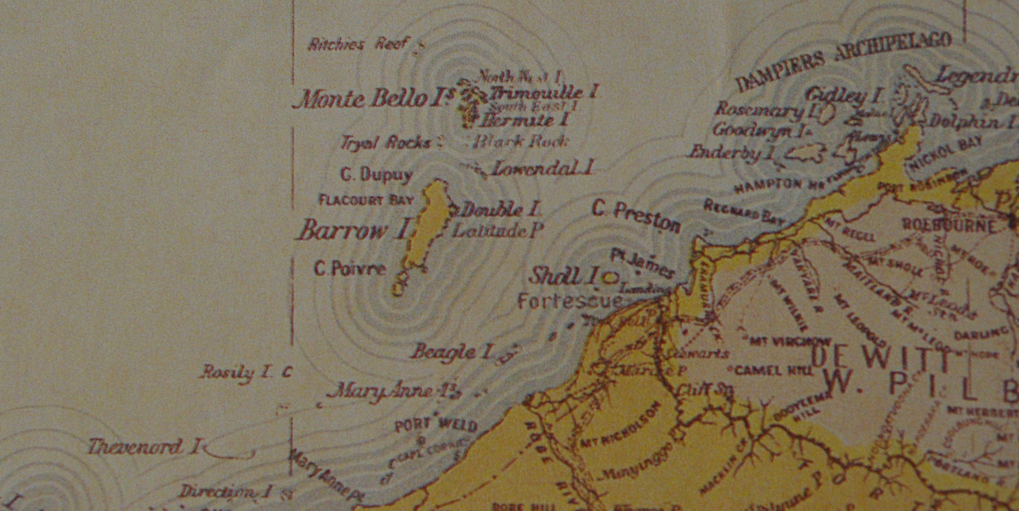
Barrow Island (Western Australia)
On 10 April 1996, Tropical Cyclone Olivia screamed across a low, flat island 50 kilometres off the Pilbara coast and produced a wind gust of 408 km/h -- the strongest non-tornadic wind ever recorded on Earth. That island was Barrow Island, a 202-square-kilometre slab of limestone and spinifex that has spent most of its existence in anonymity. Yet this unassuming patch of Western Australia holds contradictions that would seem implausible in fiction: it is simultaneously one of Australia's most important nature reserves and one of its most productive oil fields, a place where spectacled hare-wallabies forage within sight of drilling rigs, and blind cave eels swim through freshwater lenses sustained by hydrogen sulphide from deep geological faults.
An Island Adrift in Time
Barrow Island separated from the Australian mainland roughly 6,800 years ago, as rising sea levels at the end of the last ice age flooded the coastal plain. Indigenous Australians had visited the island at least 4,000 years earlier, leaving behind stone artefacts fashioned from igneous and metamorphic rocks and chert. When Europeans arrived, Phillip Parker King named the island in 1816 after Sir John Barrow, Secretary of the Admiralty and founder of the Royal Geographical Society. Whalers worked these waters from about 1800, and the island later served darker purposes: during the 1870s, Captain William Cadell used it as a base for trafficking enslaved Aboriginal people into the mainland pearling industry, until his arrest and removal from the colony in 1876. By the 1880s, guano miners had moved in, scraping bat and seabird excrement from the rock and shipping it to Perth as fertilizer.
The Ark of Vanished Species
Isolation proved to be Barrow Island's greatest gift. Cut off from the foxes, cats, and land-clearing that devastated mainland wildlife, the island became a refuge for species that were disappearing everywhere else. Thirteen mammal species persist here, including the spectacled hare-wallaby, burrowing bettong, golden bandicoot, and black-flanked rock-wallaby -- animals now extinct or critically reduced across the continent. Forty-three species of terrestrial reptiles inhabit the island's spinifex grasslands and limestone uplands, a landscape of termite mounds, sandy beaches, rocky shores, salt flats, and reefs. Beneath the surface, limestone caves harbour an even stranger community. Blind cave eels, blind cave gudgeons, and amphipod crustaceans inhabit an anchialine system -- a lens of fresh water floating above saline groundwater. One cave species, the schizomid Draculoides bramstokeri, shares this underworld with what may be the only known troglobitic reptile, Anilios longissimus. The whole subterranean ecosystem may be powered not by sunlight but by chemoautotrophic bacteria feeding on hydrogen sulphide from the Barrow fault. BirdLife International has classified the island as an Important Bird Area, home to the vulnerable Barrow Island black-and-white fairy-wren and globally significant populations of grey-tailed tattlers, red-necked stints, and fairy terns.
Black Gold Under the Spinifex
In 1964, West Australian Petroleum struck oil in commercial quantities beneath this nature reserve, and by 1967 Barrow Island had its first producing field. The paradox was immediate: one of the most ecologically sensitive islands in the Southern Hemisphere was also sitting on one of Australia's richest petroleum deposits. By 1995, 430 wells were pumping oil and natural gas across the island's southern half, connected to tankers by a submarine pipeline extending 10 kilometres offshore. A 200-room apartment complex housed workers, and Barrow Island Airport shuttled crews from Karratha and Perth. The arrangement required an act of Parliament -- Barrow Island holds A-class reserve status, the highest level of conservation protection for Crown land in Australia, and any mining activity within such a reserve demands specific ministerial permission. In 2003, a portion of the reserve was excised to accommodate the Gorgon gas project, a joint venture between Chevron, ExxonMobil, and Shell. Completed in 2017, the Gorgon project taps an estimated 40 trillion cubic feet of natural gas from reserves 60 kilometres north of the island, making it one of Australia's largest energy developments.
Guarding the Gates
The tension between extraction and preservation has defined Barrow Island for decades. When black rats established a population in 1990, the Department of Conservation and Land Management eradicated them -- a reminder that a single stowaway species could unravel millennia of isolation. Every piece of equipment, every shipping container, every worker's boot that arrives on the island is subject to quarantine protocols designed to keep invasive species at bay. Feral cats, weeds, and the common house gecko remain ongoing threats. The Western Shield project has worked to reduce the impact of introduced species across the region, and corporate-government partnerships have funded studies of the island's little-known subterranean fauna. It is a strange and precarious balance: drilling platforms and wallaby warrens, gas processing plants and fairy-wren habitat, all coexisting on a speck of land where Cyclone Olivia once broke the planet's wind record.
From the Air
Barrow Island sits at 20.8S, 115.38E, approximately 50 km off the Pilbara coast of Western Australia. From altitude, the island appears as a distinct flat landmass surrounded by turquoise shallows and reef systems. Barrow Island Airport (ICAO: YBWX) serves the island. Nearest mainland airport is Karratha/Learmonth. The island's oil infrastructure -- wells, pipelines, and the Gorgon LNG complex -- is visible from moderate altitude. Best viewed at 5,000-10,000 ft for island shape; descend lower for detail on the industrial and natural landscape contrast.