Batavia, Dutch East Indies
"Among the Grachts, the Tygersgracht is the most stately and most pleasant, both for the goodliness of its buildings, and the ornamentation of its streets, which afford a very agreeable shadow to those who pass along the street." That was a visitor's impression around 1627, describing a canal in Batavia lined with coconut trees - a tropical echo of Amsterdam transplanted to the north coast of Java. The Dutch East India Company founded Batavia in 1619 on the ruins of Jayakarta, and for the next three centuries it served as the nerve center of European commerce in Asia. By the time the Japanese occupation ended the colonial era in 1942, the city had cycled through identities: trading post, colonial capital, multicultural metropolis, occupied territory. Today it is Jakarta, a megacity of tens of millions, but the bones of Batavia still surface in the old town's warehouses, canals, and street grid.
Amsterdam in the Tropics
Amsterdam merchants first reached the East Indies in 1595 under Cornelis de Houtman, and the English East India Company established a trading post at nearby Bantam in 1602. But it was the Dutch East India Company - the VOC - that planted roots in 1619, building Batavia from scratch with a layout borrowed from home: canals, ramparts, a castle, a church and town hall on the riverbank. Three canals were dug east of the Ciliwung River that first year - the Leeuwengracht, Groenegracht, and Steenhouwersgracht. By 1627 the Tijgersgracht connected them all, creating a waterway district that visitors compared favorably to anything in the Netherlands. The Prinsestraat linked the castle's south gate to the city hall, forming Batavia's commercial spine. Eastern Batavia was fortified with a long canal connecting the castle moat to the Ciliwung, a defensive project that cost over 160,000 real - much of it extracted from the local Chinese community rather than company coffers, while slave and prison labor reinforced the castle walls.
Two Cities, One Name
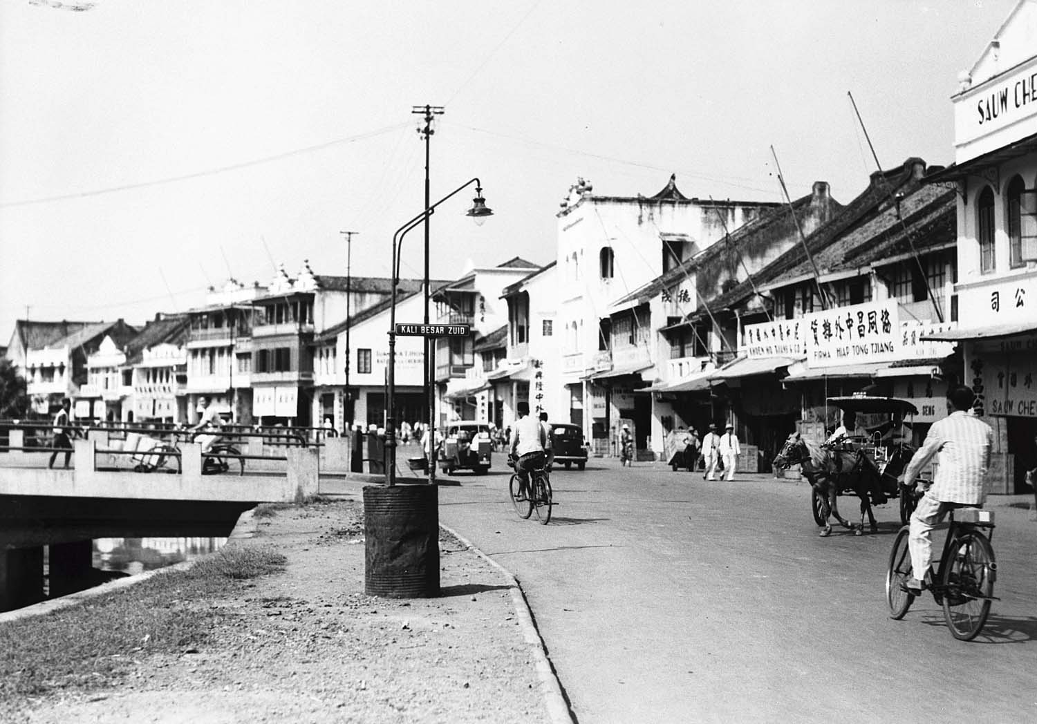
By the early 1800s, Batavia had split into two distinct halves. The original settlement - Oud Batavia, or Kota - sat on the low-lying coast, a maze of canals and warehouses increasingly plagued by disease and decay. In 1808, Governor-General Herman Willem Daendels abandoned the unhealthy old town and built a new center further south on the Weltevreden estate, connected to Kota by the Molenvliet Canal. Kota remained the commercial hub, crowded with the offices of shipping and trading firms. Weltevreden became the seat of government, the military, and the shops that served the colonial elite. The two halves reflected the colony's contradictions: business in the swamp, power on the hill. When the British briefly took control and Stamford Raffles replaced Daendels, the dual-city structure persisted. Old Batavia's moats and ramparts eventually experienced a building boom as trading companies lined the Ciliwung, and seventeenth-century facades stood shoulder to shoulder with twentieth-century commercial buildings.
A City of Many Peoples
Batavia was never purely Dutch. By the end of the nineteenth century, its population of 115,887 included 8,893 Europeans, 26,817 Chinese residents, and 77,700 indigenous islanders. By 1905, the wider metropolitan area had swelled to 2.1 million, with 93,000 Chinese, 14,000 Europeans, and 2,800 Arabs among the population. Foreigners recently arrived from China were called totoks, distinguishing them from the peranakans who had lived in the archipelago for generations. Cultural boundaries blurred in everyday life: Dutch colonists wore kebayas and sarongs after work, while the indigenous governing elite put on European dress for official duties and changed back to Javanese attire at home. Women wore batik shawls to formal events. Souw Beng Kong became the first Kapitan Cina of Batavia in the early 1600s, and the folk hero Si Pitung - a Robin Hood-like bandit - became a symbol of local resistance in the late nineteenth century. Slavery persisted until its abolition in 1853, with enslaved people living in the gardens behind their masters' houses.
The End of Batavia
On 5 March 1942, Japanese forces entered the city. The Dutch formally surrendered four days later, and Batavia was renamed Jakarta. Three centuries of colonial rule ended not with negotiation but with conquest by a different empire. Buildings were converted to internment camps for the Dutch population. The economic situation deteriorated sharply during the occupation, and the physical condition of the city declined. After Japan's defeat in 1945, Indonesian nationalists declared independence on 17 August, and the city retained its new name. The Dutch clung to their colonial claims for four more years, but when Indonesia achieved full sovereignty in 1949, Batavia ceased to exist - first as Djakarta, then simplified to Jakarta. The Ethical Policy introduced in 1901 had opened Dutch-language education to some indigenous Indonesians, inadvertently nurturing the very nationalist movement that would dismantle the colony.
Ghosts in the Old Town
Jakarta's Kota Tua district preserves fragments of Batavia's layered past. The old city hall is now the Jakarta History Museum. Colonial warehouses line canals that once connected the VOC's commercial empire to the spice islands beyond. The street grid that Dutch engineers laid out in 1619 is still legible beneath the modern city's sprawl. But Batavia was not a benign creation - it was built with forced labor, sustained by slavery until 1853, and enriched by monopoly extraction of the archipelago's resources. The canals that made visitors think of Amsterdam required constant dredging and maintenance that the company extracted from local populations. Understanding Batavia means seeing both the architectural elegance and the human cost beneath it: a city beautiful to its rulers and brutal to those who built it.
From the Air
Located at 6.13S, 106.81E on the north coast of Java, Indonesia. Historic Batavia corresponds to modern Jakarta's Kota Tua (Old Town) district along the waterfront. Nearest airport is Soekarno-Hatta International (WIII), about 25 km northwest. Halim Perdanakusuma Airport (WIHH) lies roughly 15 km southeast. From the air, the old town is identifiable by its colonial-era street pattern near the historic port of Sunda Kelapa. The Ciliwung River, central to Batavia's canal system, is visible cutting through the dense urban fabric.