Batchelor, Northern Territory
The town of Batchelor was named in 1912 for a man who never lived there. Lee Batchelor was the first minister responsible for the Northern Territory — he died in office the previous year — and a Commonwealth demonstration farm established on his watch carried his name. That farm failed to flourish, became a wartime air base, then gave its geography to a uranium mining town that grew up practically overnight in 1952. Today around 500 people call Batchelor home, a third of them of Aboriginal and Torres Strait Islander descent, and most visitors pass through on the way to Litchfield National Park.
Country Before the Colony
Long before any of this, the Warrai and Kungarakany peoples were the traditional owners of this land. Their connection to the country predates European settlement by thousands of years. When the Commonwealth established its demonstration farm in 1911, investigating the agricultural potential of the Northern Territory after South Australia handed over administration, it did so on land that already belonged to someone. The farm experimented with melons, pumpkins, cabbages, and various livestock, with varying success. It struggled to retain experienced workers amid the strikes and industrial unrest that culminated in the Darwin Rebellion. By 1919 it had given way to a private cattle station and an Aboriginal compound — and then, in 1933, its cleared land became an aerodrome.
War Comes to the Scrub
The civilian aerodrome was substantially expanded during World War II into a major air base hosting Royal Australian Air Force, United States Army Air Forces, and Royal Netherlands East Indies Army Air Force units. General MacArthur touched down here on 17 March 1942, continuing his escape from the Philippines. After the war, the base's railway siding and road infrastructure became the bones of a new town — and what filled that town was uranium.
Prospector Jack White discovered uranium at nearby Rum Jungle in 1949, having recognised the ore from a government pamphlet that accompanied a £25,000 reward notice. The find triggered Australia's first uranium mine. From August 1952, Consolidated Zinc and the Federal Government built much of modern Batchelor — houses, amenities, services — to accommodate mine workers. The original plan assumed a population of about 600, but the mine regularly exceeded that.
After the Mine
Rum Jungle Mine closed in 1971 and left behind an environmental legacy that took decades to address. Batchelor, however, found new purposes. The Batchelor Institute, established at its current campus in 1982, focuses on tertiary and vocational education for Indigenous students from across Australia — nearly 18 percent of the local workforce is employed in tertiary education. The town is also the administrative gateway to Litchfield National Park, which draws approximately 280,000 visitors each year. Seven park rangers are based here. The airfield offers scenic flights and skydiving. In October 2014, the BBC's Top Gear filmed an episode at the airfield.
Seasons and Scale
Batchelor sits in the tropics with all that entails. The wet season, from November to April, delivers 1,487 millimetres of rainfall, spectacular thunderstorms, and road closures as rivers flood the 4WD tracks into the surrounding country. The dry season, May to October, brings warm days and cool nights — this is when most visitors arrive, drawn by the waterfalls, the clear swimming holes, and the ancient termite mound fields nearby. Darwin is an hour's drive north. The rest of Australia feels very far away, though the Triple J FM transmitter ensures that cultural distance is not total.
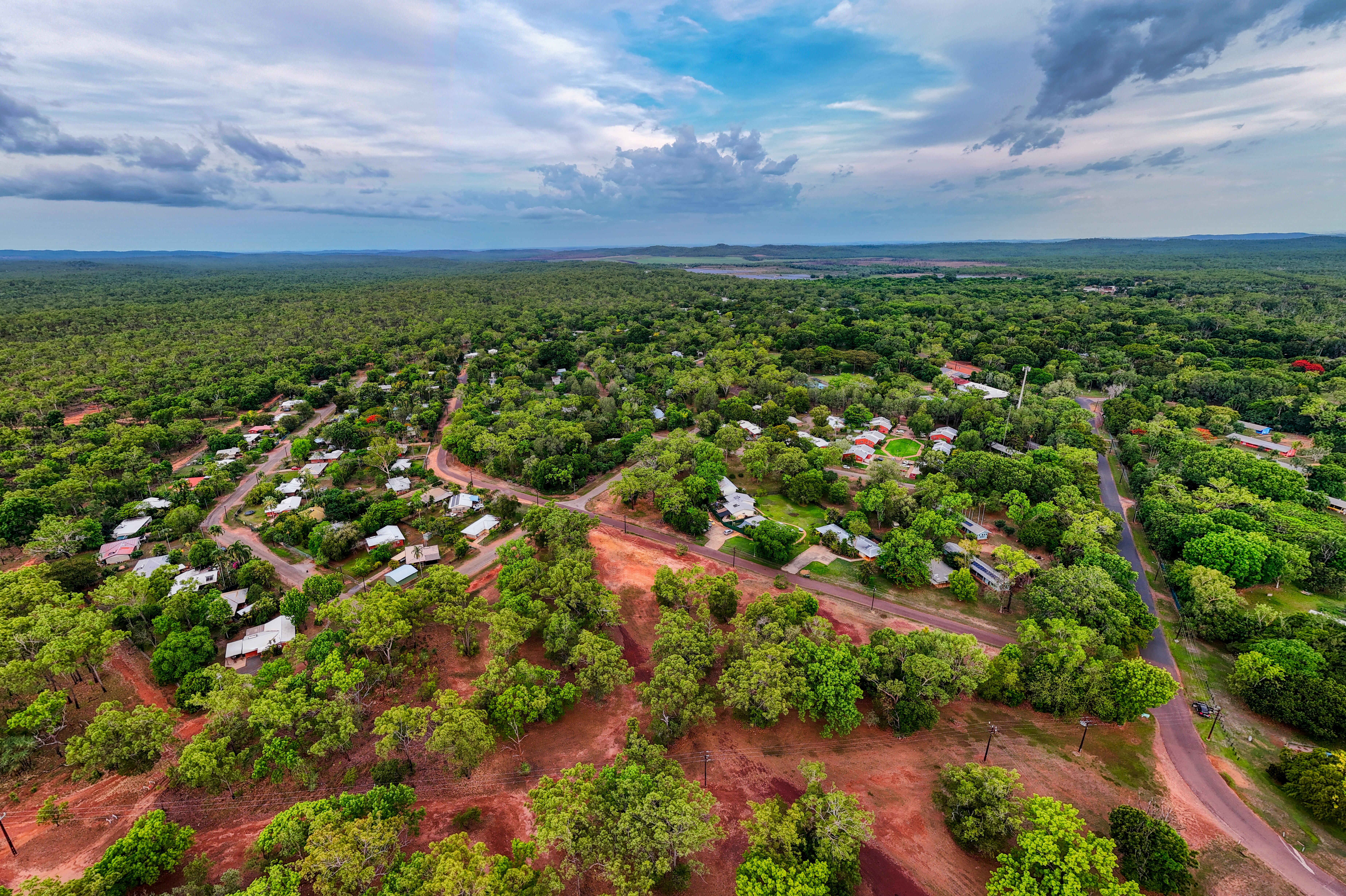
From the Air
Batchelor is located at 13.07°S, 131.02°E, approximately 98 km south of Darwin on a direct bearing. The town is clearly visible from the air, identifiable by its regular grid pattern — the street layout follows the wartime military base footprint. Batchelor Airfield (YBCR) is immediately south of town with a sealed runway. Darwin Airport (YPDN) is the nearest major facility. The surrounding landscape is tropical savanna, flat and open in the dry season, dramatically green during the wet.