Batiquitos Lagoon
Nine thousand years of human use left Batiquitos Lagoon essentially intact. A hundred years of development nearly killed it. The 610-acre coastal wetland between Carlsbad and Encinitas had been used by the Kumeyaay people for millennia, providing fish, shellfish, and waterfowl in the fluctuating brackish zone where Batiquitos Creek met the Pacific. Development across the twentieth century — agriculture, roads, suburban sprawl, and the interruption of the tidal connection — filled the lagoon's basin with sediment. By the time restoration began in 1997, the lagoon supported five fish species. Within years of restoring tidal flow, it supported sixty-five.
Nine Thousand Years
Archaeological evidence places human habitation around Batiquitos Lagoon at nine thousand years before the present — a span that covers the end of the last Ice Age, the drying of the American West, and the full development of the coastal California cultures that European explorers encountered in the 1500s. The Kumeyaay people who inhabited this coast managed the lagoon's resources without eliminating them across that span, a management record that modern conservation agencies have spent decades trying to understand and emulate. Spanish settlement in the eighteenth century did not immediately disrupt the lagoon's function, but the conversion of the watershed to agriculture in the nineteenth and twentieth centuries changed the sediment load that entered the basin with every winter rain. The lagoon began to fill. Tidal exchange diminished. The ecology that had supported nine thousand years of human use began to collapse within a single century.
The Silting and the Restoration
By the late twentieth century, Batiquitos Lagoon had lost most of its tidal exchange. The inlet to the Pacific had partially closed with sediment, and the water inside the lagoon was increasingly stagnant. Five fish species persisted — generalists tolerant of degraded conditions — where dozens had once thrived. The restoration project that began in 1997 was funded largely by the Port of Los Angeles as mitigation for harbor expansion projects hundreds of miles to the north: a regulatory arrangement that redirected development impact fees toward ecological repair. Crews dredged the inlet, removed accumulated sediment, and re-established the connection between the lagoon and the Pacific that tidal exchange required. The response was rapid by ecological standards. Fish diversity rebounded from five species to sixty-five within years of restoration. Least tern and snowy plover populations returned to nest on the sandy shores that the restoration created.
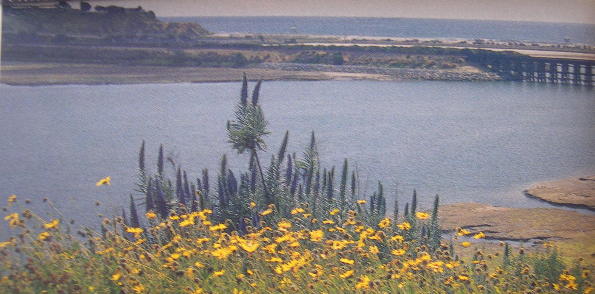
What the Trail Shows
A 1.75-mile nature trail runs along the northern shore of Batiquitos Lagoon, offering a path through the habitat that restoration rebuilt. The trail passes coastal sage scrub, willow thicket, and open water zones where herons stand in the shallows with the patience of professionals. At the eastern end, where the lagoon narrows and the creek's influence is strongest, the water is freshest. At the western end, near the restored inlet, it is nearly marine. That gradient — fresh to salt, shaded to open, narrow to wide — produces the conditions that make a coastal lagoon more diverse than either the ocean or a freshwater marsh. The 1.75 miles captures something that took nine thousand years to develop and one century to nearly destroy. The restoration did not create it. It just made space for it to come back.
From the Air
Batiquitos Lagoon is located at approximately 33.0897°N, 117.288°W between Carlsbad and Encinitas, visible from altitude as an elongated coastal wetland parallel to the Pacific. The lagoon's restored tidal inlet is visible at the western end. Recommended viewing altitude 2,500–5,000 ft AGL. Nearby airports: KOKB (Oceanside Municipal, ~10 nm north), KSEE (Gillespie Field, ~18 nm southeast). The lagoon lies immediately south of the BNSF coastal rail line.