Battle of Brice's Cross Roads
The Federal soldiers who staggered back into Memphis had been chased across six Mississippi counties. Their commander, Brigadier General Samuel Sturgis, had marched 8,100 men south from Tennessee to neutralize one of the Confederacy's most dangerous cavalry commanders. Instead, on June 10, 1864, at a nameless crossroads near Baldwyn, Mississippi, Major General Nathan Bedford Forrest turned roughly 4,800 horsemen into a wrecking force that shattered an army nearly twice his size. It remains one of the most lopsided victories in American military history -- a textbook demonstration of how speed, terrain, and timing can overwhelm raw numbers.
Sherman's Problem on Horseback
The battle at Brice's Cross Roads was born from a supply crisis 200 miles to the east. In the spring of 1864, Ulysses Grant and William Tecumseh Sherman had launched their coordinated grand strategy: Grant would grind down Robert E. Lee in Virginia while Sherman pushed south through Georgia toward Atlanta, the Confederacy's industrial back door. Four railroads radiated from Atlanta, feeding the Southern war machine, and Sherman needed every one of them intact to sustain his own advance. The problem was Forrest. Operating independently in northern Mississippi and Tennessee, Forrest's cavalry raided Sherman's supply lines with devastating effectiveness. Sherman's solution was direct -- send a force large enough to destroy Forrest once and for all. The assignment fell to Sturgis, who assembled 4,800 infantry and 3,300 cavalry and headed south from Memphis in early June.
The Crossroads Trap
Forrest understood something Sturgis did not: the Mississippi roads in June were weapons in themselves. Heavy rains had turned the clay roads to mud, and the route from Ripley to Baldwyn funneled through dense bottomland forest and across Tishomingo Creek. Forrest planned to hit the Federal cavalry first, knowing that when the infantry heard the gunfire they would be force-marched forward through the mud to provide support. By the time the foot soldiers arrived, they would be exhausted, strung out, and in no condition to fight. His men, meanwhile, would be fresh, well-fed from nearby supply depots, and fighting on ground they had chosen. The plan worked with almost mechanical precision. Confederate cavalry struck the Union horsemen at the crossroads, and Sturgis ordered his infantry forward at the double-quick through bottomland muck. Many soldiers collapsed from heat and exhaustion before they ever reached the firing line.
Six Counties of Retreat
The Federal line broke in the late afternoon. What began as a withdrawal became a rout as Confederate cavalry pursued the retreating column relentlessly. Sturgis's forces fled northwest, pursued across six counties on the long road back to Memphis. They abandoned artillery, wagons, and supplies. The 59th United States Colored Infantry Regiment, part of the 3rd Brigade, fought a critical rearguard action at the Tishomingo Creek bridge, where 400 soldiers used marksmanship and skirmisher tactics to hold off the Confederate cavalry long enough for the rest of the column to escape. The Chippewa soldiers and African American troops fell back together in one of the engagement's most determined stands. Colonel Alex Wilkin of the 9th Minnesota later documented the defeat's causes in correspondence with Sturgis: the men had been on half rations, the advance had been ordered against Sturgis's own better judgment, and the infantry arrived at the battlefield already spent.
The Wider War's Shadow
Brice's Cross Roads was a tactical masterpiece that changed nothing strategically. Sherman continued his march on Atlanta. Forrest continued raiding supply lines. The Confederacy continued its slow collapse. But the battle demonstrated something about the nature of the Civil War in Mississippi -- how a single commander with local knowledge and mobile forces could humiliate a numerically superior enemy by exploiting terrain, weather, and the limits of human endurance. Sturgis was effectively finished as a field commander. The defeat was so thorough that some historians have ranked him among the worst military leaders in history, though Wilkin's account suggests the blame extended well beyond one general. The men were hungry, the orders were questionable, and the enemy was Forrest -- a commander who understood that battles are won before they begin, in the choosing of ground and the timing of strikes.
Preserved Ground
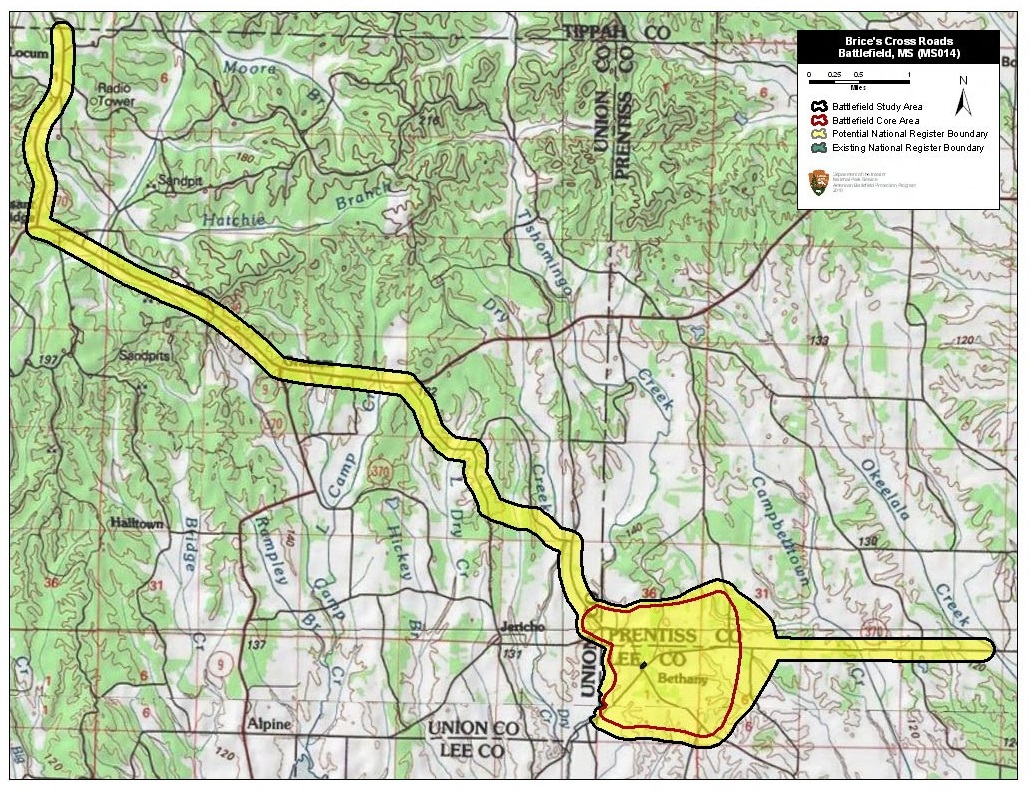
The crossroads where Forrest broke the Federal army is now one of the best-preserved Civil War battlefields in America. The Brices Cross Roads National Battlefield Site was established in 1929, with the National Park Service maintaining monuments and interpretive panels at the intersection itself. Beginning in 1996, the American Battlefield Trust and the Brice's Cross Roads National Battlefield Commission have acquired approximately 1,500 acres -- nearly the entire battlefield. Bethany Cemetery, adjacent to the National Park Service monument, predates the war and holds the graves of more than 90 Confederate soldiers killed at the crossroads. The Federal dead were initially buried in common graves on the field before being reinterred at the Memphis National Cemetery. The modern Bethany Presbyterian Church stands at the southeast corner of the crossroads, though during the battle the congregation's meeting house sat further south along the Baldwyn Road. The landscape remains remarkably unchanged -- the same rolling terrain, the same creek crossings, the same narrow roads where an army was destroyed.
From the Air
Located at 34.51°N, 88.73°W near Baldwyn in Lee County, Mississippi. The crossroads sits in gently rolling terrain with Tishomingo Creek running through the bottomland to the south. From altitude, the intersection of the old Pontotoc-Baldwyn and Ripley-Fulton roads is visible amid farmland and scattered timber. The National Battlefield Site marker and Bethany Cemetery are at the crossroads. Nearest airports: Tupelo Regional Airport (KTUP) approximately 20nm northwest; Columbus Air Force Base (KCBM) approximately 60nm east. Best viewed from 2,000-4,000 ft AGL to appreciate the terrain that shaped the battle -- the creek bottoms, ridgelines, and narrow road corridors that Forrest exploited. Clear weather recommended; summer haze common in this region.