Two Days on the Tama River That Ended a Shogunate
Nitta Yoshisada had overplayed his hand. Three days after his victory at the Battle of Kumegawa, the imperial rebel commander advanced on the Shogunate's regrouped forces at Bubaigawara, on the banks of the Tama River in Musashi Province -- present-day Fuchu, Tokyo. He expected a retreating enemy. Instead, he walked into a reinforced army with restored morale and a devastating archery barrage that stopped his advance cold. By nightfall on May 15, 1333, Nitta's campaign to overthrow the Kamakura Shogunate looked finished. By dawn on the 16th, everything had changed.
The Trap Nitta Did Not See
The Kozuke-Musashi Campaign was the decisive military operation of the Genko War, the conflict that would end the Kamakura Shogunate's century and a half of rule over Japan. Nitta Yoshisada, a warrior from Kozuke Province who had declared for Emperor Go-Daigo's cause, had been driving south toward Kamakura, the seat of shogunal power. His victory at Kumegawa on May 12 had seemed to open the road. But the Shogunate's forces, loyal to the Hojo clan that controlled the shogunate, had not broken -- they had retreated to Bubaigawara along the Tama River and dug in. Worse for Nitta, reinforcements reached the Shogunate army on May 14, restoring both their numbers and their confidence. When Nitta's forces advanced on the 15th, they expected a demoralized rearguard. They found an army ready to fight.
Arrows and Retreat
The Shogunate forces opened the engagement on May 15 with a massive archery barrage -- the opening tactic of medieval Japanese warfare, designed to disrupt formations and break momentum before close combat began. It worked. Nitta's advance stalled under the hail of arrows, and the main body of the Hojo army surged forward into the disorganized imperial lines. Nitta Yoshisada counterattacked aggressively, throwing his troops against the shogunal positions repeatedly, but the reinforced enemy held firm. Heavy casualties mounted through the day. By evening, Nitta had no choice but to pull back. The Shogunate army held the field at Bubaigawara. Had they pressed their advantage immediately, pursuing the retreating imperials through the night, the Kamakura Shogunate might have survived the Genko War. They did not pursue.
The Dawn Reversal
During the night of May 15, while the Shogunate forces rested on their laurels, Miura Yoshikatsu arrived with fresh reinforcements for Nitta's battered army. Miura was a capable commander who brought not just numbers but the aggressive spirit of a force that had not yet fought. At dawn on May 16, Miura led his troops in a surprise attack against the unsuspecting Shogunate positions. The Hojo forces, confident after the previous day's success, were caught off guard. Nitta Yoshisada and his brother Nitta Yoshisuke charged to the front while Miura harassed the enemy from the rear, creating a pincer that shattered the shogunal army's cohesion. What had been a confident defensive position collapsed into chaos. The reversal was total -- the army that had won the field the day before was now in full retreat.
The Road to Kamakura
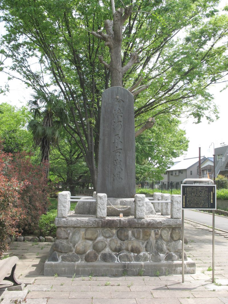
The remnants of the Hojo forces fled in disarray back toward Kamakura, the fortified capital of the shogunate, hoping to regroup behind its natural defenses of mountains and sea. Nitta pursued without pause. The Battle of Bubaigawara had been the last major obstacle between the imperial forces and the shogunate's seat of power. Within days, Nitta's army reached Kamakura itself and launched the siege that would end the Kamakura Shogunate forever. The Hojo regents who had ruled Japan for generations fell along with their capital. Today, the battle site lies beneath the suburban streets of Fuchu, a city in western Tokyo where the Tama River still flows past parks and residential neighborhoods. The riverbanks where arrows darkened the sky and samurai fought for the future of Japan are now walking paths and sports fields. The Taiheiki, the great medieval chronicle that records these events, preserves the drama of those two May days when an empire's fate turned on a single night of reinforcements.
From the Air
Located at 35.67°N, 139.47°E in Fuchu, western Tokyo, on the banks of the Tama River. The battle site lies in the suburban belt west of central Tokyo, along the broad floodplain of the Tama River, which is clearly visible from altitude as a wide ribbon of water and gravel bars running roughly east through the urban fabric. Chofu Airport (RJTF), a small general aviation field, lies approximately 3 nautical miles to the east-northeast. Tokyo International Airport / Haneda (RJTT) is roughly 20 nautical miles to the east-southeast. Best viewed from 3,000-5,000 feet AGL, looking for the distinctive curve of the Tama River near Fuchu.