Battle of Cane Hill
Colonel Joseph Shelby's Confederate troopers expected the Union attack to come up the Cincinnati Road on the morning of November 28, 1862. Instead, Brigadier General James Blunt sent his men along the Ridge Road and then the Fayetteville Road, catching Shelby's pickets off guard among the rolling hills and hardwood hollows near Cane Hill, Arkansas. What followed was not the decisive engagement either side wanted -- it was something stranger, a running fight across miles of Ozark terrain where both commanders would claim victory and historians would later compare the result to a hung jury.
The Trap That Worked Both Ways
Confederate Major General Thomas Hindman had a plan. After rebuilding Southern military strength in Arkansas through methods so aggressive they got him removed from district command, Hindman kept a field command and saw an opportunity in the Union's positioning. Blunt's division sat isolated in Benton County, separated from the rest of the Army of the Frontier by over a hundred miles of rugged Ozark terrain. Hindman sent Brigadier General John Marmaduke with about 2,000 cavalry and six cannons to Cane Hill to collect supplies and lure Blunt further south, away from his reinforcements at Springfield, Missouri. The problem was that Blunt refused to play defense. Believing himself abandoned by his superior General Schofield, and still stinging from an earlier incident when he fortified against an attack that never came, Blunt decided to go on the offensive.
Artillery Against the Mountain
The disparity in firepower told the story before a single infantry charge began. Blunt brought thirty artillery pieces to the fight; Marmaduke had six. The Confederates were also short on ammunition and percussion caps. Colonel William Cloud's men led the Union advance and made contact with Shelby's troopers on the morning of November 28. After an artillery duel drove Shelby from the Cane Hill area, Marmaduke reformed his line at Newburg, then fell back again to Reed's Mountain. Shelby conducted a textbook rear-guard action, posting small forces to confront the Union advance before falling back to allow the next line to engage. At Reed's Mountain the Confederates made a stand but were forced to withdraw under the weight of Union guns. Several miles further south, Colonel Charles Carroll laid an ambush for Blunt's leading elements, then presented a flag of truce as a ruse to buy time for his men to escape the field.
A Verdict Without a Jury
Casualties were remarkably light for the scale of the engagement. Union losses stood at roughly six to eight killed and thirty-two to thirty-five wounded. Confederate casualties were similar: about ten killed, sixty-six wounded, and six missing. Historians attribute the low numbers to weapons that were inaccurate beyond close range, difficult terrain, poor aim, the Confederate rear-guard tactics, and the fact that only portions of each army were engaged at any one time. Blunt held the field and had driven Marmaduke from the area. But the Confederates escaped with their supply train and accomplished something potentially more valuable: they had drawn Blunt further south, placing his Union soldiers much closer to the main Confederate force than to their reinforcements. Both sides declared success.
Nine Days to Prairie Grove
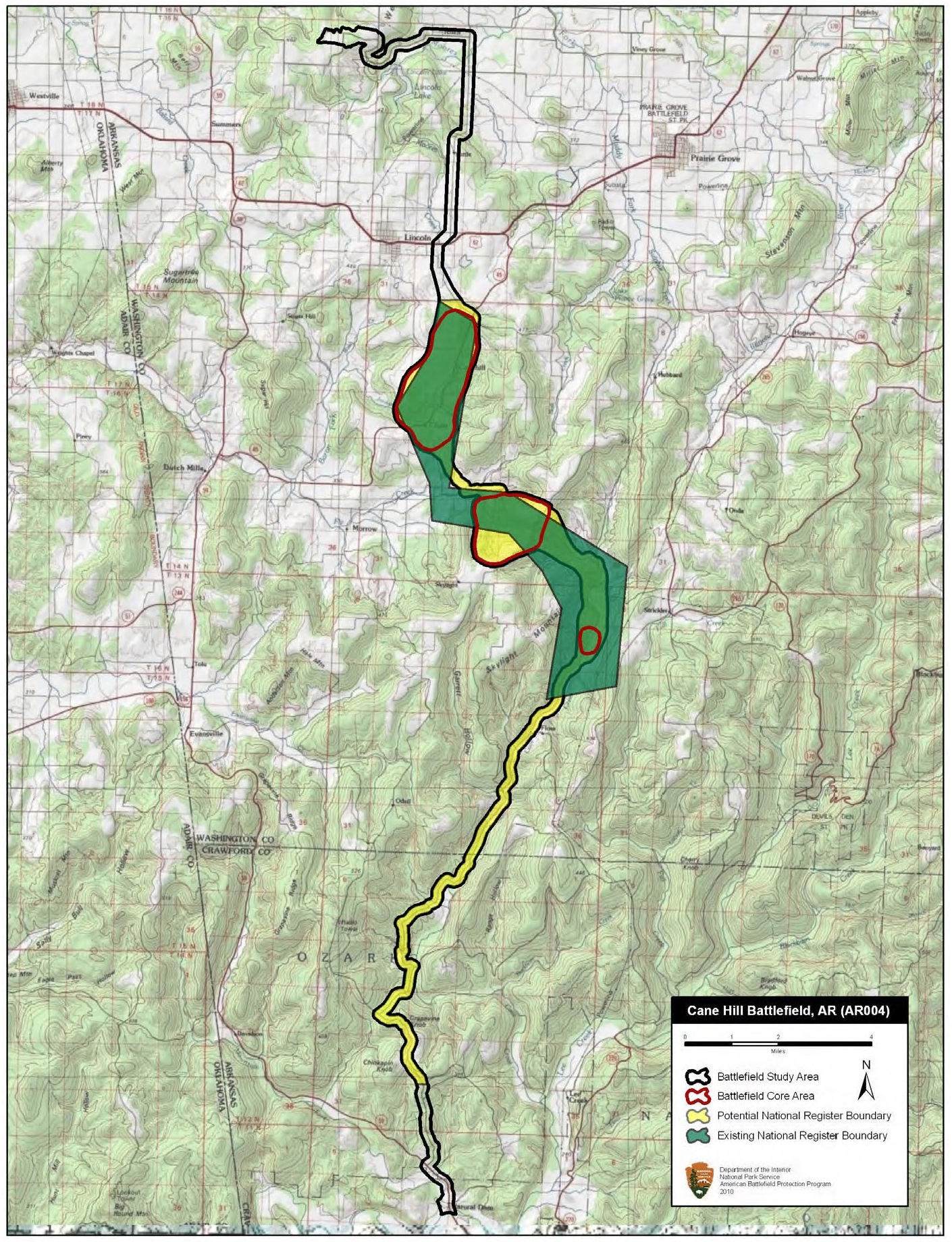
Blunt made Cane Hill his base of operations. Marmaduke withdrew to Dripping Springs, north of Van Buren. On December 3, Hindman moved his entire army north to attack Blunt's isolated division. But Blunt had anticipated the move, and Brigadier General Francis Herron force-marched two divisions from Springfield -- covering the distance in three and a half days on foot. On December 7, Hindman intercepted Herron near Prairie Grove. The two forces fought inconclusively through the morning before Blunt arrived in the afternoon and joined the battle. The Confederates withdrew after nightfall. The fighting at Prairie Grove ensured that Missouri and northwestern Arkansas remained under Union control for the rest of the war. A portion of the Cane Hill battlefield was listed on the National Register of Historic Places in 1994. The town of Cane Hill, once a regional cultural center, has since greatly declined.
From the Air
Located at 35.908N, 94.397W in the Ozark Mountains of northwestern Arkansas. The battlefield sits in rolling terrain with hardwood forests and hollows typical of the Boston Mountains region. Drake Field (KFYV) near Fayetteville is approximately 20 nm to the northeast. The terrain rises and falls between 1,200-2,000 feet MSL through this area. Reed's Mountain and the ridge lines that shaped the battle are visible from moderate altitude. Best viewed at 3,000-5,000 feet AGL in clear conditions.