Battle of Canyon de Chelly
Colonel Dixon S. Miles explored Canyon de Chelly once, in 1858, and left a single recommendation: no command should ever re-enter it. Six years later, in January 1864, the United States Army ignored that warning. The campaign that followed did not produce a dramatic pitched battle. Instead, it broke a nation through starvation and winter, forcing nearly 8,000 Navajo people from a canyon they had called home for generations and sending them on a deadly march that would scar the collective memory of the Navajo forever.
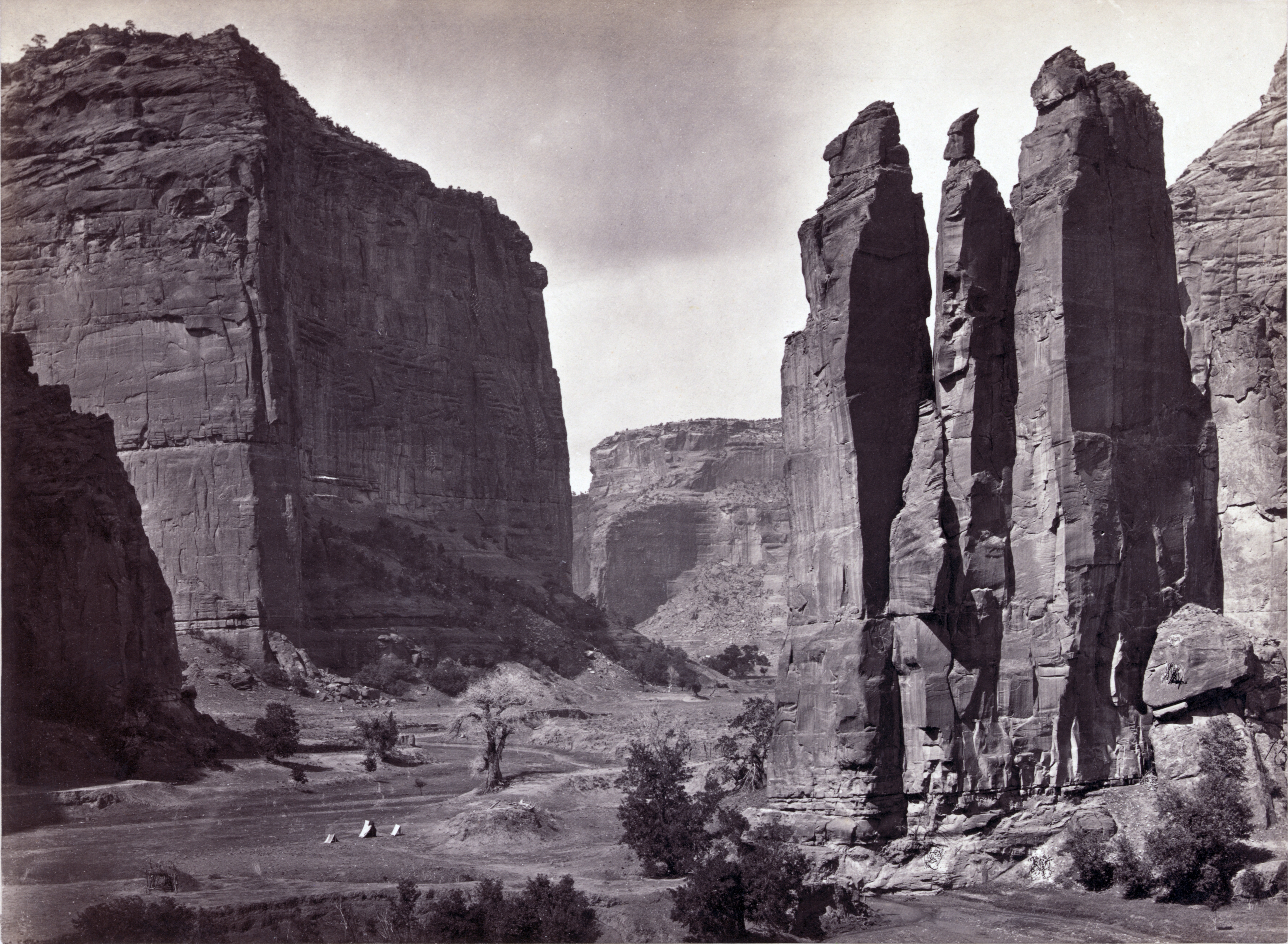
The Stronghold No Army Was Meant to Enter
Canyon de Chelly cuts deep into the red sandstone of northeastern Arizona, its sheer walls rising hundreds of feet above a narrow valley floor where the Navajo had built settlements, planted orchards, and grazed livestock for centuries. By the time of the American Civil War, the Navajo were the largest Indigenous nation in the Southwest. The canyon served as their ultimate refuge, a natural fortress of soaring cliff faces and narrow passages that made military assault nearly impossible. The bands sheltering within its walls were led by formidable leaders: Manuelito, Barboncito, and Barboncito's brother Delgado. They had already endured raids from Ute warriors and the U.S. military, but the canyon itself had never fallen.
Carson's Scorched Earth
Kit Carson, the frontier legend turned Army colonel, did not attack the canyon with guns. He attacked it with hunger. Under orders from Brigadier General James H. Carleton, Carson waged a scorched earth campaign across Navajo territory throughout 1863, systematically destroying homes, crops, livestock, and food stores. His policy was to capture rather than kill, but by November 1863, only 200 Navajo had surrendered to the reservation at Bosque Redondo. Carleton then ordered Carson directly into the canyon stronghold. Carson advanced from the west while Captain Albert Pfeiffer pushed through from the east. Pfeiffer's column was harassed by Navajo defenders along the cliff tops, but neither force met serious armed resistance. The real weapon was the winter itself, and the fields and orchards Carson had already destroyed.
Fortress Rock and the Breaking Point
Barboncito and Manuelito both vowed never to surrender. They led their followers to Fortress Rock, a rocky butte at the confluence of the canyon's two main branches, where they had stockpiled food and could hold an elevated defensive position against any direct assault. The Army could not take Fortress Rock by force. But the defenders' isolation worked against them. Cut off from the wider landscape they depended on for survival, unable to hunt or gather, the Navajo on Fortress Rock watched their supplies dwindle as winter deepened. Delgado's followers broke first, concluding they could not survive the season, and surrendered at Fort Defiance. Delgado then returned to the canyon to urge others to come in, promising food, blankets, and protection at the Army forts.
The Long Walk
By spring 1864, nearly 8,000 Navajo had surrendered. Manuelito was among the few who never did, fleeing into Hopi lands rather than submit. The rest were forced to march roughly 300 miles to Bosque Redondo, a bleak reservation near Fort Sumner in eastern New Mexico. The journey became known as the Long Walk of the Navajo, a forced removal that killed hundreds along the way and confined the survivors to land utterly unsuited to their way of life. For four years, the Navajo endured exile at Bosque Redondo, suffering disease, starvation, and despair. In 1868, they were finally permitted to return to their homeland, a rare reversal in the history of American Indian removal.
Sacred Ground Preserved
Today Canyon de Chelly is a National Monument operated by the National Park Service, with its Visitor Center located three miles from Route 191 in Chinle, Arizona. What makes it unique among national monuments is that Navajo families still live and farm within the canyon, maintaining a continuous connection to land their ancestors defended. The towering red walls that once sheltered a besieged nation now draw visitors from around the world, but for the Navajo, this is not a relic of the past. It remains home, a place where the story of resistance, removal, and return is written into the stone itself.
From the Air
Canyon de Chelly is located at 36.16N, 109.51W in northeastern Arizona. From altitude, the canyon system appears as dramatic dark gashes in the red sandstone plateau. The canyon's sheer walls and winding tributaries are visible from above 5,000 feet AGL. Nearest airport is Chinle Municipal (E91). Window Rock Airport (RQE) lies about 60 nm to the southeast. The surrounding Navajo Nation landscape of red mesas and desert washes provides striking visual context.