Battle of Mud Springs
Empty cans of oysters, fruit, and codfish littered the abandoned camp. Colonel William Collins and his exhausted soldiers found these remnants of plunder scattered across the frozen Nebraska prairie as they tracked the massive encampment northward. Three days earlier, only fourteen men had stood behind the sod and log walls of Mud Springs station, watching as an advance party of Sioux warriors appeared on the horizon. What followed was one of the largest engagements of the Plains Indian Wars in Nebraska, a clash born from the ashes of Sand Creek that would see over a thousand warriors lay siege to a remote telegraph outpost in the bitter February cold.
Revenge Rides North
The violence at Mud Springs did not begin there. Three months earlier, in November 1864, Colonel John Chivington had led Colorado militia in an attack on a peaceful Cheyenne and Arapaho encampment at Sand Creek, killing over 150 people, mostly women and children. The survivors fled north, spreading word of the massacre. By January 1865, a coalition of Lakota Sioux, Cheyenne, and Arapaho had united in fury, spending weeks raiding along the South Platte River in Colorado. On February 2, they burned the settlement of Julesburg. The next day, they destroyed a telegraph station on Lodgepole Creek. On February 4, their advance party reached Mud Springs, a lonely stagecoach and telegraph station eight miles northwest of present-day Dalton, Nebraska. The coalition was moving toward the Powder River Country of Wyoming, striking as they traveled.
Fourteen Against a Thousand
The sod walls of Mud Springs station sheltered nine soldiers and five civilians when the first warriors appeared. The advance party quickly captured eighteen horses and a large cattle herd, but the telegraph remained operational. The operator tapped out desperate appeals for help: Fort Mitchell lay fifty-five miles west, Fort Laramie one hundred five miles beyond that. Lieutenant William Ellsworth rode through the night with thirty-six men, arriving at daybreak on February 5 to find more than a thousand warriors gathering around the station. When Ellsworth sent sixteen troopers to hold a nearby bluff, five hundred warriors attacked, forcing a retreat that cost one soldier killed and another wounded. Archaeological evidence reveals the intensity: bullets from twenty-one different firearm types have been recovered from the site. Both sides carried Spencer carbines, the repeating rifle that was revolutionizing warfare on the frontier.
Horses Loosed and Arrows Falling
The defenders found an unexpected tactic. That afternoon, soldiers opened the corrals and released their remaining horses. The stampeding animals scattered across the prairie, and hundreds of warriors broke from the siege to chase them. By evening, the warriors had tired of trading fire with men protected by thick walls and withdrew to a camp ten miles east. Colonel Collins arrived at two in the morning on February 6 with twenty-five men, and by dawn his full command of one hundred twenty soldiers staggered into Mud Springs, frostbitten and exhausted from a two-day forced march. When the warriors returned that morning, perhaps a thousand strong, Collins secured his horses in a makeshift corral of four wagons. From seventy-five yards away, two hundred warriors showered the corral with arrows, killing and wounding horses and injuring men. Collins sent soldiers forward to push the archers out of range and seize the high ground. The warriors slowly withdrew, departing the battlefield.
Pursuit Across Frozen Ground
That night, Lieutenant William Brown arrived with fifty additional troopers and a twelve-pounder mountain howitzer. Collins prepared to attack the next morning, but the allied forces had gone. The massive encampment, perhaps four to five thousand men, women, and children, moved leisurely to the North Platte River, crossing on ice and camping among bluffs five miles north. They planned to rest their horses for four days, not expecting pursuit. Collins surprised them. Leaving a garrison at Mud Springs, he followed the trail with one hundred eighty-five men, finding the abandoned camp strewn with plunder. At the North Platte, he discovered the encampment and engaged them again in what became known as the Battle of Rush Creek. One soldier later remarked sarcastically that catching the warriors "was an easy enough matter, but we had a terribly hard time letting them go."
Contested Memory
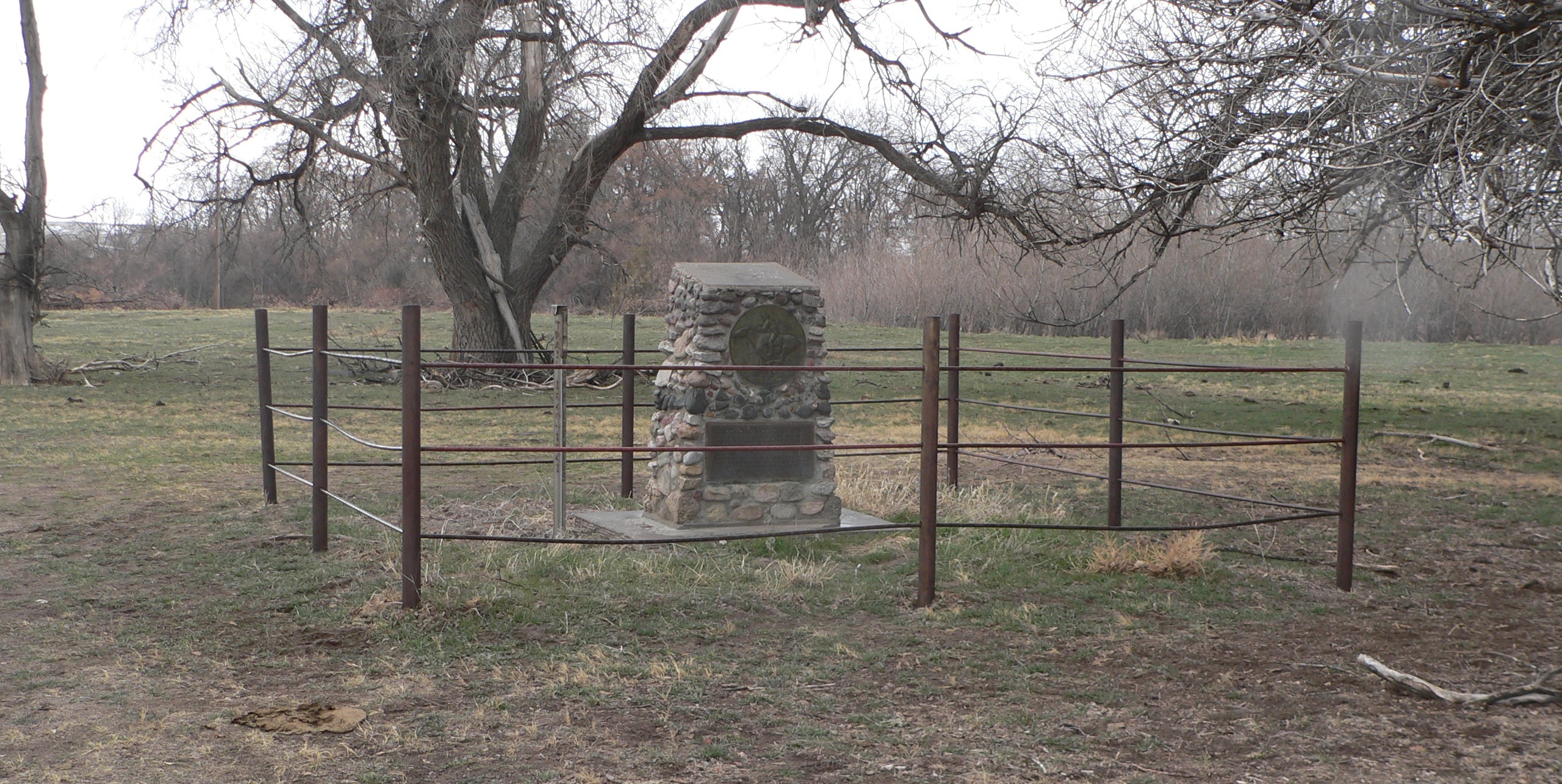
Official Army records listed one soldier killed and eight wounded at Mud Springs. Colonel Collins estimated thirty Indigenous casualties. The Cheyenne warrior George Bent, who may have participated in the engagement, later claimed no warriors died. Both accounts cannot be true, and the discrepancy speaks to the fog of frontier warfare, where neither side could accurately assess enemy losses and both had reason to inflate or minimize the count. What remains certain is that Mud Springs represented a significant engagement, one of the largest gatherings of Plains tribal warriors against Army forces in Nebraska Territory. Today the site is a National Historic Landmark, the sod walls long dissolved back into prairie earth, the telegraph line silent for over a century. Only the landscape endures, rolling grassland where a handful of men once held out against overwhelming odds in the freezing February wind.
From the Air
The Battle of Mud Springs site is located at 41.48N, 103.02W in Morrill County, Nebraska, approximately 8 miles northwest of Dalton. The terrain is rolling high plains prairie with minimal vertical features. Best viewed at 2,000-3,000 feet AGL. The site itself has no prominent visual markers from the air; look for the general area along the historic trail route northwest of Dalton. Nearby airports include Sidney Municipal Airport (KSNY) approximately 25 miles southeast and Western Nebraska Regional Airport (KBFF) in Scottsbluff approximately 35 miles west. The North Platte River valley is visible to the north where the Battle of Rush Creek occurred.