Battle of North Anna
"We must strike them a blow," Robert E. Lee repeated from his sickbed, delirious with illness while the greatest tactical trap of his career sat waiting to be sprung. It was May 1864, and along the banks of the North Anna River in central Virginia, Lee had split Ulysses S. Grant's army in two with an ingenious line of earthworks shaped like an inverted V. The Union forces had walked right into it. But the blow never came. The Battle of North Anna, fought May 23 through 26, stands as one of the Civil War's most tantalizing might-have-beens: a moment when Confederate engineering brilliance collided with the frailty of a single human body, and the entire course of the war hung in the balance.
The Chess Match South
By late May 1864, Grant and Lee had been locked in a grinding dance of death for three weeks. After the bloodbaths of the Wilderness and Spotsylvania Court House, with nearly 61,000 combined casualties between them, Grant refused to retreat north as every previous Union commander had done. Instead, he kept sliding southeast, always seeking Lee's right flank, always trying to wedge his 68,000 men between the Confederate army and Richmond. Lee, commanding roughly 53,000 troops, kept racing him to each new defensive line. Grant's target was the North Anna River and the critical railroad junction at Hanover Junction, modern-day Doswell. If he could seize both, he would sever Lee's supply line from the Shenandoah Valley and deny the Confederates their next natural defensive position. Grant dangled Hancock's II Corps as bait, hoping Lee would attack the isolated 20,000-man force. Lee did not take the bait. His army reached the North Anna first, on May 22, and began digging in.
Bayonets as Ladders
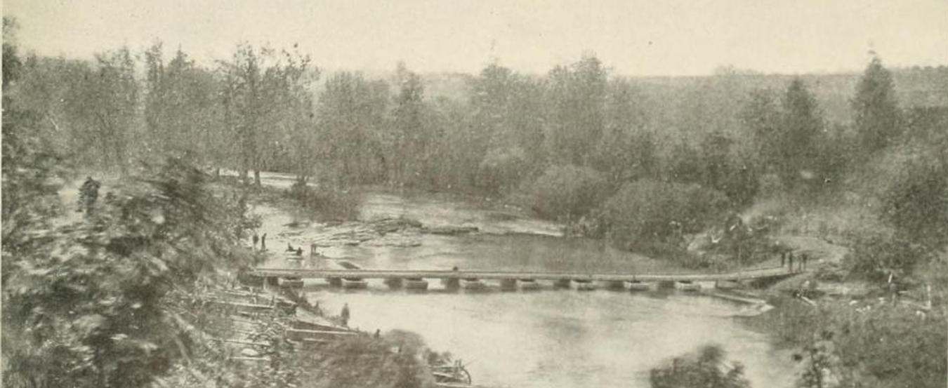
On the morning of May 23, the Union army arrived at the river in force. Hancock's corps advanced down the Telegraph Road toward Chesterfield Bridge, where a small South Carolina brigade under Colonel John W. Henagan had thrown up a dirt redoubt. Meanwhile, General Warren's V Corps marched upstream to ford the river at Jericho Mills, finding the crossing completely undefended. The fighting at Chesterfield Bridge was fierce and inventive. Union soldiers stabbed bayonets into the earthworks and used them as makeshift ladders, climbing over each other's backs to scale the defenses. Henagan's outnumbered defenders fled across the bridge, trying to burn it behind them, but Union sharpshooters drove them off. At Jericho Mills, Warren's men waded across unopposed, but A.P. Hill's Confederate counterattack nearly drove them into the river. Warren's artillery, positioned on a ridge, saved the day with plunging fire that shattered the attacking brigades. The next morning, Lee dressed down Hill with a stinging rebuke: "Why didn't you throw your whole force on them and drive them back as Jackson would have done?"
The Hog Snout Line
That night, Lee and his chief engineer Martin L. Smith conceived one of the war's most elegant defensive positions. Rather than simply fortifying the river bluffs, they designed a five-mile line shaped like an inverted V, nicknamed the "hog snout line," with its apex anchored at the impassable Ox Ford. A.P. Hill's corps held the western arm, while Anderson and Ewell stretched east through Hanover Junction to a swamp. The geometry was devastating. Grant's army, crossing the river on either side of the V's apex, would be split into two wings unable to reinforce each other without recrossing the North Anna twice. Lee planned to pin Warren and Wright on the western arm with 7,000 men, then concentrate 36,000 troops against Hancock's 20,000 on the eastern side. Lee confided to a local physician with quiet confidence: "If I can get one more pull at him, I will defeat him."
The Blow That Never Fell
On May 24, Grant fell directly into the trap. His men crossed the river on both sides of Ox Ford, exactly as Lee had planned. Grant even telegraphed Washington triumphantly: "The enemy have fallen back from North Anna. We are in pursuit." He had no idea his army was being split apart. The day's most remarkable episode belonged to Brigadier General James H. Ledlie, who ordered an assault on the Ox Ford fortifications while thoroughly drunk. His brigade was shattered by Mahone's entrenched defenders during a violent thunderstorm, but Ledlie inexplicably received praise for his men's "gallant" behavior. He would later be promoted, only to disgrace himself permanently at the Battle of the Crater in July. But the Confederates could not capitalize on any of this. Lee was struck by a debilitating bout of illness and was confined to his tent. His subordinates were spent: Hill was sick, Ewell exhausted, Stuart dead, Longstreet wounded. Civil War historian Gary Gallagher identifies this as the one time Lee's health directly and decisively affected the outcome of a battle.
What Remains Along the River
For two more days the armies stared at each other from their earthworks. Grant finally grasped the danger of his divided position and ordered his men to dig in rather than advance. On the night of May 26, the Union army slipped away to the southeast, beginning another flanking march toward the crossroads of Cold Harbor. Union casualties for the four days totaled 2,623, relatively modest by the Overland Campaign's grim standards. Today, the North Anna Battlefield Park preserves 165 acres of the original field, including the so-called "killing fields" where the heaviest fighting took place. The American Battlefield Trust has acquired and preserved over 654 acres at Jericho Mills alone. The earthworks of Lee's inverted V, among the most innovative field fortifications of the entire Civil War, can still be traced through the Virginia countryside, a monument to a plan that was perfect in every respect except the health of the man who conceived it.
From the Air
The North Anna battlefield is located at 37.89N, 77.49W in Hanover County, Virginia, roughly 25 miles north of Richmond. From 3,000 feet, the North Anna River is clearly visible winding through the landscape. The inverted-V earthwork line extended approximately five miles from the river's south bank. Nearest airports include Richmond International (KRIC) about 25 nm south and Hanover County Municipal (KOFP) approximately 10 nm southeast. The Chesterfield Bridge site along the Telegraph Road (now US Route 1) and the Jericho Mills ford upstream are the two primary crossing points visible from the air.