Battle of Pilckem Ridge
Zero hour came at 3:50 AM on July 31, 1917, chosen so that British troops advancing from the west would have the light behind them while Germans looked into darkness. It was still night when the barrage began, the unbroken cloud ceiling so low that dawn brought no illumination. Across a front stretching from the Ypres-Comines Canal to the flooded marshes north of the city, British, French, and Belgian forces rose from their trenches and walked into the Third Battle of Ypres. By afternoon, they had captured Pilckem Ridge and advanced nearly three miles in places. Then the rain began.
The Grand Design
Field Marshal Haig's plan was ambitious: break out of the Ypres Salient, advance to the Passchendaele-Staden ridge, cut the railways supplying the German Fourth Army, then drive for the Belgian coast to eliminate submarine bases threatening Britain's lifeline. The Fifth Army under General Hubert Gough would lead the attack, supported by the Second Army on the southern flank and the French First Army in the north. The preliminary bombardment had lasted from July 16 to 25, delivering over four million shells onto the German positions. The attack was to proceed in stages, with infantry advancing behind a creeping barrage moving at 100 yards every four minutes.
Triumph on the Flanks
The French First Army achieved remarkable success on the northern flank. General Francois Anthoine's troops crossed the Yser Canal and advanced over a mile, capturing Bixschoote and taking more than 600 prisoners. They recovered most of the ground lost in the German gas attack of April 1915. In the British XIV Corps area, the Guards Division had already pushed forward two days earlier after reconnaissance aircraft spotted empty German trenches. The 38th Welsh Division and neighboring formations crossed the Steenbeek River and captured ground nearly to the final objective. The German defenses in the north had been pulverized by the bombardment.
The Plateau Problem
On the Gheluvelt Plateau to the south, where the Germans had concentrated their strongest defenses, the story was different. II Corps faced the most difficult ground and the heaviest opposition. The 30th Division got lost in the darkness, mistaking Chateau Wood for their objective of Glencorse Wood, an error not discovered until mid-morning. The 24th Division was stopped by machine-gun fire from pillboxes that the bombardment had failed to destroy. Boggy ground, loss of direction, and intact German strongpoints limited the advance to a few hundred yards in places. The plateau's commanding heights remained in German hands.
The Afternoon Counter-Attack
By midday, reserve brigades in XIX Corps had pushed beyond the Steenbeek River toward the green line objective, nearly three miles from the start. Then rain began to fall, cutting off the forward troops from observation. At 2:30 PM, German regiments from the specialist counter-attack divisions advanced from behind Passchendaele Ridge under cover of smoke shells. The British infantry, depleted and out of touch with their artillery, were rolled up from flank to flank. By the time they reached the black line positions, where British artillery observers could still see them, the three reserve brigades had suffered 70 percent casualties. The Germans were stopped there by massed artillery and machine-gun fire, but the ambitious green and red line objectives were lost.
The Beginning of the Rains
Rain fell throughout the afternoon and evening of July 31, then continued for days. The carefully planned sequel attacks were postponed repeatedly. The second major assault, originally scheduled for August 4, did not occur until August 16. The green line objectives on the Gheluvelt Plateau were not captured until September 20. The shelling that had preceded the attack had destroyed the drainage canals crisscrossing Flanders; the rain turned shell craters into death traps. Men who slipped from duckboards could drown before rescue arrived. The optimistic plans for exploitation, cavalry advances, and amphibious landings dissolved in the mud. Pilckem Ridge marked both a tactical success and the beginning of the campaign's descent into attrition warfare.
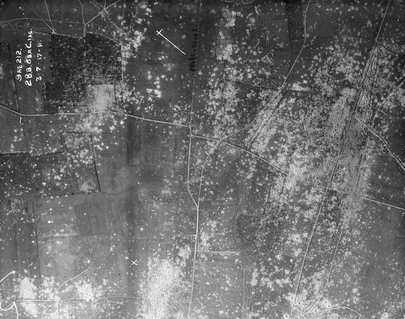
From the Air
Located at 50.89N, 2.88E at Pilckem (Pilkem) Ridge northwest of Ypres, Belgium. The ridge overlooks the Steenbeek valley and the approaches to Langemarck to the northeast. The flooded areas of the Yser River system are visible to the north. Ypres and the Menin Gate memorial lie approximately 3nm to the south. Essex Farm Cemetery, where John McCrae wrote 'In Flanders Fields,' is nearby. Kortrijk-Wevelgem Airport (EBKT) is approximately 18nm south. Best viewed at 2,500-4,000 feet AGL to appreciate the subtle terrain features that shaped the battle.