Battle of Suomussalmi
The Soviet plan looked elegant on paper: send the 163rd Rifle Division west from Ukhta, capture the crossroads village of Suomussalmi, and push on to the port city of Oulu on the Gulf of Bothnia. Finland would be severed at its narrow waist, its northern half cut off from reinforcement. On 30 November 1939, the first day of the Winter War, columns of Soviet infantry, tanks, and cavalry crossed the border and advanced into a landscape of frozen lakes, dense forest, and logging trails that no one in Moscow had adequately mapped.
Into the Forest Trap
The 163rd Division advanced on two axes. The 662nd Infantry Regiment turned north toward Peranka, while the 81st Regiment pushed south to join the 759th in attacking Suomussalmi. Finnish border units were thin here; nobody had expected a major offensive through this roadless wilderness. By 7 December, Soviet troops had captured Suomussalmi village itself. But capturing a crossroads and holding it are different problems. On 6 December, Finnish independent battalion ErP 16 stopped the northern Soviet thrust at the Piispajärvi straits. Paavo Susitaival took command of Task Force Susi to the north and east, while Colonel Hjalmar Siilasvuo's Regiment JR 27 arrived by 9 December and blocked the Soviet push toward Hyrynsalmi. Within days, Siilasvuo had severed the Raate Road supply line east of Suomussalmi, and Finnish troops cut the northern communications link at Hulkonniemi.
The Motti Tactic
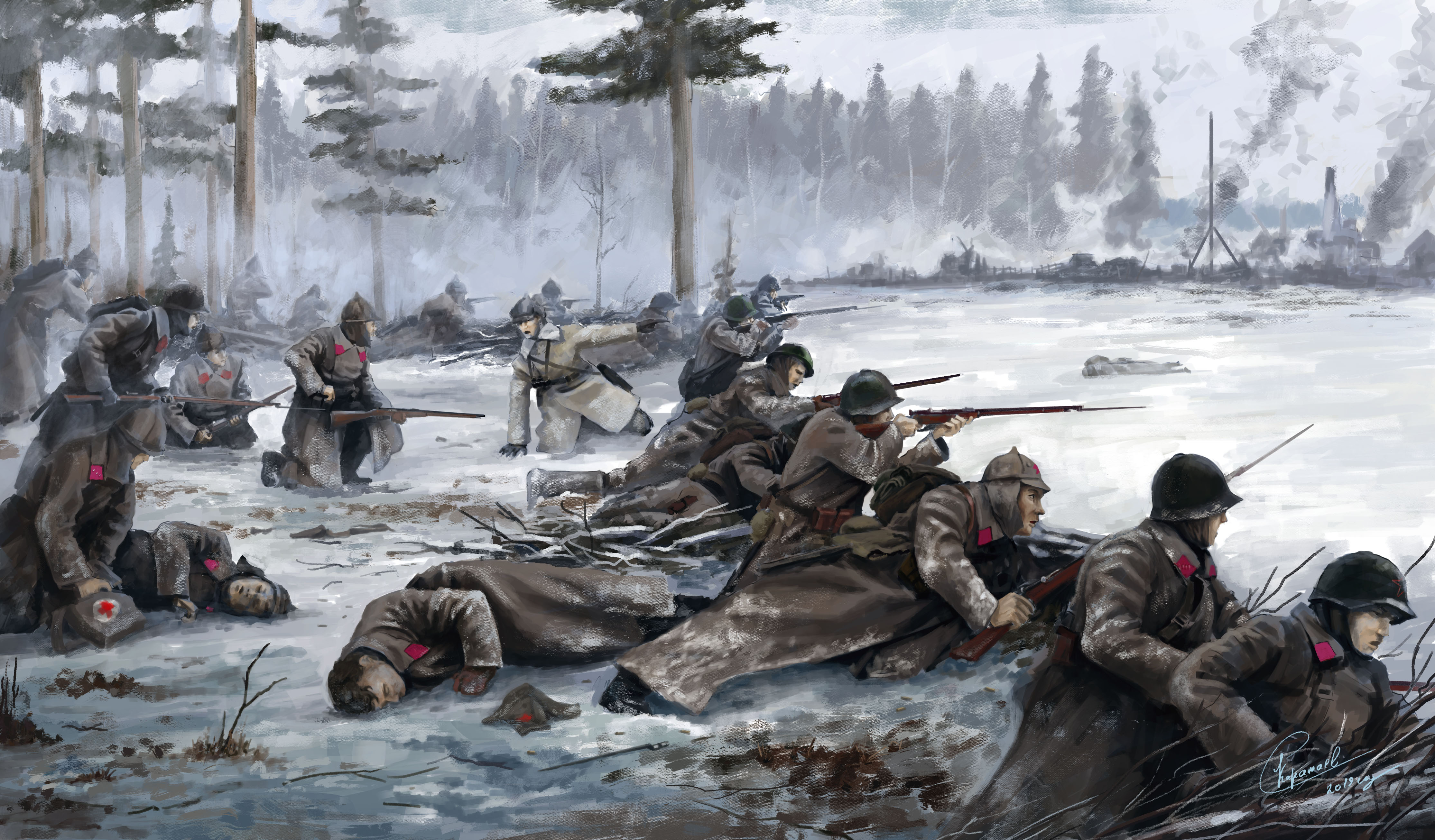
What followed was a masterclass in asymmetric winter warfare. The Finns employed a technique they called motti—named after a measure of stacked firewood. Soviet mechanized columns, confined to the few roads that threaded through frozen marshland, were divided into isolated pockets by mobile Finnish ski troops who moved freely through the deep snow. Each pocket was then surrounded and attacked piecemeal. Finnish strategy was flexible, sometimes ruthlessly pragmatic: troops targeted Soviet field kitchens, denying warmth and food to soldiers already struggling in sub-Arctic temperatures that plunged well below minus thirty. Soviet winter camouflage was inadequate, their communications relied on easily intercepted phone lines, and morale crumbled as political officers proved no substitute for proper supply chains.
Christmas Offensive
By late December, the Soviet 163rd Division was surrounded in the Hulkonniemi-Suomussalmi area. On 24 December, commander Zelentsov tried to break out to the south but was stopped by JR 27's Second Battalion. The next day, a westward breakout attempt also failed. On 25 December, Siilasvuo reorganized his forces into the 9th Division, absorbing Regiment JR 64, guerrilla battalion Sissi P1, and bicycle battalion PPP 6. Two days later, Task Force Susi—reinforced by Regiment JR 65—captured the key position at Palovaara, severing the 662nd Regiment from the rest of the 163rd Division. Siilasvuo then launched his final assault: Kaarle Kari attacked from the northwest, Frans Fagernäs and Martti Harola led flanking columns, PPP 6 struck from the north, and Paavola sealed the lakeside route along Kiantajärvi. The 163rd Division was destroyed.
Why Finland Won
The Soviet objective of cutting Finland in half through the Oulu region was, as one analysis put it, inherently unrealistic. The terrain was forested marshland where the road network consisted of logging trails. Mechanized divisions that relied on these tracks became sitting targets for mobile Finnish ski troops who knew the ground intimately. Finnish morale was high—these soldiers were defending their homeland—while Soviet troops had been given exclusively political reasons for their attack. The final Finnish assault was deliberately simple: a head-on charge that minimized the chance of tactical errors in rough weather. The battle, fought from 30 November 1939 to 8 January 1940, is considered the most significant Finnish victory in northern Finland during the Winter War. It proved that terrain, mobility, and will could overcome massive numerical superiority.
From the Air
Located at 64.89°N, 28.89°E near the village of Suomussalmi in the Kainuu region of eastern Finland. The terrain below is dense boreal forest interspersed with frozen lakes and marshland. Lake Kiantajärvi is visible as a major landmark. Recommended viewing altitude: 3,000–8,000 ft AGL to appreciate the road network and surrounding wilderness. Nearest airport: Kajaani (EFKI), approximately 130 km southwest. The Finnish-Russian border lies roughly 50 km to the east.