Battle of the Tongue River
Jim Bridger saw the smoke first. On August 28, 1865, the legendary mountain man spotted a thin column rising from an Arapaho village 35 miles west of the U.S. Army's position. By 8 a.m. the next morning, Brigadier General Patrick Edward Connor's soldiers would charge into that village with howitzer cannon and complete surprise, beginning a battle that covered 70 miles and 36 hours, and left deep scars on the Powder River Country that remain preserved in the Wyoming landscape today.
Orders from the Missouri
The Powder River Expedition of 1865 grew from frustration. Cheyenne, Sioux, and Arapaho warriors had been raiding overland mail routes, wagon trains, and military posts along the Oregon and Overland trails. Major General Grenville M. Dodge, commanding the Department of the Missouri, ordered a punitive campaign to end the attacks. He gave tactical command to Connor, who had experience fighting in the District of Utah. The expedition was a three-pronged affair involving 2,600 soldiers, civilians, and tribal scouts, designed to converge on the Powder River Country of Wyoming and Montana. Connor led the western column himself, commanding 380 soldiers from the 6th Michigan Cavalry, 7th Iowa Cavalry, and 11th Ohio Cavalry, along with 95 Pawnee scouts under Captain Frank J. North and 84 Omaha and Winnebago scouts.
A Village Caught Unprepared
Connor moved fast once his scouts located the village. He assembled 200 of his most mobile soldiers, two mountain howitzers, and 70 allied scouts, then marched through the night with Bridger guiding. The village, led by chiefs Black Bear and Medicine Man, held about 500 people, but many warriors were away raiding Crow camps along the Big Horn River. When the soldiers charged at dawn on August 29, they found mostly old men, women, and children. The howitzers pounded the tipis while soldiers rushed in. In the chaos, firing was indiscriminate. Women and children died alongside warriors. The few able fighters mounted a defense and began retreating up Wolf Creek, covering the flight of survivors over twelve desperate miles.
Pursuit and Counterattack
Connor and 30 men, including 15 Pawnee scouts, pursued the retreating Arapaho while most soldiers remained to loot and burn the village. The chase proved costly. The Arapaho counterattacked, and Connor's horses gave out. He retreated to the burning village, where his men had captured more than 500 horses. The Arapaho harassed them from the surrounding hills, trying to reclaim their herd, but the soldiers abandoned the destroyed village around 2:30 that afternoon. North and the Pawnee led the column, driving the captured horses before them. The Arapaho pursued but could not recover the animals. By 3 a.m. the following morning, Connor's exhausted force reached their starting point.
The Toll and Its Aftermath
Connor claimed 63 Arapaho warriors killed, though many casualties occurred among women and children. On the Army's side, Private Little Bird of the Omaha Scouts died, and Acting Sergeant Charles M. Latham of the Signal Corps was mortally wounded. Six men were wounded, including Second Lieutenant Oscar Jewett. Connor singled out Chief Little Priest of the Winnebago and Captain Frank North for bravery. He forbade looting and ordered captured women and children released. Yet the attack failed to cow the Arapaho. Two days later, they killed Captain Osmer F. Cole of the 6th Michigan Cavalry. On September 1, more than 100 Arapaho attacked the Sawyers wagon train along the Tongue River, killing two men and besieging 60 wagons for two weeks until Connor's soldiers rescued them.
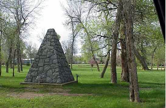
What Remains
A portion of the battlefield is preserved today at Connor Battlefield State Historic Site in Ranchester, Wyoming, listed on the National Register of Historic Places. The grass grows over the site where tipis once stood, where howitzer shells fell, where women and children fled up Wolf Creek. The Tongue River still flows through this country, and the site stands as a reminder of the violent conflicts that shaped the American West. The Powder River Expedition continued until winter ended the campaign, part of the larger Red Cloud's War that would cost the Army dearly before it was done.
From the Air
Connor Battlefield State Historic Site sits at coordinates 44.91N, 107.16W near Ranchester, Wyoming, at approximately 3,800 feet elevation. The nearest general aviation airport is Sheridan County Airport (KSHR), about 15 miles to the southeast. From altitude, the Tongue River valley is clearly visible running through the Powder River Country. The Big Horn Mountains rise to the west. The battlefield occupies relatively flat terrain along the river, distinct from the surrounding rangeland.