Battle of Wadi Akarit
Rommel had identified this position months earlier, back when the Afrika Korps was still winning. After the Second Battle of El Alamein, he wanted to retreat here, to the Wadi Akarit north of Gabes, where the Mediterranean Sea on one side and impassable salt marshes on the other created a bottleneck that no flanking maneuver could bypass. By April 1943, Rommel was gone from North Africa, but the Axis forces were exactly where he had wanted them, dug into the last readily defensible line before the coastal road opened toward Sfax and Tunis. The only way through was straight ahead.
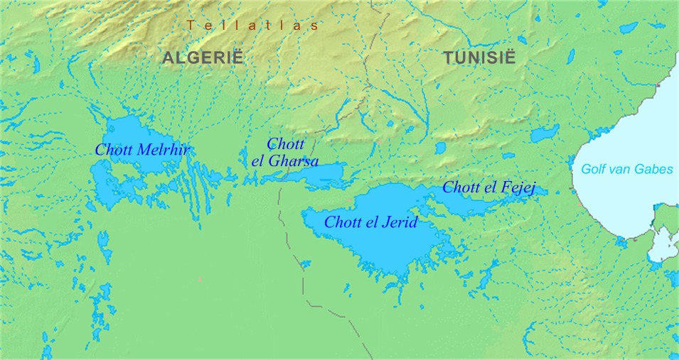
The Geography of No Choice
The Gabes Gap earned its name honestly. East of the town of Gabes, the defense line followed the Wadi Akarit for five miles from the coast, its steep banks impassable to armor. Beyond the wadi, the ground rose to Djebel er Roumana, the last in a chain of hills forming the northern boundary of the Chott el Djerid salt marshes. An anti-tank ditch blocked the approaches to the high ground. There were no flanks to turn, no opportunity to disperse the defenders by attacking at multiple points, as Montgomery had done at El Alamein. Unlike the Mareth Line, which the Eighth Army had outflanked through the Tebaga Gap, the Wadi Akarit offered no back door. A frontal assault on prepared defenses was unavoidable, and everyone from Montgomery down to the infantry privates knew it.
Mountain Warriors at Dawn
The assault plan hinged on an unconventional proposal. Major-General Francis Tuker, commanding the 4th Indian Division, persuaded Montgomery to let his mountain-trained infantry attack Jebel Fatnassa, a steep eight-hundred-foot hill that the conventional plan had avoided. The gamble paid off. In the predawn darkness of April 6, Gurkha and Rajputana riflemen scaled the heights and overwhelmed the Italian and German defenders. The 4th Battalion, 6th Rajputana Rifles pushed nearly five miles beyond the hills onto the plain behind, a penetration so deep it threatened to unravel the entire Axis line. Meanwhile, the 50th Northumbrian Division drove into determined resistance from Italian marines dug in along the wadi itself, well supplied with automatic weapons and grenades. The cost was steep: the 6th Battalion of the Green Howards lost two senior officers, six NCOs, and 118 other ranks killed in the fighting for Point 85.
The Counterattack That Came Too Late
The Axis response was fierce but disjointed. Italian General Messe ordered the 164th Leichte Afrika Division to shift from the western hills to the center, then sent the 15th Panzer Division to join the 90th Light Division in a counterattack against positions the 51st Highland Division had captured on Djebel Roumana. Three German counterattacks crashed against the Highlanders during the afternoon, each one repulsed by the 7th Battalion, Argyll and Sutherland Highlanders. The 10th and 21st Panzer Divisions, which had been facing the US II Corps at El Guettar, were also rushed toward the British penetration, but they arrived too late to change the outcome. By nightfall, the Axis position was untenable. Messe reported the situation to von Arnim. Kesselring and Rome urged the army group to continue fighting, but Arnim ordered a retreat to Enfidaville, 240 kilometers to the north.
The Road North Opens
At dawn on April 7, the Allies found the Axis trenches empty. The 2nd New Zealand Division and the 1st Armoured Division launched a pursuit across the coastal plain, from semi-desert into olive groves that offered ambush opportunities. There was little resistance. Axis prisoners were sometimes surprised to see Allied troops so far beyond what they thought was the front line, and the retreating forces left behind enormous quantities of material, including captured American supplies. The Eighth Army covered 140 miles north of Wadi Akarit. Sfax fell, then Sousse. The cost of the battle itself had been 1,289 Allied casualties and 32 tanks, in exchange for shattering the last natural defensive barrier before Tunis. At least three Italian divisions had been so badly mauled they had to be consolidated into a single unit. The Axis forces fell back to Enfidaville, twenty-five miles south of Cape Bon, where they would make their final stand before the surrender of over 260,000 troops in May.
From the Air
Located at 33.88°N, 10.12°E in southern Tunisia, north of the town of Gabes. The wadi itself runs roughly east-west from the coast to the salt marshes of the Chott el Djerid. Djebel er Roumana and Jebel Fatnassa are visible as ridge lines running perpendicular to the coast. Nearest airport is Gabes-Matmata (DTTG). The vast white expanse of the Chott el Djerid is dramatically visible from altitude to the west. Overfly at 4,000-6,000 ft AGL to see how the terrain funneled the battle into this narrow gap.