Battle of Westport
Buffalo Bill Cody fought here as a private. Wild Bill Hickok served as a scout. Frederick Benteen, who would later ride into history at Little Bighorn, assumed command of a brigade when his colonel was wounded. On October 23, 1864, the fields and creek banks south of Westport, Missouri, became the stage for one of the American Civil War's decisive western engagements, where more than 30,000 soldiers collided in a battle that ended the last major Confederate offensive west of the Mississippi River.
Price's Desperate Gamble
In September 1864, Confederate Major General Sterling Price led 12,000 men into Missouri with an audacious goal: recapture the state for the South and turn Northern voters against Abraham Lincoln weeks before the presidential election. The plan unraveled almost immediately. St. Louis was too heavily fortified. Jefferson City was too well defended. Price turned westward, his army shrinking with every mile as disease, desertion, and battlefield losses whittled his force down to 8,500 men. Behind him, Union cavalry under Alfred Pleasonton closed the gap. Ahead, Major General Samuel R. Curtis assembled a force he called the Army of the Border, bolstered by Kansas militia after the governor finally relented. Price was walking into a trap of his own making.
Daybreak Along Brush Creek
General James Blunt had constructed a defensive line along Brush Creek, perpendicular to the Kansas state line. At daybreak on October 23, Blunt sent his skirmishers splashing across the icy creek. The Confederates under Jo Shelby counterattacked with his Iron Brigade, driving the Federals back so hard that one brigade retreated nearly to the streets of Westport itself. The Confederate momentum stalled when Shelby's men ran out of ammunition. At that critical hour, Union reinforcements arrived and Curtis heard Pleasonton's guns engaging the Confederate rear at Byram's Ford. Needing a breakthrough, Curtis found a local farmer named George Thoman, furious that Confederates had stolen his horse the night before. Thoman showed Curtis a gulch cut by Swan Creek leading to Shelby's exposed flank. Curtis personally directed the 9th Wisconsin Battery through the gully, and when their guns opened fire on the Confederate flank, the tide turned irreversibly.
Collapse and Flight
As Shelby's lines buckled, disaster struck the Confederate rear as well. Pleasonton's cavalry forced their way across the Blue River at Byram's Ford, and a third Federal column drove Confederates from a ford near Hickman Mills. Price's army was now being hit from three directions. The Confederates pulled back to a final line along Forest Hill, where Colonel James McGhee's Arkansas cavalry made a desperate charge down Wornall's Lane to capture a Union battery. Captain Curtis Johnson of the 15th Kansas Cavalry intercepted them, and the two commanders fought each other with revolvers at close range. Both were badly wounded but survived. When Pleasonton's artillery arrived in support, the last Confederate resistance broke. Price's men set fire to prairie grass to create a smoke screen and fled south, the road littered with debris from the shattered army.
Where Parks Remember War
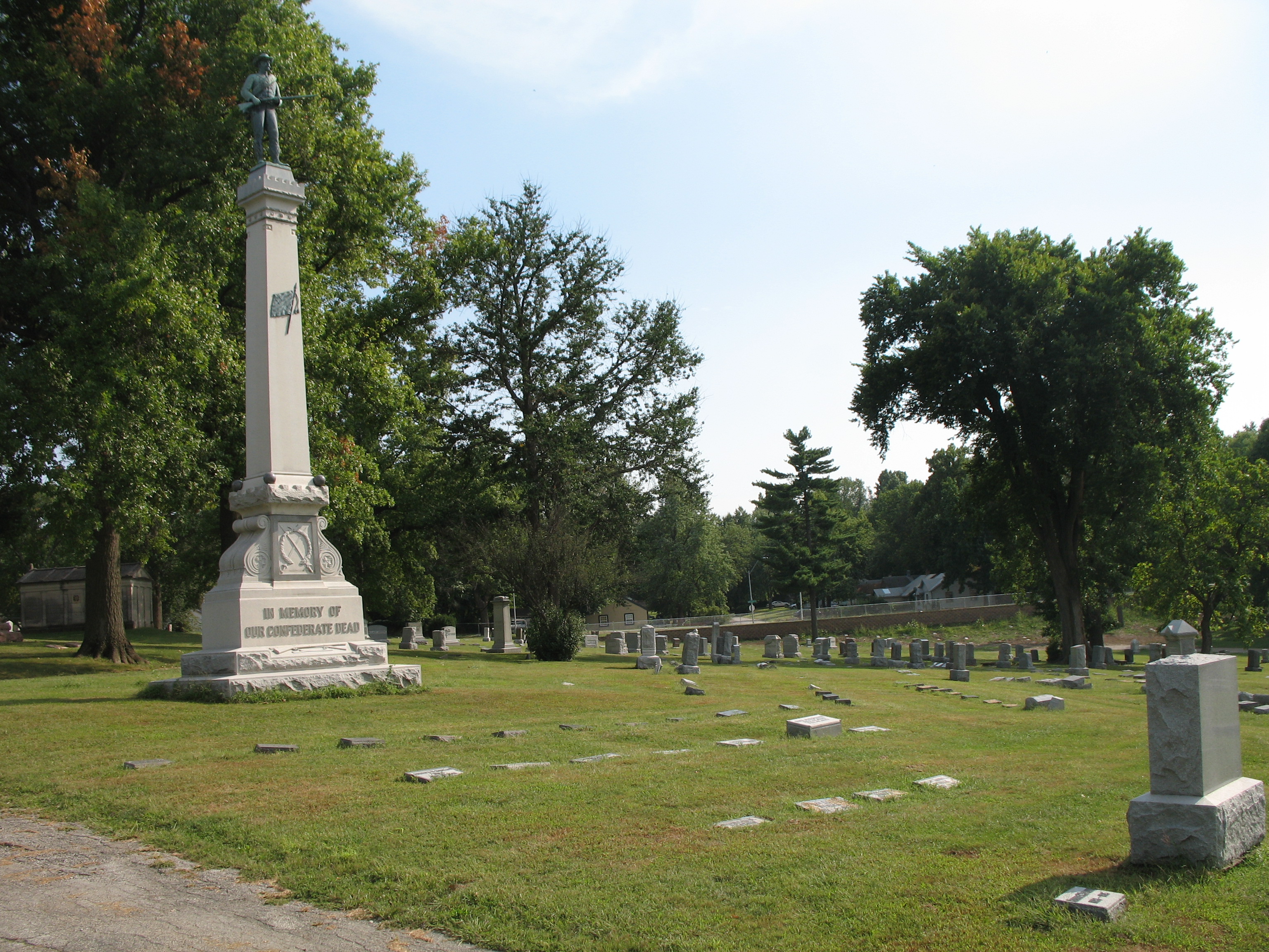
The Battle of Westport ended Confederate ambitions in Missouri forever. Curtis wrote to Washington that "the victory at Westport was most decisive." Federal forces chased Price through Kansas and southern Missouri, engaging him at Mine Creek and Newtonia before he retreated into Indian Territory with fewer than 6,000 survivors from his original 12,000. Today the center of the main battlefield lies beneath Loose Park, south of the Country Club Plaza. The Wornall House, used as a hospital by both sides during the battle, still stands. A driving tour begins at Kelly's Westport Inn, the oldest standing building in Kansas City, and Forest Hill Cemetery holds the remains of General Shelby and his Iron Brigade. The battlefield entered the National Register of Historic Places in 1989, and former President Harry S. Truman was a charter member of the Civil War Round Table that helped preserve these sites.
From the Air
The battlefield spans the area around Loose Park and Brush Creek in south Kansas City, centered near 39.03N, 94.59W. The Country Club Plaza is immediately north. Byram's Ford site is along the Blue River to the east in Swope Park. Wornall House and Forest Hill Cemetery are visible landmarks. Nearest major airport: Kansas City International (KMCI). Recommended viewing altitude: 3,000-5,000 feet AGL to see the creek lines and park layout that defined the battle.