Batu Islands
The equator draws an invisible line through the Batu Islands, passing between the island of Pini to the south and Tanahmasa to the north, as though the Earth itself wanted to bisect this quiet archipelago. Seventy-eight islands -- three large, seventy-five small, fewer than half inhabited -- scatter across the Indian Ocean off the western coast of Sumatra, suspended between the larger island of Nias to the north and Siberut to the south. In Indonesian and Malay, batu means stone, and there is something geological in the stubbornness of these islands: remote, lightly populated, governed from a regency capital on a different island entirely, they persist in a kind of dignified obscurity that the modern world is only now beginning to notice.
Stone Islands on the Equator
The three primary islands -- Pini, Tanahmasa, and Tanahbala -- are roughly equal in size, anchoring the archipelago like three stepping stones laid across open ocean. Around them, smaller islands fan out in clusters: Sipika, Tello, and Sigata off the west coast of Tanahmasa; Simuk considerably further west, alone in deeper water; Bojo hanging off the southern edge of Tanahbala. The total land area across all seven administrative districts is about 1,201 square kilometers, supporting a population estimated at roughly 35,000 as of mid-2024. Administratively, the islands belong to South Nias Regency within North Sumatra province, a jurisdictional arrangement that has been subdivided repeatedly -- the original two districts have since become seven, each carved from the last like Russian nesting dolls of bureaucratic reorganization.
A Language Carried Across Water
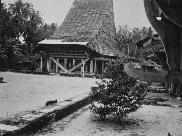
The people of the Batu Islands speak Li Niha, the language of Nias, their larger neighbor to the north. The linguistic connection runs deeper than shared vocabulary; it speaks to centuries of interaction across the strait that separates the two island groups. Historically, the Batu Islands served as a refuge for enslaved people who managed to escape from Nias, a place where the ocean itself offered protection from pursuit. That the islands became a destination for people seeking freedom says something about their character -- remote enough to shelter, hospitable enough to sustain. The population at the 2010 Census counted 28,468 people, a figure that has grown modestly in the years since. Life here moves at a pace dictated by weather and water, not clocks.
Leopards in the Canopy
Among the Batu Islands' most remarkable residents are ones that few inhabitants ever see. A population of the Sunda clouded leopard -- Neofelis diardi, a species distinct from the mainland clouded leopard and found only in Borneo and Sumatra -- has been recorded on the islands. How these elusive cats came to inhabit a relatively small archipelago is itself a question that connects to deep geological time, when lower sea levels may have joined these islands to the Sumatran mainland. The clouded leopard is a creature of the forest canopy, stocky and short-legged with the longest canine teeth relative to body size of any living cat. Their presence on the Batu Islands suggests that enough contiguous forest habitat remains to support a viable population, though how long that will hold as human settlement expands is an open question.
The Swells Rolling In
In recent years, the Batu Islands have begun appearing on a very different kind of map. Surfing boat charters departing from Padang, the major port city on the Sumatran mainland, have started making runs to the archipelago, drawn by the same Indian Ocean swells that have made the neighboring Mentawai Islands a surfing legend. The Batu breaks are less documented and less crowded -- for now. The islands lack the infrastructure that the Mentawais have built over decades of surf tourism, which is precisely the appeal for surfers willing to trade comfort for uncrowded waves. Whether this growing attention will transform the Batu Islands the way tourism has reshaped other Indonesian archipelagoes remains to be seen. For the moment, the islands occupy a threshold: known enough to attract visitors, remote enough to remain themselves.
Where the Map Thins Out
In 2006, BBC presenter Simon Reeve visited the Batu Islands during his documentary series Equator, following the line of zero latitude across the globe. His arrival highlighted what anyone flying over the archipelago immediately grasps: this is a place where the map thins out, where the dense annotations of coastal Sumatra give way to scattered green shapes on blue water. From altitude, the three main islands are clearly visible, fringed by reef and surrounded by their constellation of smaller companions. The water shifts from deep oceanic blue to the pale turquoise of shallow lagoons. There are no towering landmarks, no famous ruins, no grand infrastructure projects. What the Batu Islands offer instead is something increasingly rare -- an inhabited archipelago that still belongs more to the sea than to the world beyond it.
From the Air
Located at 0.23S, 98.37E in the Indian Ocean, approximately 100 km off the west coast of Sumatra. The three main islands (Pini, Tanahmasa, Tanahbala) are clearly visible from cruising altitude, arranged roughly north-to-south. The equator crosses between Pini and Tanahmasa. Nias island is visible to the north, and on clear days the Sumatran mainland is visible to the east. Binaka Airport on Nias (WIMB) is the nearest significant airfield, approximately 80 km north. Minangkabau International Airport in Padang (WIPT) lies roughly 200 km to the southeast. Expect tropical weather patterns with afternoon convective buildup. Best viewed at 3,000-8,000 ft AGL.