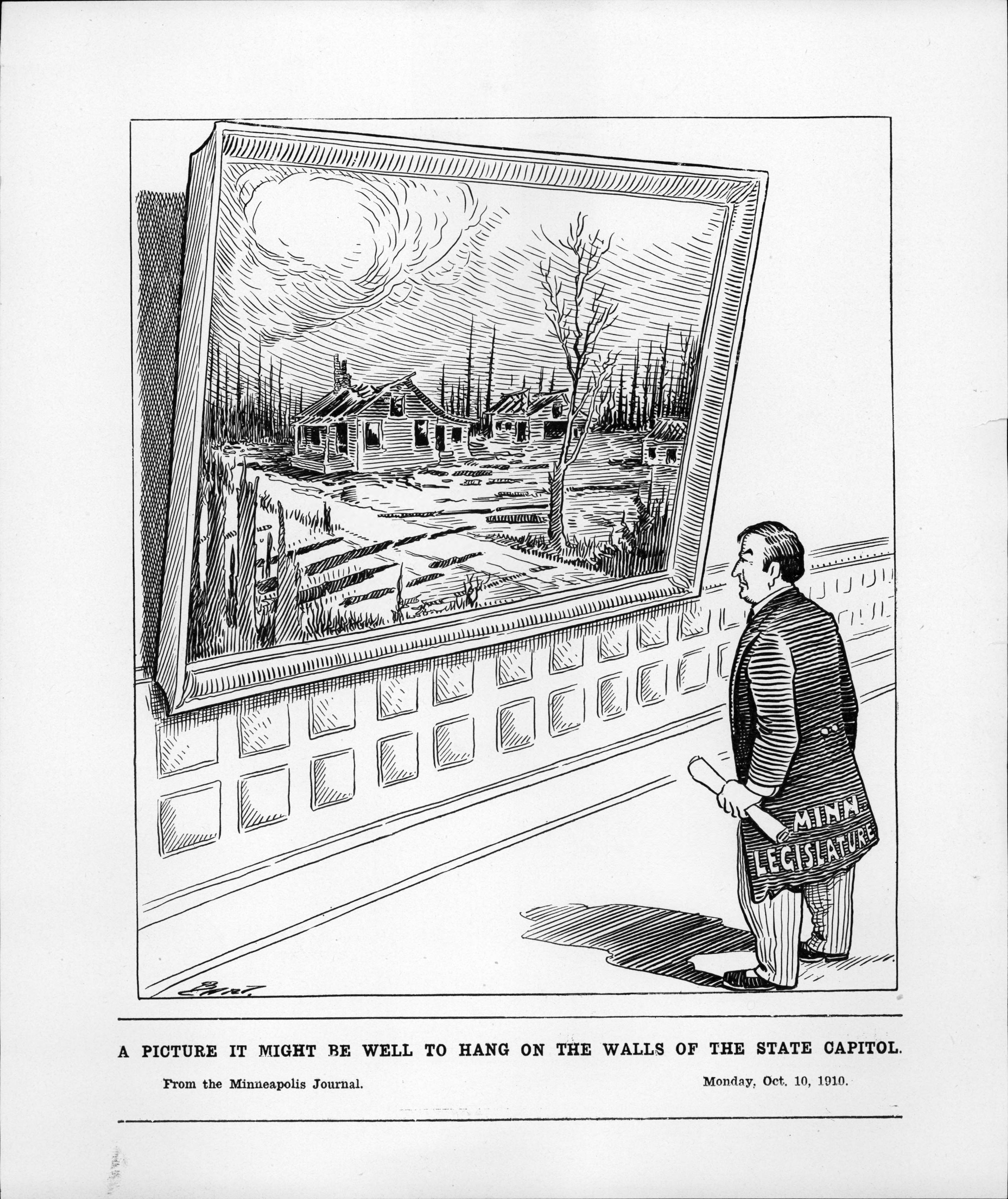
Baudette Fire of 1910
At the peak of logging season in Lake of the Woods County, a skilled person could walk across the bay without getting wet. Logs packed the waterway so tightly that the Baudette River disappeared beneath a carpet of timber, each trunk waiting its turn at the sawmills lining the shore. It was an image of prosperity, but also a warning. By the fall of 1910, the forests around the twin towns of Baudette and Spooner had been stripped to stubble, the ground carpeted with slash -- the tangled leftover branches and treetops that loggers left behind. Months of severe drought had turned this debris into kindling. On October 7, wind-driven flames erupted from the slash piles and consumed nearly everything in their path, burning between 300,000 and 360,000 acres across Lake of the Woods County in a single catastrophic day.
A Landscape Built to Burn
Lake of the Woods County in the early 1900s was timber country through and through. Several large sawmills operated at Baudette, Spooner, and across the river in Rainy River, Ontario. Homesteaders supplemented their income by cutting and selling wood, and lumber was the area's economic engine. Timber was floated down tributaries of the Rainy River to the mills or hauled by rail to distant markets. But the logging practices of the era left devastation in their wake. Most homestead land remained heavily forested, and the small cleared fields were barely enough to grow animal feed. Between those patches of cultivation lay vast tracts of slash-filled cutover land -- a patchwork of drying fuel waiting for a spark. The conditions for a massive conflagration were not just present; they were inevitable.
The Day the Sky Turned Black
The spark came on October 7, 1910, ignited by passing trains or smoldering brush fires in the tinder-dry slash. Heavy winds drove the flames into a wall of fire that swept across the county, leveling everything it touched. The twin towns of Baudette and Spooner were nearly obliterated. The villages of Graceton, Pitt, Williams, and Cedar Spur burned as well. Across the international border, the Canadian towns of Stratton, Pinewood, Rainy River, and Sprague suffered their own losses, though the town of Rainy River lost its lumber mill but kept its residential district intact. That accident of geography became a lifeline: residents of Baudette and Spooner fled across the river into Canadian homes, where they stayed for months as their own towns were rebuilt. The shared disaster forged a lasting bond between the American and Canadian communities that persists to this day.
Winter at the Door
The fire killed an estimated 29 to 42 people. On October 13, a funeral was held for 27 victims, who were buried together in a mass grave at Elm Park Cemetery in Baudette. Thousands more were left homeless, and the calendar was merciless -- northern Minnesota winters arrive early and stay long. The American Red Cross mobilized quickly, and a tent city rose within a day to shelter survivors. Supplies poured in from across the region as communities raced to provide food, clothing, and building materials before the first freeze. The devastation ranked as Minnesota's third-deadliest wildfire, behind the Cloquet fire of 1918 and the Great Hinckley Fire of 1894, placing it in a grim trilogy of infernos that scarred the state's collective memory.
From Ashes to Forestry
The Baudette fire, along with the other catastrophic blazes that had ravaged Minnesota's cutover timberlands, forced a reckoning. The state legislature approved funding to establish the Minnesota Forestry Service -- the forerunner of what would become the Minnesota Department of Natural Resources. For the first time, the state created a system of forest rangers and forestry districts to manage logging practices and prevent the reckless slash accumulation that had turned its northwoods into a powder keg. The lesson was paid for in lives, in entire towns reduced to ash, in a landscape remade by flame. Baudette rebuilt itself and endures today as the county seat of Lake of the Woods County, a small town on the Canadian border where the memory of October 7, 1910 is preserved at the Lake of the Woods Historical Society -- a reminder that the price of ignoring a landscape's warnings can be measured in everything a community holds dear.
From the Air
Located at 48.70N, 94.58W in Lake of the Woods County, far northern Minnesota near the Canadian border. The terrain is flat boreal forest and wetland, with the Rainy River visible as it flows northwest toward Lake of the Woods. Baudette International Airport (KBDE) sits one mile north of town with a single paved runway. Falls International Airport (KINL) at International Falls is approximately 75 nm to the east. From 3,000-5,000 feet, the patchwork of forest, farmland, and waterways is clearly visible. The Rainy River forms the international border with Ontario, Canada directly to the north. Lake of the Woods, one of the largest lakes in North America, lies to the northwest.