Bay of Islands
The Ngapuhi have a proverb for this place: Ka kata nga puriri o Taiamai, the puriri trees are laughing with joy. It is a phrase of welcome, of delight in the world itself, and the wider Bay of Islands region has been known as Taiamai ever since. Captain James Cook gave the bay its English name on 27 November 1769 when he landed on Motuarohia Island during his first voyage and counted the islands stretching across the 16-kilometre-wide harbour. He stopped at 144. Since then, every major chapter in New Zealand's early history has played out along these shores: the arrival of whalers and missionaries, the signing of the Treaty of Waitangi, the Flagstaff War, the founding and abandonment of the nation's first capital. A 2006 study found the Bay of Islands has the second bluest sky in the world, after Rio de Janeiro. The Ngapuhi, who have lived here for 700 years, could have told the researchers that without the instruments.
Where the Canoes Landed
About 700 years ago, the Mataatua, one of the great Maori migration canoes from Hawaiki, was sailed into the Bay of Islands by Puhi, a progenitor of the Ngapuhi iwi that today is the largest tribe in New Zealand. Maori settled throughout the bay and on its islands, establishing communities like the Ngati Miru at Kerikeri. The bay's sheltered waters and abundant fisheries made it an ideal base, and from here Ngapuhi influence spread across Northland. Many notable figures emerged from these shores, including Hone Heke, who would later spark the Flagstaff War by repeatedly cutting down the British flagstaff at Kororareka. The settlements that grew along the bay's margins would prove pivotal: Okiato became the nation's first capital, Waitangi the site of the treaty signing, and Kerikeri the location of the country's first permanent mission station.
Whalers, Missionaries, and Man-Carrying Dogs
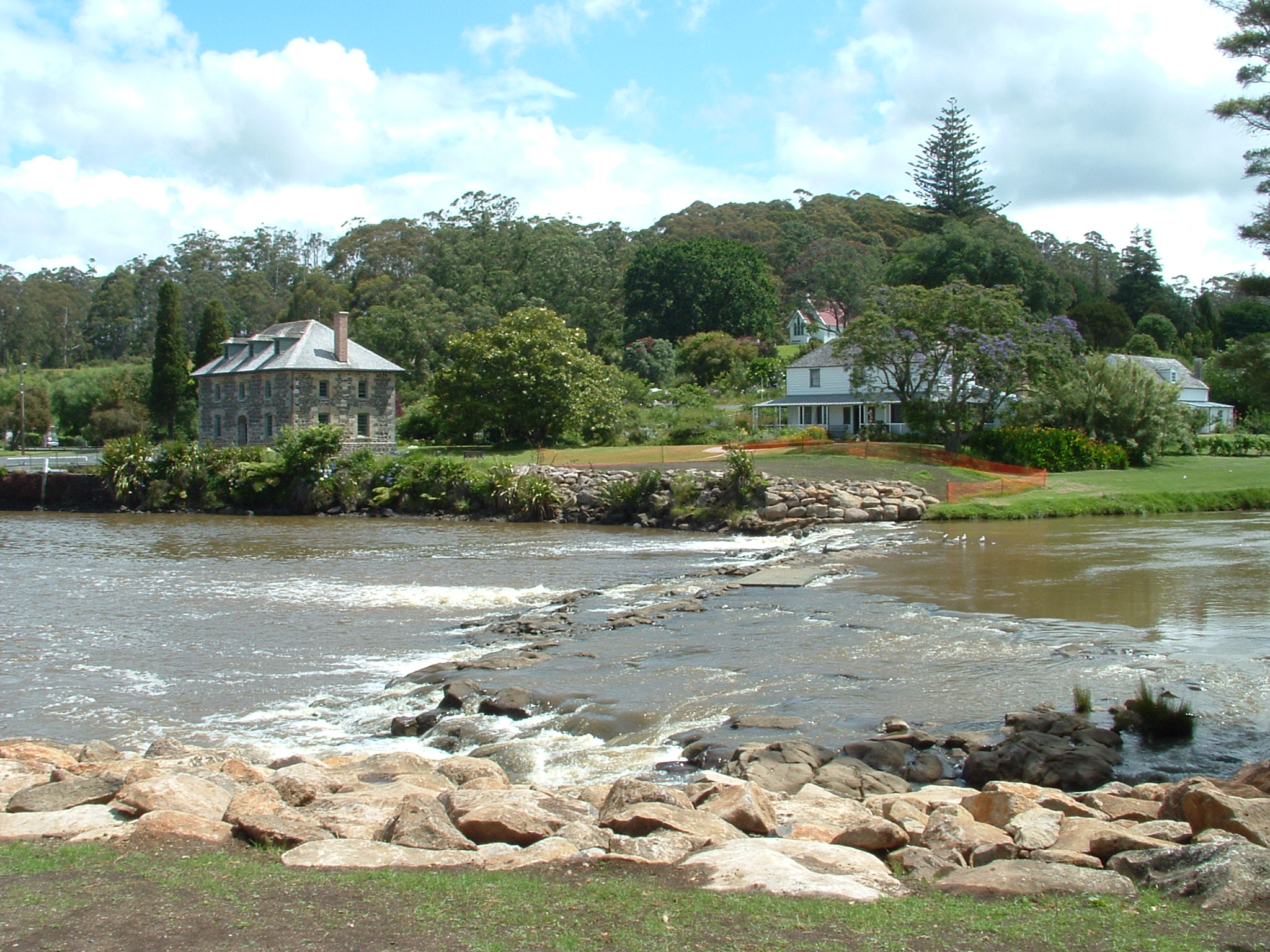
Whalers arrived toward the end of the 18th century, and their ships turned the bay into one of the Pacific's busiest harbours. They bartered with local iwi, trading goods for potatoes and pork. Missionaries followed in 1814, establishing stations that would reshape the cultural landscape. The first European child recorded as born in New Zealand, Thomas King, arrived in 1815 at Oihi Bay. Russell, then known as Kororareka, earned a reputation as the wildest whaling port in the Pacific. Charles Darwin visited in December 1835 and was less than enchanted. But amid the rough trade, something gentler was happening. Early settlers brought horses, and the Maori, who had never seen such animals, named them kurī waha tangata: man-carrying dogs. Kerikeri's Mission House, also called Kemp House, still stands as the oldest wooden structure in New Zealand, while the Stone Store, begun on 19 April 1832, remains the country's oldest stone building.
The Cream Trip and Island Life
In 1886, Albert Ernest Fuller launched the sailing ship Undine to deliver coal to the communities scattered across the bay's islands. When motors arrived in the early 20th century, Fuller expanded his routes as far as Cape Brett, and in 1927 he acquired the Cream Trip from Eddie Lane, a service that collected cream from island dairy farms. The route became a lifeline for communities that had no road access, delivering mail, supplies, and gossip alongside the milk cans. By the 1960s, the Bay Belle had taken over the run, and although a modern catamaran now traces the original route, the Bay Belle still ferries visitors and locals between Paihia and Russell. The Cream Trip endures as a reminder that for much of the bay's history, water was the highway and boats were the buses.
Birthplace of a Nation
In February 1840, members of the United States Exploring Expedition watched from the bay as Maori chiefs and British officials gathered at Waitangi to sign the document that would become New Zealand's founding charter. The Treaty of Waitangi was meant to establish partnership between Maori and the Crown, though its two versions, one in English, one in te reo Maori, promised subtly different things. The consequences played out in plain sight of the bay: the capital was moved to Auckland, trade dried up, and Hone Heke began his campaign against the Kororareka flagstaff. Today the Treaty Grounds at Waitangi are a national memorial, and the tensions embedded in the treaty remain central to New Zealand's political life. The bay that witnessed the signing continues to witness the reckoning.
Islands Beyond Counting
From the air, the bay's 144 islands look scattered almost randomly across the water, a mix of bush-covered humps, rocky outcrops, and white sand crescents. Urupukapuka, the largest, holds archaeological sites from centuries of Maori settlement. Cape Brett Peninsula extends 10 kilometres into the Pacific at the bay's eastern edge, its lighthouse marking the gateway between sheltered harbour and open ocean. The Purerua Peninsula shields the northwestern corner from the Pacific swells. Between these headlands, the water shifts through shades of blue and green that the 2006 study measured but that words struggle to capture. Dolphins swim regularly in these waters, and the big-game fishing that American author Zane Grey publicized in the 1930s still draws anglers from around the world. The bay sprawls across 260 square kilometres, and you could spend a lifetime exploring its inlets and never see the same view twice.
From the Air
The Bay of Islands is centred at approximately 35.2S, 174.167E on the northeast coast of New Zealand's North Island. The bay spans 16 kilometres wide and contains 144 islands, making it unmistakable from the air. Cape Brett Peninsula extends prominently to the east, and the Purerua Peninsula marks the northwest boundary. Key landmarks include Russell (Kororareka) on the southeastern peninsula, Paihia on the western shore, and the Waitangi Treaty Grounds. Nearest airport is Kerikeri/Bay of Islands Airport (NZKK), located about 10 nautical miles northwest of the bay centre. Best viewed at 2,000-5,000 feet AGL for full appreciation of the island-studded harbour. Whangarei (NZWR) is approximately 60 km to the southeast.