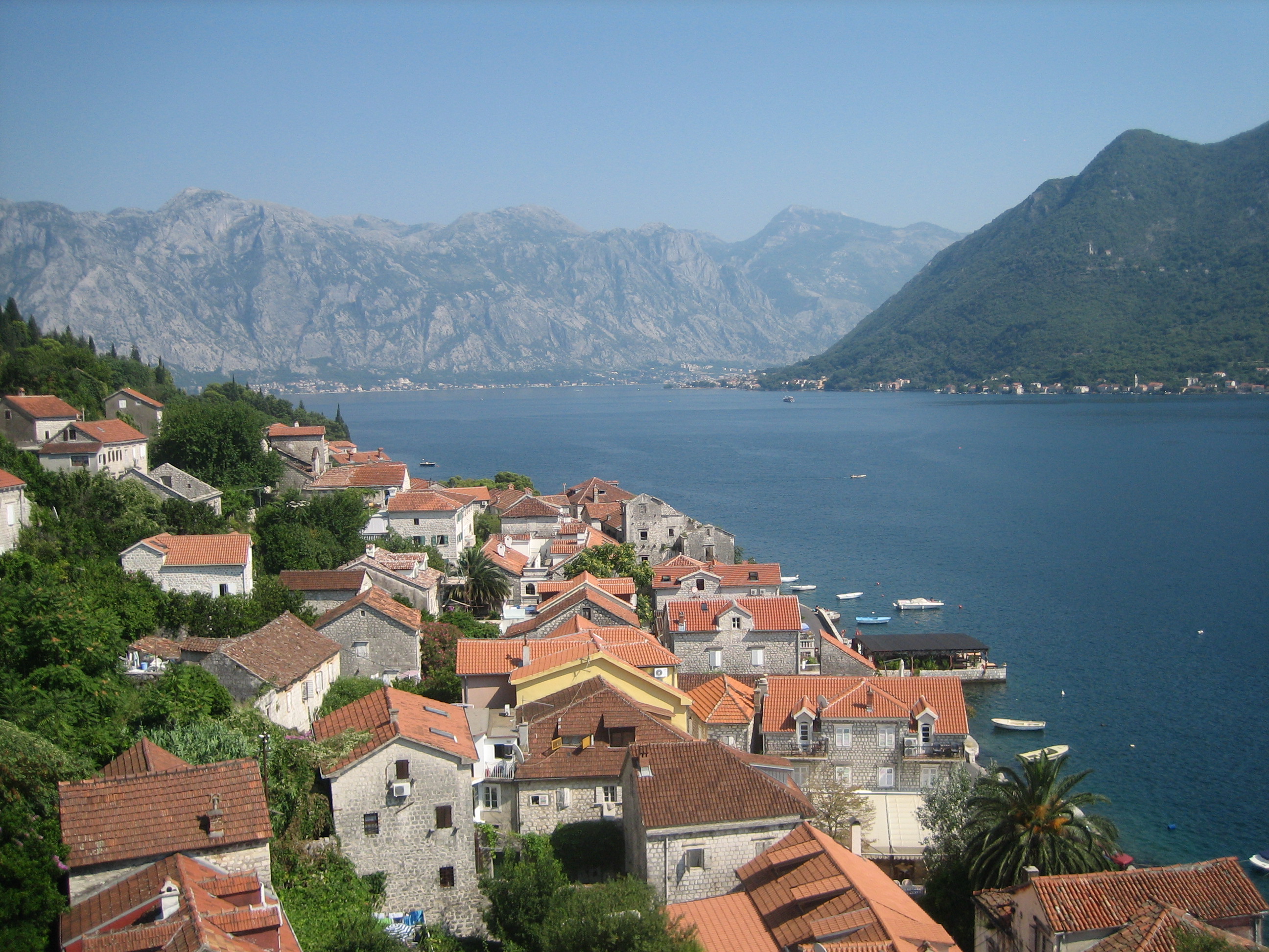
Bay of Kotor
Fly over the Montenegrin coast and you might mistake the Bay of Kotor for a fjord -- a deep blue channel cutting inland between sheer limestone walls, bending and narrowing until the mountains seem to close ranks above the water. Geologists will correct you: this is not a fjord but a submerged river canyon, carved by freshwater long before the Adriatic filled it. The distinction matters less than the effect. The Boka Kotorska, as locals call it, is 88 square kilometers of sheltered water divided into four smaller gulfs, connected by two narrow straits, and surrounded by towns that have been fortifying themselves against invaders since Illyrian times. UNESCO inscribed the bay and the city of Kotor as a World Heritage Site, and approaching by water or by air, you understand why within seconds.
Four Gulfs, Two Straits
The bay unfolds like a series of nested chambers. The outermost gulf belongs to Herceg Novi, founded in 1382 near the Croatian border, where a six-kilometer esplanade traces the waterfront through centuries of layered architecture. The Kumbor strait channels water into the gulf of Tivat, a modern town increasingly defined by Porto Montenegro, its luxury yacht marina. The Verige strait -- the narrowest point, where a ferry shuttles cars between Lepetane and Kamenari for four euros -- opens into the two innermost gulfs: Risan, the oldest settlement in the bay and once the capital of the Illyrian kingdom, and Kotor, where the ancient fortified town sits wedged between mountain and water at the bay's deepest reach. Between these four gulfs, the ethnic and linguistic landscape shifts -- Serb majorities in Herceg Novi and Tivat, a Montenegrin majority in Kotor, a significant Croat minority throughout -- though everyone speaks mutually intelligible varieties of Serbo-Croatian, heavily seasoned with Italian.
Perast and the Invented Island
Perast, a baroque village built almost entirely of pale stone, sits on the inner bay facing two small islands. One of them, Our Lady of the Rocks, is artificial -- constructed over centuries by local sailors who, according to tradition, dropped a stone into the shallows each time they returned safely from a voyage. The church that crowns it holds votive paintings and a tapestry reportedly embroidered over twenty-five years by a local woman using her own hair alongside gold and silver thread. Tourist boats from Perast make the short crossing constantly during summer, but the village itself remains remarkably quiet, its waterfront palazzi reflecting in the still water of the gulf like a stage set waiting for actors who left centuries ago.
Where Empires Left Their Walls
Every power that controlled the eastern Adriatic left its mark on the Bay of Kotor. Illyrians fortified the hilltops. Byzantines rebuilt the fortresses. Venetians gave Kotor its massive walls and the Republic of Cattaro its administrative structure. Austrians added barracks and coastal batteries. The French, briefly, contributed Napoleonic ambition. Each layer is visible -- in the ramparts climbing the mountain behind Kotor, in the baroque facades of Perast, in the Austro-Hungarian fortifications that dot the shoreline. The bay's UNESCO designation, awarded in 1979 after a devastating earthquake, covers not just the architecture but the entire natural and cultural landscape: the water, the mountains, the towns, and the relationship between them.
The Bay from Above
From the air, the Bay of Kotor reveals its full geometry -- the serpentine channel, the pinch points of the two straits, the way the mountains fold around the water like cupped hands. Cruise ships enter through the outer gulf, and watching a vessel that size navigate the Verige strait is a lesson in scale: the passage is barely wider than the ship is long. Mount Lovcen rises behind Kotor to over 1,700 meters, its summit often in cloud, its slopes dropping with theatrical steepness to the medieval walls below. The road from Kotor to the old Montenegrin capital of Cetinje switchbacks up Lovcen's face in twenty-five hairpin turns, and driving it is an experience that belongs more to aviation than to motoring. At water level, the bay is intimate and human-scaled. From above, it is a landscape of almost violent drama.
From the Air
Located at 42.45N, 18.67E on the Adriatic coast of Montenegro. The bay is unmistakable from altitude -- a deep, serpentine inlet cutting over 25 km inland between steep limestone mountains. The narrow Verige strait connecting the outer and inner bays is a key visual landmark. Tivat Airport (LYTV) sits on the bay's southern shore with a runway oriented roughly east-west. Dubrovnik Airport (LDDU) in Croatia is approximately 50 km to the northwest. Mount Lovcen (1,749 m) rises dramatically behind Kotor at the bay's innermost point. Recommended viewing altitude 4,000-8,000 feet AGL to appreciate the full fjord-like geometry. Cruise ships are frequently visible in the bay during summer months.