Beaufort, South Carolina
Robert Smalls was born enslaved in Beaufort, South Carolina. In 1862, he commandeered the Confederate military transport CSS Planter in Charleston Harbor, piloted it past five Confederate forts, and delivered it to the Union Navy -- earning his freedom and eventually a seat in the U.S. Congress. Today, one of Beaufort's main roads bears his name: the Robert Smalls Parkway. It is a fitting tribute in a town where every street seems to carry the weight of some extraordinary story. Founded in 1711, Beaufort is the second-oldest city in South Carolina, a place where colonial ambition, the brutality of slavery, the courage of abolitionists, and the slow bloom of artistic reinvention have laid down layer after layer of meaning beneath the Spanish moss and live oaks.
Five Neighborhoods, Four Centuries
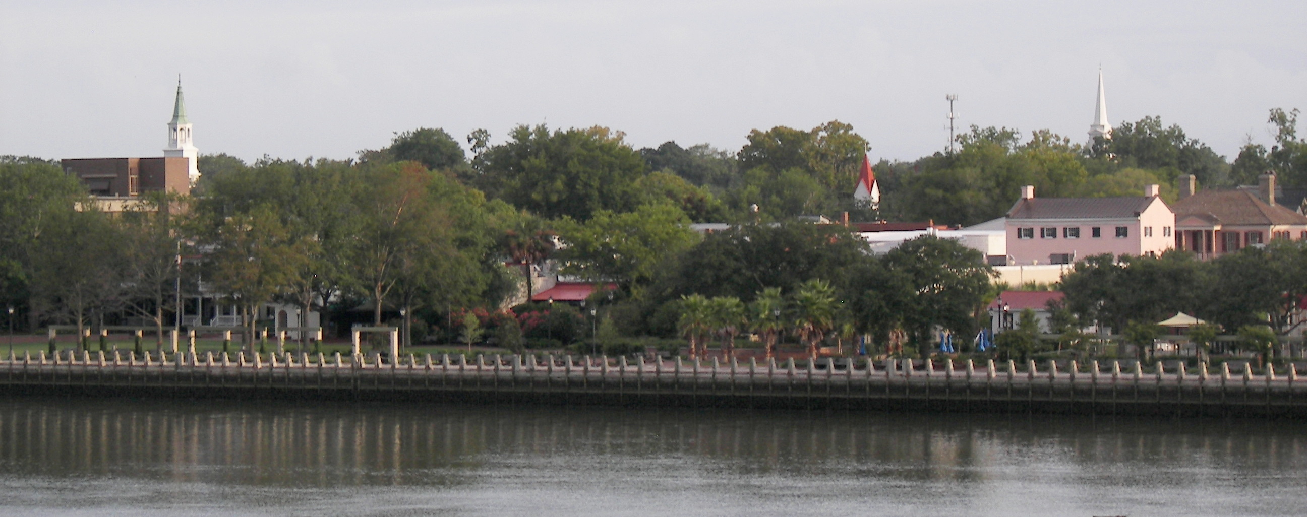
Beaufort's historic district occupies a peninsula jutting into the Beaufort River, and much of it has been designated a National Historic Landmark. Downtown divides into five distinct neighborhoods: the commercial core, The Point (with its stately antebellum homes), The Bluff, The Old Commons, and the Northwest Quadrant. Close to 70 sites in the area are listed on the National Register of Historic Places. The John Mark Verdier House on Bay Street -- the only historic home open year-round to the public -- dates to the Federal period. Wandering these streets, the architecture tells the story: grand plantation-era mansions that Union officers seized as headquarters in 1861 stand alongside the modest structures of Pigeon Point and Higginsonville, where street names honor the abolitionists -- women like Frances Gage and Clara Barton -- who came south during the Civil War to teach freedmen schools on nearby Parris Island.
Smokin' Joe and the Literary South
Beaufort has produced an improbable range of talent. Joe Frazier, the heavyweight boxing champion who became the first man to defeat Muhammad Ali, grew up here. So did Pat Conroy, whose novels drew so heavily on Beaufort's military culture and Lowcountry landscapes that the town became almost a character in his work. His father, Colonel Donald Conroy, was the real-life inspiration for The Great Santini, stationed at nearby Marine Corps Air Station Beaufort. The literary thread runs deeper still: the Citizens Cemetery in downtown Beaufort is the real-world "garden" of John Berendt's Midnight in the Garden of Good and Evil, and the voodoo practitioner Minerva in that novel was based on Beaufort resident Valerie Boles, who lived near the cemetery. The Beaufort International Film Festival and nearly 20 galleries keep the arts scene alive, earning the town recognition as one of America's best small-city arts destinations.
Gullah Roots and Sea Island Culture
Beaufort sits at the heart of Gullah Geechee country. The descendants of enslaved West Africans who worked the Sea Island rice and indigo plantations preserved a distinct language, cuisine, and set of cultural traditions that survive here in ways found nowhere else in the United States. Queen Quet, Marquetta L. Goodwine -- the elected Chieftess of the Gullah Geechee Nation -- is a Beaufort native and has spent decades as an author, preservationist, and advocate for the community's heritage. Lady's Island, partially annexed by Beaufort, figures in Lawrence Hill's award-winning novel The Book of Negroes, which traces the story of enslaved people evacuated from Manhattan by the British after the Revolutionary War and resettled in Nova Scotia as Black Loyalists. The Gullah presence gives Beaufort a cultural depth that few Southern towns of its size can match.
Water, Shrimp, and the Intracoastal
Water defines life in Beaufort. The downtown marina opens onto the Intracoastal Waterway and the surrounding Sea Islands, making the town a popular harbor for boaters cruising the East Coast. The annual Shrimp Festival, held the first weekend of October, celebrates the traditional industry that still sustains local watermen, and was named a Southeast Tourism Society Top 20 Event. Field and Stream has rated Beaufort one of the top 20 fishing towns in America, and National Geographic Adventure called it a Top 50 Adventure Town and the number seven waterfront adventure town in the country. Hunting Island State Park, nearby on the Atlantic, is the most visited state park in South Carolina. US Highway 21 threads through town as the principal route to the Sea Islands and doubles as the hurricane evacuation route -- a reminder that this beautiful coast exacts a price for its proximity to the open Atlantic.
The Military Heartbeat
Beaufort's modern identity is inseparable from the military. Marine Corps Air Station Beaufort was annexed into the city in the 1990s, and MCRD Parris Island sits just minutes to the south. The military presence doubled Beaufort's population during the 1940s and 1950s, shaping entire neighborhoods -- West End, Depot, and the Battery Creek communities -- around the influx of personnel and families. The Port Royal Railroad once carried Marine recruits directly to Parris Island; its tracks were pulled up in 2011 and replaced by the Spanish Moss Trail, a rail-to-trail conversion that now winds through the Lowcountry landscape. Beaufort County Airport on Lady's Island handles general aviation, while commercial flights connect through Hilton Head, Charleston, or Savannah. The rhythm of jet noise from the air station and the distant cadence of recruits marching on Parris Island are woven into daily life as surely as the tides.
From the Air
Located at 32.433N, 80.683W on a peninsula in the Beaufort River, South Carolina Lowcountry. The historic downtown is visible as a compact grid on the peninsula between the Beaufort River and surrounding marshland. Best viewed at 3,000-5,000 feet AGL. Nearest airports: KARW (Beaufort County Airport, 3nm E on Lady's Island), KNBC (also known as Beaufort Executive), KNBE (MCAS Beaufort, military -- restricted). KSAV (Savannah/Hilton Head Intl, 35nm SW). The Richard V. Woods Memorial Bridge and J.E. McTeer Bridge connecting to Lady's Island are prominent visual landmarks. Marine Corps Air Station Beaufort is visible to the north.