Belknap Crater
The Dee Wright Observatory sits atop McKenzie Pass, built from lava blocks quarried from this very volcano. Through its stone windows, visitors gaze across one of the most striking volcanic landscapes in North America: Belknap Crater's black, treeless lava fields spreading in every direction, a stark interruption in Oregon's green Cascades. This is the youngest shield volcano in the entire Cascade Range, its barren flows so fresh in geological terms that forests have barely begun to reclaim them. Belknap last erupted around 480 CE, roughly the time the Roman Empire was falling, and the evidence of that violence remains written across the landscape in basalt.
Fire in the Sisters Reach
Belknap sits within a volcanic cluster geologists call the Sisters Reach, a zone of intense Holocene activity stretching from Mount Bachelor north to Three Fingered Jack. At least 466 Quaternary volcanoes crowd this region, with 125 centers becoming active between 4,000 and 1,300 years ago. Belknap was the last to erupt in the Three Sisters area. The volcano formed on the lower slopes of Mount Washington, a much older and highly eroded peak whose pinnacle rises nearby. Unlike Hawaii's gently sloping shields, Cascade shields like Belknap are steeper and smaller, often crowned with cinder cones. Belknap's summit features a cinder cone containing three craters of different sizes, aligned along a north-northwestern trend.
Lava Curls and Tree Molds
The lava fields preserve remarkable volcanic features. Along the Skyline Trail, flows from Little Belknap peeled back as they cooled, creating overturned slabs of hardened rock that geologist Taylor called 'lava curls.' Dozens of tree molds dot the western flows, cylindrical voids where ancient trees stood as molten rock engulfed them. Some molds reach several feet in diameter; others trace the shapes of roots charred by the advancing flow. Radiocarbon dating of charred material from one mold yielded a date of 360 CE, plus or minus 160 years. Near Little Belknap's summit, a small lava cave system features an unusual two-level arrangement connected by a vertical conduit, its walls lined with stalactites formed from remelted lava.
Rivers of Stone
Belknap's eruptions dramatically reshaped the McKenzie River drainage. Final-phase lava flows extended miles to the west, entering McKenzie Canyon and creating the upstream swamp known as Beaver Marsh. The river now disappears into permeable sediment and talus formed by these ancient flows, vanishing underground before re-emerging at Tamolitch Falls. The volcano's fluid lavas settled into intersecting channels rather than forming extensive streams, creating complicated drainage patterns across more than 20 square kilometers. Four Holocene eruptive periods built the complex: the first around 5050 BCE produced the Tamolitch flow, followed by activity at Little Belknap around 1030 BCE, eruptions at South Belknap and Twin Craters around 800 BCE, and the final event at the main crater around 480 CE.
A Landscape in Waiting
The USGS considers Belknap's threat potential 'Low/Very Low,' but the region remains volcanically restless. Postglacial mafic eruptions occur more frequently in the Sisters Reach than anywhere else in the Cascade arc. The McKenzie and Santiam Pass area saw more than a dozen distinct eruptions between 4,500 and 1,100 years ago. About 6,500 people live within 10 kilometers of the crater, with 362,000 within 50 kilometers. Future eruptions in this region could disrupt highways 20, 22, and 242, while tephra could threaten communities across central Oregon. High-volume lahars would travel far to the west, potentially blocking the McKenzie River and creating downstream floods.
Trails Through Time
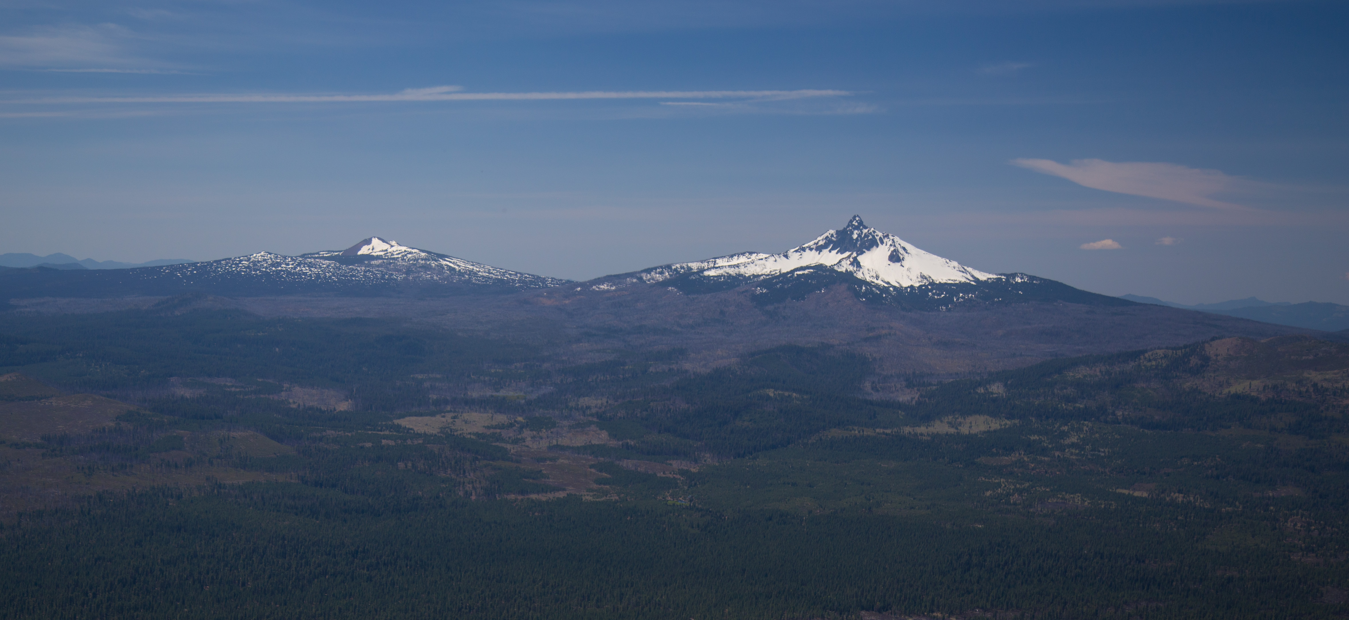
Native Americans traveled paths along Belknap's lava fields long before European settlement, harvesting huckleberries in the surrounding forests. The Oregon Skyline Trail still follows some of these ancient routes west of the lava flows. In the early 1870s, J.H. Belknap invested in a toll road over McKenzie Pass; his father R.S. Belknap had discovered the nearby hot springs in November 1869. Today, hikers can reach Little Belknap Crater via a moderate round-trip from the Pacific Crest Trail intersection with Route 242. The trail to Belknap Crater itself runs about 5 miles round-trip, more challenging due to the steep climb on fine cinders. The views encompass Mount Washington, Black Crater, and the Three Sisters across a primordial landscape of black basalt.
From the Air
Located at 44.285N, 121.842W in the central Oregon Cascades. The barren lava fields create a striking visual contrast against surrounding forests, making Belknap highly visible from altitude. Best viewed at 6,000-10,000 feet. The Dee Wright Observatory at McKenzie Pass provides a ground reference point. Roberts Field (KRDM) lies 35nm east; Eugene Airport (KEUG) 55nm west. Expect mountain wave turbulence when winds exceed 25 knots. The Three Sisters peaks rise prominently to the south, with Mount Washington's eroded pinnacle immediately adjacent to Belknap.