Ben Lomond (Otago)
Duncan McAusland was a shepherd, not a mountaineer. But standing on the slopes above the new settlement at Queenstown in the 1860s, looking up at the broad-shouldered peak that dominated the northwest skyline, he saw something familiar. He named it after Ben Lomond in Scotland, the mountain that overlooks Loch Lomond, and the name stuck. The New Zealand version is taller than its Scottish namesake by more than seven hundred metres, reaching 1,748 metres above a landscape of deep lakes, tussock saddles, and mountains sharp enough to earn the name The Remarkables. Today it is the most popular summit hike in the Queenstown area, a full day's effort rewarded with views that take in half of Otago.
The Climb from Town
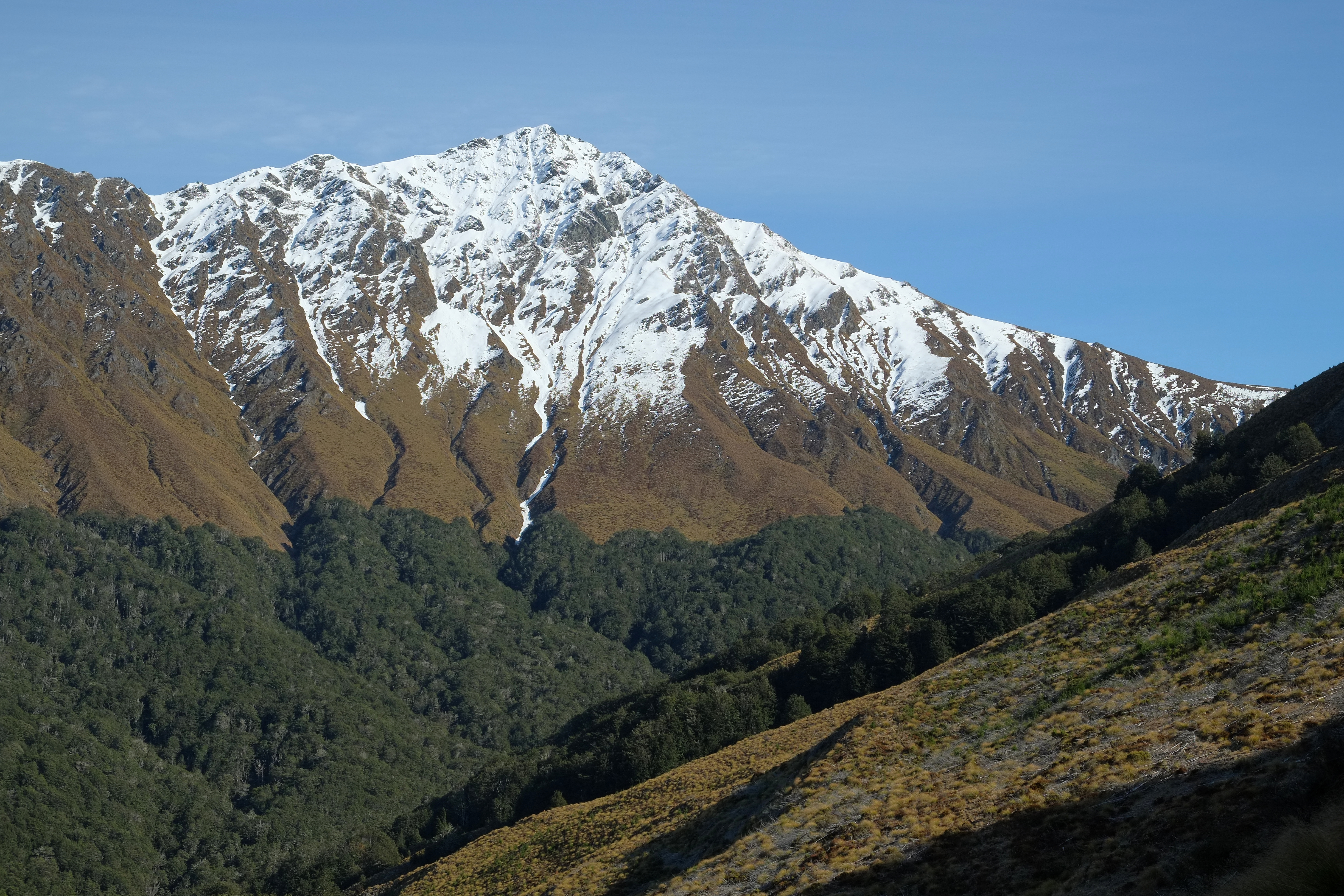
Three routes leave from Queenstown itself. The most popular starts at the Skyline Gondola building on Brecon Street, where hikers can either ride the gondola partway up or grind through the Tiki Trail, a steep zigzag through Douglas fir forest that delivers you to the luge area soaked in sweat and wondering why you did not buy a gondola ticket. From there the track pushes through mountain beech before breaking into open tussock grasslands, the trees falling away as altitude strips the soil to bare rock and hardy grass. The Ben Lomond Saddle, at roughly 1,326 metres, offers the first truly panoramic views and a decision point. Many hikers turn back here, satisfied with the vista. Those who continue face a steep, exposed scramble along a narrowing ridge to the summit, gaining another four hundred metres of elevation over ground that demands hands as well as feet in places. Alternative routes approach from the Moonlight Track, starting at either Moke Lake or Arthurs Point, both meeting at the saddle after considerably longer and harder approaches. The round trip from Queenstown covers eleven kilometres with 1,438 metres of elevation gain, a statistic that looks modest on paper and registers in your legs for days.
A Mountain of Many Uses
Ben Lomond is not just a hiking destination. The lower slopes, designated the Ben Lomond Scenic Reserve, are threaded with mountain biking trails that range from gentle forest cruises to white-knuckle downhill runs accessible via the Skyline Gondola. The Fernhill Link Track connects the suburbs of Fernhill and Sunshine Bay through beech forest, serving as both a commuter path and a recreational walk. Above the tree line, runners push through the tussock in trail races that use the saddle as a turnaround point. In winter, the upper mountain collects snow, and while it is not a ski field, the alpine conditions demand respect. The Department of Conservation rates the summit track as advanced, and weather can close in with startling speed. Cloud that sits harmlessly over Queenstown can mean zero visibility and driving wind at the saddle, a transition that catches unprepared hikers every season.
The View That Explains Everything
From the summit, the geography of the Wakatipu Basin unfolds like a relief map. Lake Wakatipu stretches southeast in its distinctive zigzag shape, eighty kilometres of glacially carved water so deep its floor sits below sea level. Directly south, The Remarkables rise as a wall of jagged schist, their serrated ridgeline running almost perfectly north-south. To the west, Cecil Peak and Walter Peak frame the lake's far shore, accessible only by boat or float plane. Queenstown itself is a compressed cluster of buildings on a small bay, dwarfed by the scale of the landscape around it. Bowen Peak, connected to Ben Lomond and only slightly shorter at 1,631 metres, anchors the view to the west. On a clear day you can trace the Dart River valley to the north, the route toward Mount Aspiring and the heart of the Southern Alps, and pick out the rumpled terrain of the Crown Range to the east. It is a view that explains why Queenstown became what it is, a place where the scenery is so theatrical it turned a gold-rush settlement into the adventure capital of a country that trades on adventure. McAusland's mountain stands at the centre of it all, patient and unmoved, the same summit a homesick Scottish shepherd saw and recognized.
From the Air
Located at 45.01°S, 168.62°E, immediately northwest of Queenstown. The summit at 1,748 m (5,735 ft) is the dominant peak visible from Queenstown's town centre. The Skyline Gondola line on the lower slopes provides a visual reference point. Connected to Bowen Peak (1,631 m) to the west and Bob's Peaks below. Nearest airport: Queenstown Airport (NZQN), approximately 8 km east of the summit. The Remarkables ski field is visible to the southeast across the lake. Best viewed from 6,000-10,000 feet. Weather can change rapidly with cloud frequently sitting on the upper slopes even when Queenstown is clear.