Ben Nevis
In 2006, workers from the John Muir Trust, the conservation charity that owns most of Ben Nevis, were clearing debris from one of the summit cairns when they uncovered a piano. It had been carried to the top -- 1,345 metres above sea level, the highest point in the British Isles -- by removal men from Dundee, apparently for charity, some twenty years earlier. The discovery was absurd, and yet it captured something essential about Ben Nevis: this is a mountain that people have been hauling things up, building things on, and testing themselves against for centuries, driven by motives that range from scientific ambition to pure, stubborn eccentricity.
The Bones of a Collapsed World
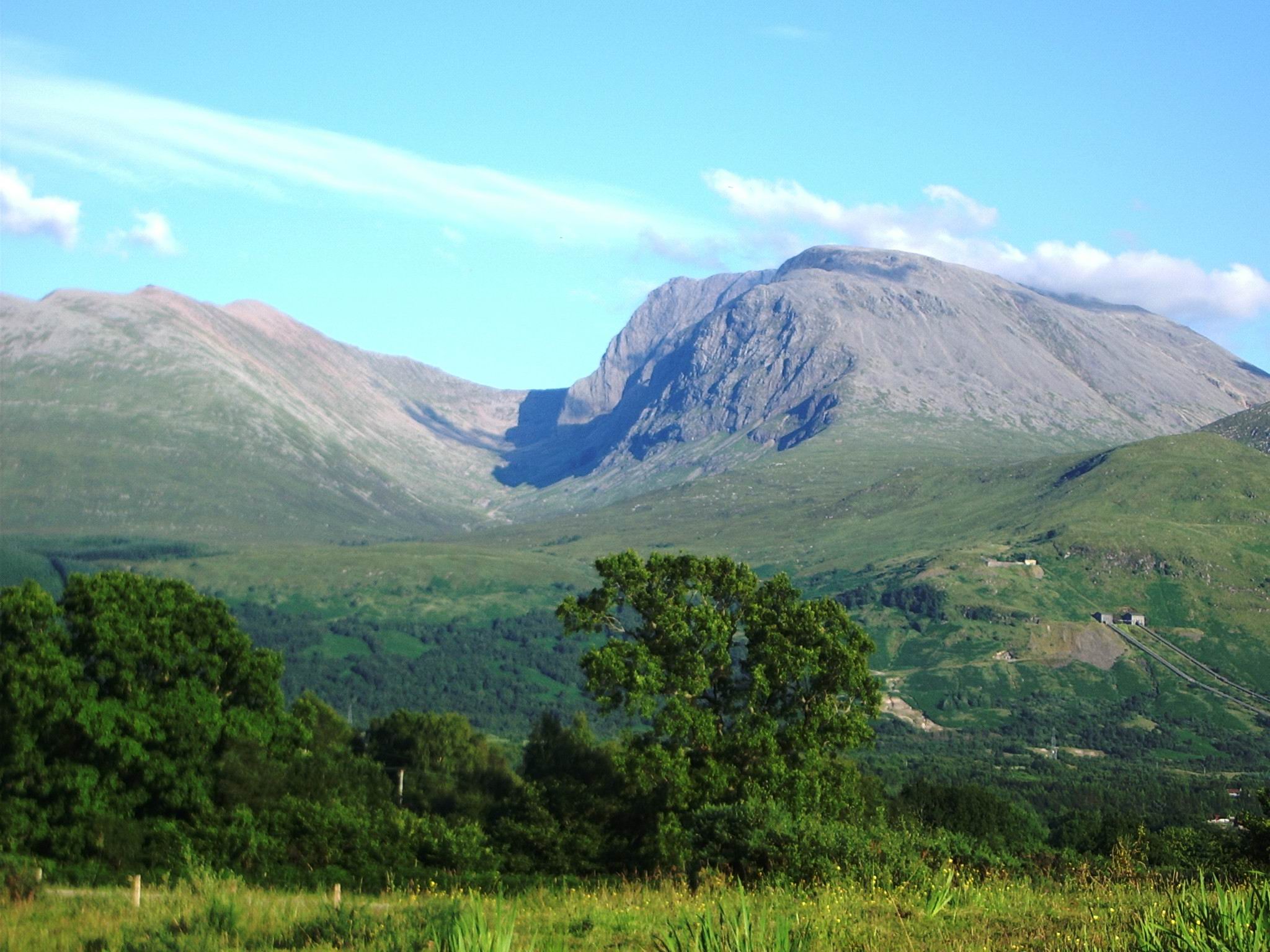
Ben Nevis is the remnant of a Devonian volcano that collapsed catastrophically around 350 million years ago. Evidence of the cataclysm is written in the summit rocks: light-coloured granite, which formed in subterranean chambers kilometres below the surface, sits beside dark basaltic lavas that could only have formed at the surface. The two lying side by side is proof that the volcano's inner dome imploded, bringing deep rock to the surface in an explosion comparable to Krakatoa or the ancient eruption of Thera. What remains is the collapsed core, sculpted over millions of years by glaciation into the massive form that dominates the western end of the Grampian Mountains. The mountain's name comes from the Gaelic Beinn Nibheis, though scholars debate whether this means 'mountain of the Nevis' (after the river at its base) or derives from an older root meaning 'the misty one.' Locals simply call it 'the Ben.' Its western and southern flanks rise twelve hundred metres in just two kilometres above Glen Nevis -- the longest and steepest hill slope in Britain -- giving the mountain an aspect of overwhelming bulk from the town of Fort William below.
The Observatory in the Clouds
The most remarkable chapter in Ben Nevis's history began in 1883, when the Scottish Meteorological Society opened a weather observatory on the summit. For twenty-one years, a small team of scientists lived and worked at the top of Britain, recording temperature, pressure, rainfall, wind speed, and cloud cover in conditions that would have defeated most people within hours. The summit sees an average of 261 gale days per year. Snow lies on the ground for roughly seven months. Rainfall is approximately four times that of London. The data collected during those two decades remains the most comprehensive record of British mountain weather ever assembled, and its influence extended far beyond meteorology: the physicist C. T. R. Wilson, who worked at the observatory as a young man, was so fascinated by the optical phenomena he observed in the summit clouds that he went on to invent the cloud chamber, a device that became fundamental to particle physics and earned him the Nobel Prize. The observatory closed in 1904 for lack of funding. Its ruins are still visible on the summit plateau, and an emergency shelter has been built atop the old tower for climbers caught in bad weather.
Seven Hundred Metres of Vertical Rock
The tourist path to the summit -- the Pony Track, built in 1883 to supply the observatory -- follows a gentle gradient up the mountain's broad western flank, and roughly 150,000 people walk it each year. But Ben Nevis has another face entirely. The north face drops seven hundred metres in sheer cliffs, buttresses, and gullies that constitute some of the most serious climbing terrain in Britain. Tower Ridge, Observatory Ridge, and the Northeast Buttress offer classic rock routes in summer and demanding ice climbs in winter, when the face holds snow and ice well into spring. The Charles Inglis Clark Memorial Hut, built in 1929 by the Scottish Mountaineering Club in the remote northern corrie, is described as the only genuine alpine hut in Britain. Pioneering climbers like J. N. Collie, Willie Naismith, and Harold Raeburn established routes here before the First World War. In summer 1943, the conscientious objector Brian Kellett made seventy-four repeat climbs and seventeen first ascents in a single season, fourteen of them solo. The mountain has also hosted a foot race since 1898; the current men's record, set in 1984 by Kenny Stuart, stands at an almost incomprehensible one hour, twenty-five minutes, and thirty-four seconds from Fort William to the summit and back.
The View from Britain's Roof
The summit of Ben Nevis is not the dramatic peak that most people imagine. It is a broad, stony plateau of about forty hectares, a felsenmeer of shattered rock where the highest point is marked by a large cairn bearing an Ordnance Survey trig point. On a clear day -- a rarity, given that the summit is cloud-free only a fraction of the year -- the view extends over 190 kilometres, taking in the Torridon Hills, Lochnagar, Ben Lomond, and on exceptional days, Knocklayd in County Antrim across the sea in Northern Ireland. The summit is the highest ground in any direction for nearly 740 kilometres, until the Scandinavian Mountains of western Norway. A peace memorial cairn, erected on V-J Day in 1945 by a youth group from Dudley who carried the materials up by hand, sits on the plateau and is recognized as Britain's highest war memorial. The mountain's dangers are real and persistent -- over a hundred fatalities have been recorded since 1849, most from avalanches and navigation errors on the featureless summit plateau. In 2000, the John Muir Trust purchased the Ben Nevis Estate, ensuring that the south side of the mountain, including the summit, would be managed for conservation. The Ben stands as it has for millions of years, indifferent to the people who climb it, the weather that punishes it, and the piano someone once carried to its top.
From the Air
Ben Nevis stands at 56.80°N, 5.00°W near Fort William in the western Scottish Highlands, rising to 1,345 metres -- the highest point in the British Isles. The summit plateau and the dramatic cliffs of the north face are visible from the air. Glen Nevis runs along the southern base. Fort William lies at the foot of the mountain. Nearest airport: Inverness (EGPE) approximately 55 nm to the northeast. Caution: the mountain creates significant turbulence and downdrafts in strong winds.