Assumption Harbor's Second Life
Jose de Canizares named this cove Puerto de las Asunta because he discovered it on the feast day of the Assumption in 1775. He was sailing aboard the San Carlos with Juan Manuel de Ayala, the first ship to enter San Francisco Bay, and he marked the sheltered water north and west of what would become Benicia with the letter 'J' on his famous 1781 map. The cove's current name, Southampton Bay, arrived with Commodore Thomas ap Catesby Jones, who sailed the Navy frigate Southampton into these waters with a small fleet in 1849. Today the bay anchors 447 acres of marsh, grassy hillside, and rocky shoreline that make up the Benicia State Recreation Area, one of the most ecologically significant patches of wetland remaining on the northern rim of San Francisco Bay.
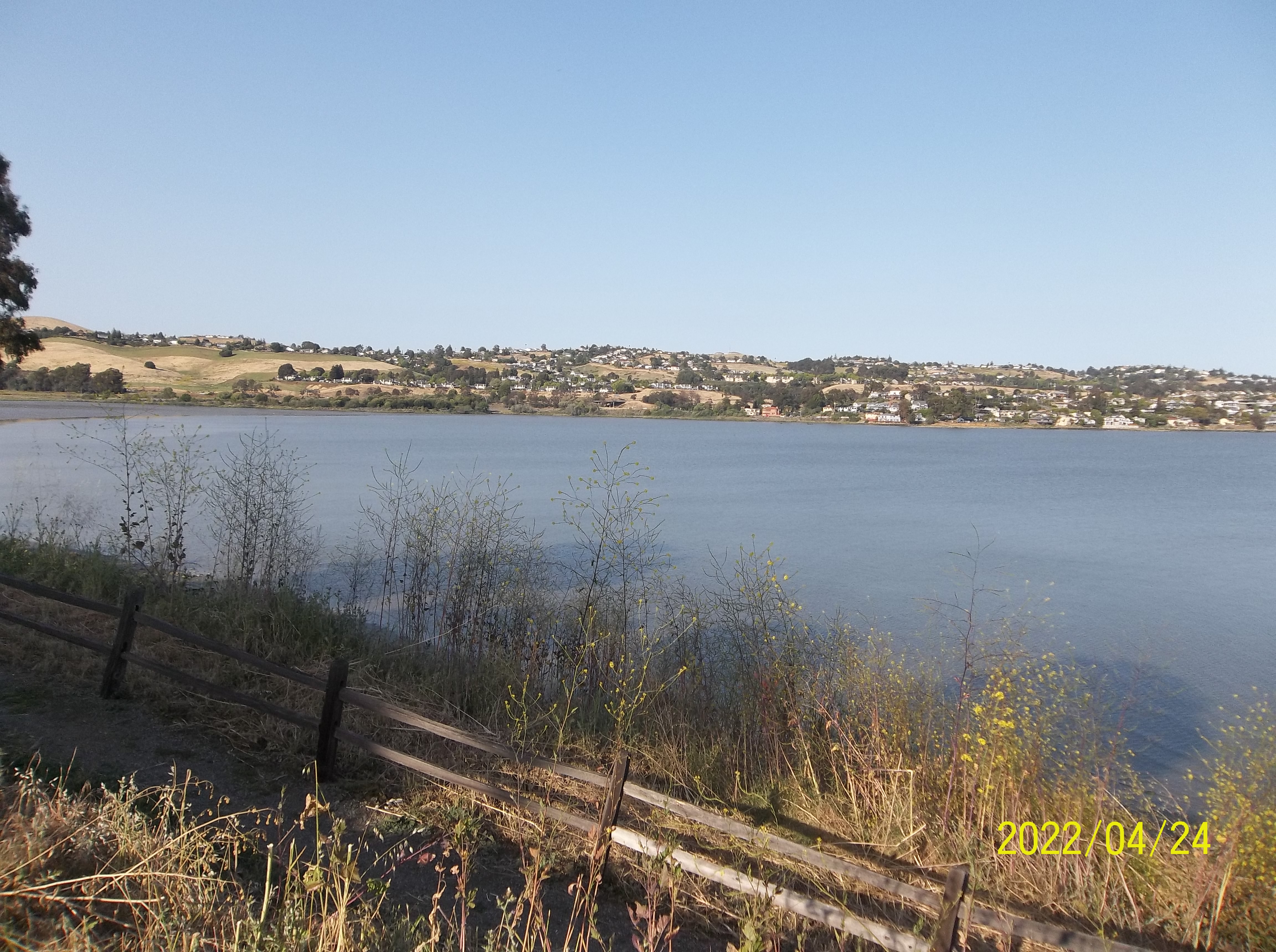
Where Two Rivers Meet the Bay
The park sits along the narrowest stretch of the Carquinez Strait, the geological bottleneck where the combined waters of the Sacramento and San Joaquin rivers squeeze through on their way to San Pablo Bay. Southampton Creek feeds into the tidal marsh that fronts Southampton Bay, creating a transition zone where freshwater, brackish, and saltwater ecosystems layer atop one another. The Southampton mudflat, built from eroded silt and clay carried downriver, extends to deposits exceeding a thousand feet thick. From Dillon Point, anglers cast for white sturgeon, starry flounder, and striped bass, three species that have navigated these converging currents for millennia. The park lies two miles west of downtown Benicia and borders Vallejo's Glen Cove neighborhood, straddling a boundary between suburban life and untamed estuary.
The Marsh That Shelters the Endangered
The Southampton Bay Wetland Natural Preserve accounts for seventy percent of the park, and it harbors species that survive almost nowhere else. The northern salt marsh harvest mouse, federally listed as endangered, builds its tiny nests among the pickleweed and salt grass. Soft bird's-beak, an endangered gray-green herb in the snapdragon family, clings to the marsh edges. The preserve's three principal habitats, brackish marsh, saltwater marsh, and freshwater marsh, support a plant community that includes coyote bush and salt grass alongside the pickleweed and bird's-beak. Designated an Important Bird Area, the park provides critical habitat for the endangered California clapper rail and the secretive black rail. Virginia rails, Suisun song sparrows, and salt marsh common yellowthroats round out the roster of uncommon species. Each winter, waterfowl traveling the Pacific Flyway descend on these wetlands by the thousands.
Beaver, Fur, and the Opening of the West
California golden beavers returned to the park around 2007, likely migrating from the Sacramento-San Joaquin River Delta. Their reappearance carries historical weight. Before the California Fur Rush of the late eighteenth and early nineteenth centuries, the Delta probably held the largest concentration of beaver in North America. It was the pursuit of those pelts, more than any other factor, that opened the West and the San Francisco Bay Area to world trade. In 1840, explorer Captain Thomas Farnham wrote that 'there is probably no spot of equal extent in the whole continent of America which contains so many of these much-sought animals.' Trappers nearly exterminated them. That beavers are now building lodges again along Southampton Creek, in a park where coyotes, river otters, and muskrats also roam, suggests a landscape slowly recovering what the fur trade stripped away two centuries ago.
The View Toward Diablo
From the park's grassy hillsides, Mount Diablo rises to the southeast, its 3,849-foot summit the dominant landmark of the East Bay horizon. The rocky beaches along the strait offer a vantage point where the industrial and the wild coexist in plain sight: oil tankers and container ships pass through the Carquinez Strait while great blue herons hunt the shallows a few yards away. The park connects to both the San Francisco Bay Trail and the Bay Area Ridge Trail, threading hikers along the water's edge and up into the coastal hills. It is a place where the deep history of Spanish exploration, the ecological devastation of the fur trade, and the patient return of endangered species all converge on a single stretch of shoreline.
From the Air
Located at 38.07N, 122.19W on the south shore of the Carquinez Strait, two miles west of downtown Benicia. The park's tidal marshlands and Southampton Bay are visible from the air as a green-brown wetland area contrasting with the surrounding development. Mount Diablo (3,849 ft) rises prominently to the southeast. The Carquinez Bridge (I-80) and Benicia-Martinez Bridge (I-680) bracket the area to west and east respectively. Nearby airports include Buchanan Field (KCCR) 10nm south and Napa County Airport (KAPC) 18nm north. Note restricted airspace near Travis AFB (KSUU) 15nm northeast.