Bhismaknagar
A brick inscribed with a king's name lay buried for centuries beneath jungle creepers in Arunachal Pradesh, India's least explored state. When archaeologists finally uncovered it, the inscription confirmed what Tai chronicles had long suggested: this was Che-lung, the "Great City," capital of the Chutia kings who ruled the upper Brahmaputra region from the 11th to the 15th century. Today, the fortified ruins of Bhismaknagar spread across 2,500 acres of the Lower Dibang Valley, their fired-brick walls still standing 4.5 meters high in places, guarding terracotta figurines and decorated tiles that speak to a sophisticated medieval civilization at the edge of the known world.
The Great City of the Chutias
Bhismaknagar served as one of the principal strongholds of the Chutia Kingdom, a Tibeto-Burmese dynasty that controlled the region around Sadiya from roughly the 11th to the 16th century CE. Copper inscriptions refer to the region as Sadhayapura, and the rulers styled themselves Sadhayapur-ishwar. The site has been identified with Svadhayapuri, the political center of the kingdom. A brick bearing the name of Chutia king Lakshminarayana, who reigned in the early 15th century, provides the most concrete dating evidence. Paleographical analysis of the inscription supports this timeline, placing the fort's construction squarely in the medieval period when the Chutias were at the height of their power, controlling trade routes between the Tibetan plateau and the Brahmaputra lowlands.
Walls Against the Mishmi Hills
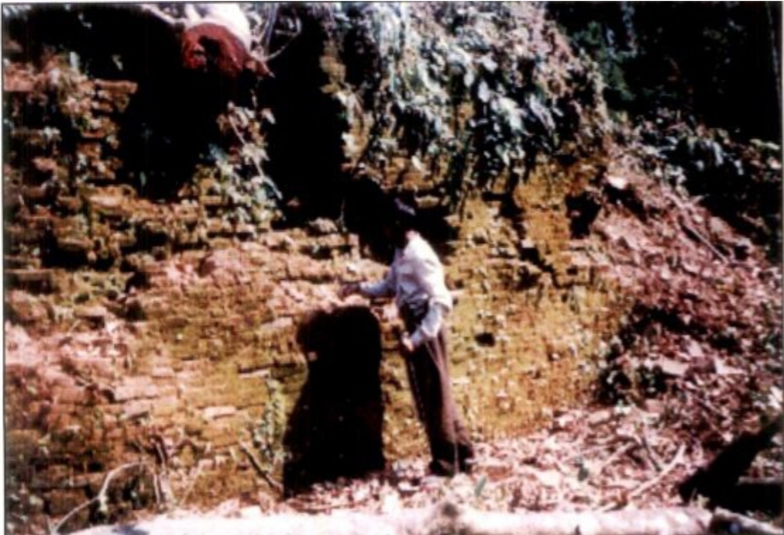
The fortified city covers roughly 10 square kilometers, an enormous footprint for a medieval settlement in this remote corner of South Asia. The defensive walls run along the eastern, western, and southern perimeters, built from granite stone laid in six to nine courses and topped with fired brick, rising 4.5 meters high and stretching 6 meters wide. To the north, the builders needed no wall at all. The Mishmi Hills provided a natural rampart, their forested slopes forming an impassable barrier. Preliminary excavations have revealed three water tanks and two gateways on the eastern and western flanks. The central complex alone extends over 1,860 square meters and contains three halls, six ingresses, and two extension rooms, with a 2-meter-high stone wall running through its interior.
Terracotta and Forgotten Artisans
Remarkably little excavation has been carried out at Bhismaknagar, yet what has emerged from the earth is striking. Terracotta figurines, decorative plaques, and ornamental tiles point to a culture that valued artistic expression alongside military strength. Potsherds litter the grounds, and fired bricks of uniform dimension suggest organized production on an industrial scale. The architecture blends practical fortification with aesthetic ambition: the gateways, though partially damaged in their upper portions, reveal careful masonry and deliberate decorative patterning. For a kingdom that left no written histories of its own, these physical artifacts carry the full weight of memory. Each tile and figurine is a sentence in a story that would otherwise be lost entirely to the jungle.
A Name That Wandered Through Time
The name Bhismaknagar itself arrived late. It first appeared in the Assam District Gazetteer of 1928, traced to a reference in a work by the 16th-century Vaishnavite saint Sankardev that circulated in the Sadiya region and later entered the Chutia chronicles. The original name, Sadhayapura, has a far older provenance, documented in copper plate inscriptions. The Tai Ahom historical records, known as buranjis, refer to the site as Che-lung, meaning simply "Great City." This layering of names mirrors the layering of cultures across northeastern India, where Tibeto-Burmese, Indo-Aryan, and Tai influences have overlapped for centuries, each leaving its own label on the landscape.
From the Air
Located at 28.05N, 96.00E in the Lower Dibang Valley of Arunachal Pradesh, northeastern India. The site sits in a river valley flanked by the Mishmi Hills to the north and dense forest on all sides. Elevation is approximately 400 meters. The nearest airport is Pasighat (IXP), about 100 km to the southwest. Dibrugarh Airport (DIB) in Assam is the nearest major facility, roughly 200 km west. From altitude, the Dibang River valley provides a visual corridor; the fort ruins are not visible from cruising altitude but the broad valley and surrounding hill terrain are distinctive.