Bidar Fort
Beneath the walls of Bidar Fort, an invisible river flows. The karez system, a Persian water-harvesting technology brought to the Deccan by the Bahmani kings in the 15th century, runs for two kilometers through underground tunnels punctuated by 21 vertical shafts, carrying groundwater from natural springs to the fort's garrison and the civilian settlements beyond its gates. Rocky laterite soil made wells impractical here, so the sultans imported a solution from halfway across the known world. That combination of ambition and ingenuity defines Bidar Fort, a place where Persian culture met Deccan geography and produced something neither could have built alone.
Capital of the Deccan
When Sultan Ahmad Shah I shifted his capital from Gulbarga to Bidar in 1427, he was not simply moving his court. He was announcing that the Bahmani Sultanate, established in 1347, had outgrown its origins. Bidar sits on the edge of its namesake plateau, the northernmost in Karnataka state, where low laterite hills give way to the Manjira River, a major tributary of the Godavari. The fort Ahmad Shah built here featured double lines of defensive fortifications, and over the following centuries it witnessed the full arc of Deccan history: the rise and fragmentation of the Bahmani dynasty into five successor sultanates, capture by the Barid Shahi and Adil Shahi dynasties, and finally seizure by the Mughal emperor Aurangzeb during the blockade of 1657.
Walls of Color
More than 30 monuments crowd the fort's interior, but the Rangin Mahal captures its spirit most directly. The name means "colored palace," and its walls were decorated with tiles in patterns that reveal Persian artistic influence layered onto Indian architectural forms. Frescoed Arabic calligraphy adorns other structures within the complex. Archways repeat through corridors like a visual echo. The Solah Khamba Mosque, the Lal Bagh gardens, and the Tarkash Mahal each represent different phases of construction and patronage, different dynasties leaving their mark on the same stone. UNESCO placed the entire complex on its tentative list for World Heritage Site designation in 2014, grouping it with other Monuments and Forts of the Deccan Sultanate.
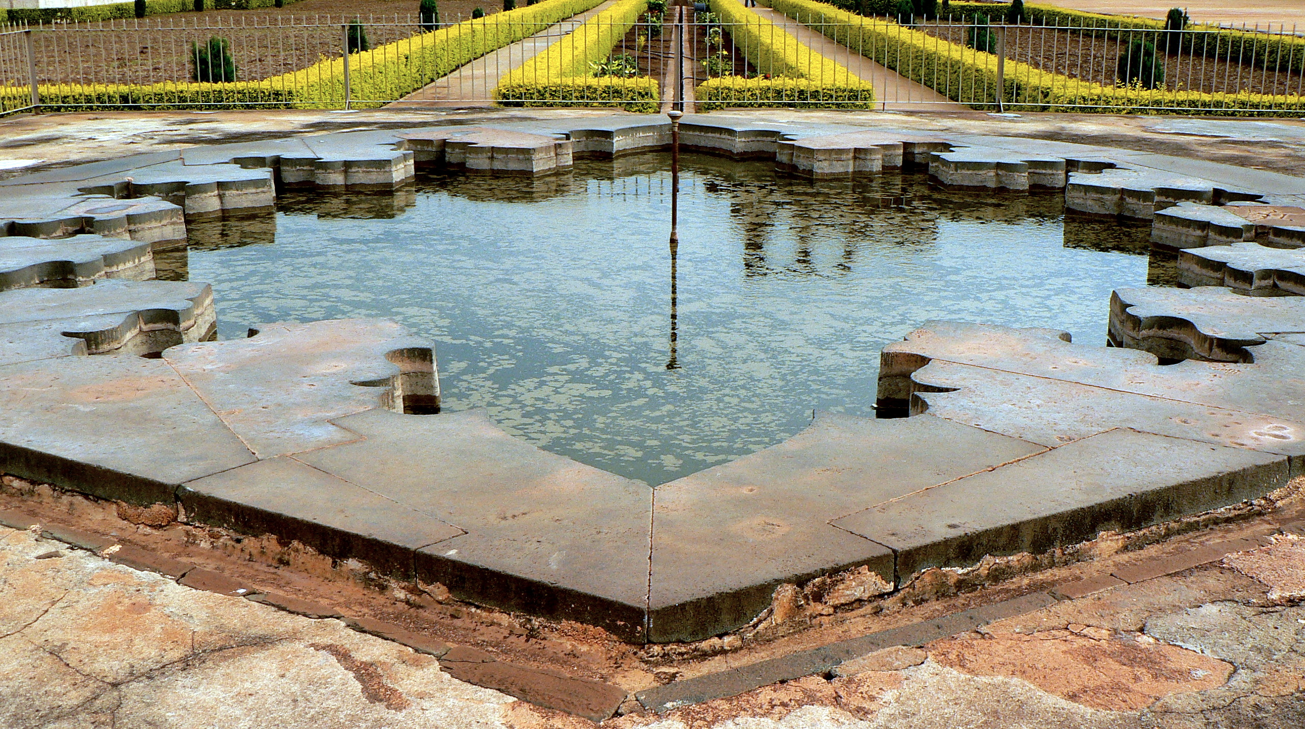
Water from Below
The karez system remains the fort's most remarkable engineering achievement. The technology originated in Persia, where it is known as a qanat: a network of underground canals that taps into groundwater sources or natural springs and transports water through tunnels to the surface, ending in canals and pools used for drinking, washing, livestock, and irrigation. Bidar's rocky soil made conventional water access nearly impossible, and the karez solved a problem that military force could not. Of the original 21 vertical shafts connecting the tunnels to the surface, only 17 remain visible today. Builders and developers have closed the rest, a reminder that the fort's most important infrastructure was always the hardest to see.
The Plateau's Edge
Bidar's geography is as layered as its history. The district sits on Deccan Trap, the vast basalt formation left by volcanic eruptions that covered much of peninsular India millions of years ago, with underlying gneiss emerging along the eastern boundary. The Karanja River, a sub-tributary, drains the surrounding lowlands into the Manjira and then the Godavari, making Bidar the only part of the Godavari basin in all of Karnataka. About 40 miles to the west lies Basavakalyan, the ancient capital of the Western Chalukya Empire, a reminder that this plateau has attracted power for over a thousand years. Empires rise and fall, but the geology that drew them here endures.
Fort on Film
Bidar Fort's dramatic profile has drawn filmmakers as well as historians. Parts of the Kannada film Bara were shot within its walls, and the 2011 Bollywood hit The Dirty Picture used the fort as a backdrop for its song "Ishq Sufiyaana," featuring Vidya Balan and Emraan Hashmi. A Mughal-era farman from 1702 survives among the fort's artifacts, a royal decree from Aurangzeb transferring command from one garrison commander to another. Documents like these make the fort a working archive, not merely a ruin. Though the nearest commercial airport sits in Hyderabad at Rajiv Gandhi International, Bidar itself has an airfield that serves as an Indian Air Force station, and the fort remains the most visible landmark in the city that shares its name.
From the Air
Located at 17.92N, 77.52E on the northern edge of the Bidar plateau in Karnataka. The fort complex is visible from altitude as a large walled area within the old city. Bidar has an Air Force station airfield (VABR) adjacent to the city, though it is not a commercial airport. The nearest commercial airport is Rajiv Gandhi International Airport (VOHS) in Hyderabad, approximately 140 km to the southeast. The Manjira River valley to the north provides a geographic reference.