Big Bend: The Borderland That Both Countries Forgot
The Rio Grande makes a 90-degree turn here, and the map follows. The bend that gives Big Bend its name creates a U-shaped intrusion of Texas deep into Mexico, three mountain ranges rising from Chihuahuan Desert, canyons carved by a river that serves as international boundary. This is the least-visited national park in the Lower 48, not because it lacks beauty but because it lacks accessibility. The nearest major airport is 350 miles away; the nearest traffic light is over 100 miles. The isolation isn't bug but feature - Big Bend preserved what development elsewhere destroyed, a landscape so harsh that neither country bothered to develop it, where the border is a river you can wade across to buy beer and folk art from Mexican vendors who row across to meet you.
The Canyons
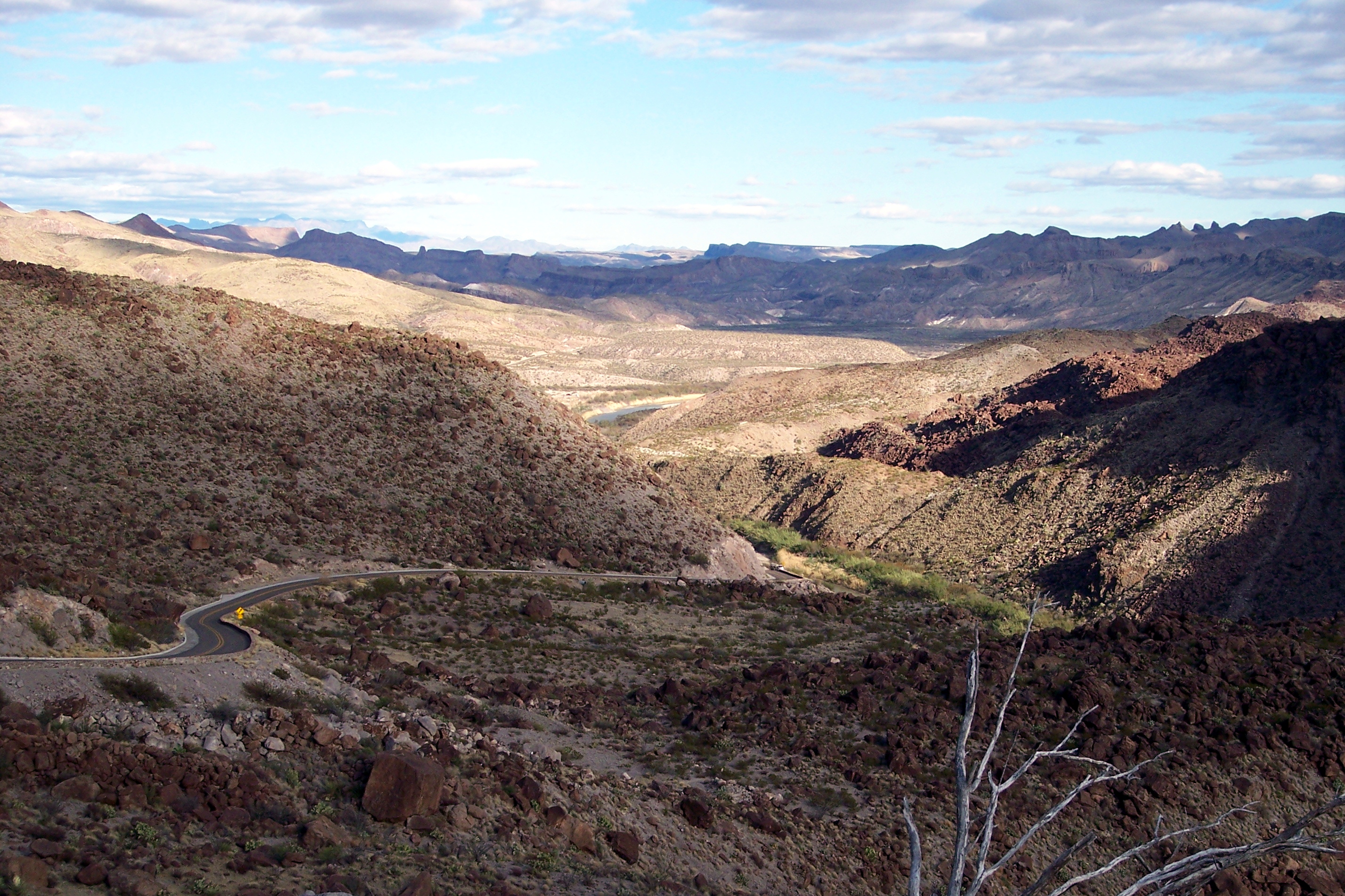
The Rio Grande sliced three canyons through Big Bend's mountains. Santa Elena Canyon, most dramatic, features 1,500-foot walls rising directly from the water; you can stand in Texas and touch Mexico. Mariscal Canyon and Boquillas Canyon offer similar drama at different scales. The river that carved them is dying - upstream diversions leave the Rio Grande barely a trickle by the time it reaches Big Bend. Rafting depends on seasonal flows; some years barely enough water floats a boat. The canyons testify to what the river once was: powerful enough to cut through mountain ranges, now diminished to a controversial trickle that both nations drain before it reaches this border it supposedly defines.
The Chisos
The Chisos Mountains rise unexpectedly from the desert floor, a sky island ecosystem where pine and oak forests survive at elevation while cactus dominates below. The Window, a V-shaped pour-off where Basin waters drain, frames sunset views. Emory Peak, highest point at 7,832 feet, offers 360-degree views of terrain that seems to extend forever. The mountains create their own weather - thunderstorms build afternoon clouds, temperatures drop 20 degrees from desert floor. Wildlife concentrates here: black bears returned after decades of absence, mountain lions roam the rimrock, and javelinas root through campsites. The isolation that preserved the landscape preserved the wildlife within it.
The Border
The Rio Grande here is not the militarized boundary of El Paso or the Rio Grande Valley. For decades, residents of Boquillas del Carmen, Mexico, rowed across to sell handicrafts to tourists. The crossing closed after 9/11; Boquillas's economy collapsed. It reopened in 2013 as an official port of entry - you can legally cross by rowboat, visit the Mexican village, eat tacos, buy folk art, and return. The informality persists in other ways: the river is shallow enough to wade, and isolation means enforcement is theoretical. The border here is what borders once were elsewhere - a line on maps that locals crossed for commerce and kinship, the international division less meaningful than the shared landscape.
The Dark
Big Bend earned International Dark Sky Park designation because almost nothing competes with stars. The nearest significant light pollution is Fort Stockton, 100 miles north. On moonless nights, the Milky Way casts shadows; meteor showers overwhelm the sky. The park holds star parties where telescopes line up like artillery, revealing galaxies visible nowhere near cities. The darkness extends beyond night sky - cell service barely exists, radio stations fade, the isolation is comprehensive. What makes Big Bend inconvenient makes it genuine: the silence is complete, the dark is absolute, the landscape unchanged from what it was before humans recorded it.
Visiting Big Bend
Big Bend National Park is located in far west Texas, accessible via Alpine (100 miles) or Marathon (70 miles). The nearest major airport is Midland (230 miles) or El Paso (350 miles). Fuel is available inside the park but expensive; fill up before arriving. The Chisos Mountains Lodge provides the only in-park lodging; camping is extensive. Santa Elena Canyon Trail offers canyon access without river skills; river trips require outfitters. Boquillas crossing allows Mexico day trips (passport required). Summer temperatures exceed 110°F at river level; spring and fall are ideal. Winter brings cold at elevation. Stock water, food, and patience - services are limited and distances vast. The experience rewards commitment: few places in America feel this remote.
From the Air
Located at 29.25°N, 103.25°W in far west Texas where the Rio Grande bends sharply south then east, creating the park's distinctive shape. From altitude, Big Bend appears as rumpled desert terrain punctuated by the dark mass of the Chisos Mountains rising like an island. The Rio Grande traces the park's southern and western boundaries, its canyons visible as dark slits in lighter terrain. Mexico extends endlessly to the south; Texas ranchland continues north. The isolation is apparent - no roads connect directly across the river, no towns visible for dozens of miles. Santa Elena Canyon's thousand-foot walls are visible where the river exits to the west. What appears from altitude as empty borderlands is wilderness preserved by inaccessibility - a landscape too harsh for development that remains as it was before either nation noticed it.