Big Morongo Canyon Preserve
Two deserts meet at Big Morongo Canyon — the Mojave pressing down from the north and the Colorado Desert rising from the southeast — and where they meet, something unusual happens. Water flows year-round through the canyon, feeding one of the ten largest cottonwood-willow riparian habitats in California. In a landscape that seems to forbid such abundance, Big Morongo Canyon Preserve has become one of the premier birdwatching destinations in the American Southwest.
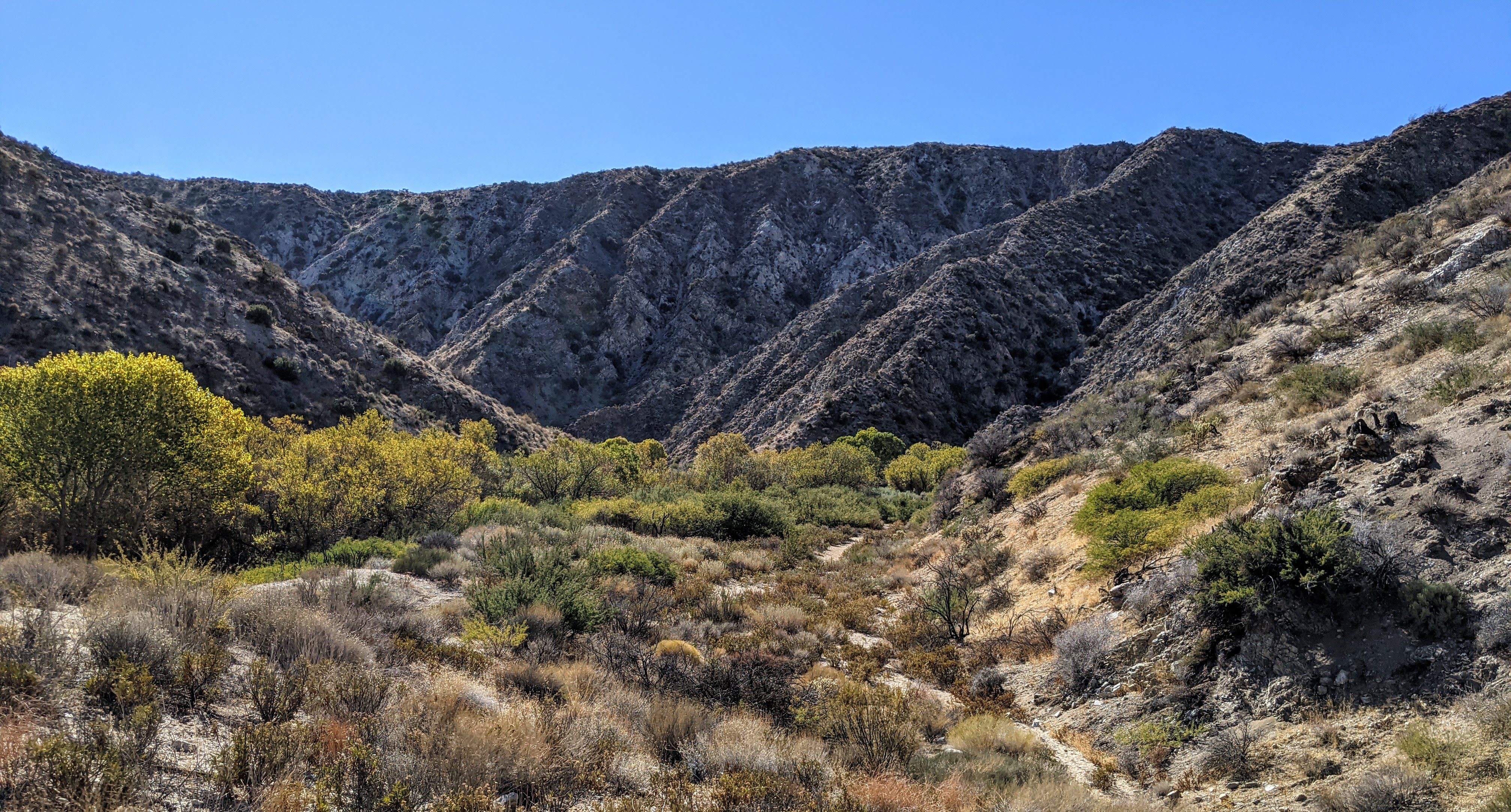
Where Mountains Drain into Desert
The preserve occupies 31,000 acres in the Little San Bernardino Mountains, which form the western boundary between the Coachella Valley and the high desert plateau. The canyon itself cuts through the range, funneling water from higher elevations down into the desert floor below. This water sustains a riparian corridor dominated by cottonwood and willow trees, dense thickets of mesquite and arrowweed, and the rare open water that makes the canyon so valuable to wildlife. The underlying geology is ancient — the oldest exposed rocks in the preserve date to approximately two billion years — which gives the canyon a deep-time quality that the cottonwood trees, themselves long-lived, can only partially represent. The San Andreas Fault runs nearby, and the tectonic history of the region is written in the canyon's compressed geology.
Two Hundred and Forty-Seven Reasons to Look Up
Birders discovered Big Morongo long before the preserve was formally established, drawn by the improbable concentration of species that gather where water and shade exist in the desert. More than 247 bird species have been recorded in the preserve, with 72 known to breed there. The canyon serves as a critical stopover for migratory species moving along the Pacific Flyway, particularly in spring and fall, when the riparian vegetation provides food and cover unavailable for miles in any direction. Warblers, flycatchers, and vireos move through in waves during migration. Year-round residents include species that would be unremarkable in wetter California environments but carry special weight here — birds that chose this canyon over the surrounding heat and dryness. The preserve is regularly listed among the most important birding sites in Southern California.
The People of the Canyon
Before the Nature Conservancy and the Bureau of Land Management arrived, the Serrano people — the Morongos — lived in and around the canyon for generations. The name Morongo derives from that association, a trace of indigeneity embedded in the preserve's formal designation. Their presence in the canyon was predicated on the same qualities that make it valuable today: the water, the shade, the concentration of wildlife that water in the desert always attracts. In 1982, the Nature Conservancy, San Bernardino County, and the BLM jointly established the preserve, recognizing the canyon's ecological significance and the need to protect it from the development pressure moving through the surrounding valley.
Fire and Recovery
In 2005, the Paradise Fire burned more than 2,000 acres of the preserve, destroying riparian vegetation that had taken decades to establish. Fires are not foreign to California's desert-edge ecosystems, but the intensity and scale of modern fires — driven by drought, heat, and the accumulation of dry fuel — can set back recovery timelines by years. The preserve has continued to support its bird populations and wildlife through the post-fire period, aided by the year-round water that draws animals back even when vegetation cover is reduced. Desert bighorn sheep move through the canyon. Mountain lions have been documented in the area. The convergence of two desert systems at this one canyon means that the species list is unusually long for a preserve of any size, and fire, while damaging, cannot erase the fundamental reason the canyon exists: the water that comes down from the mountains regardless of what burns above it.
From the Air
Located at 34.001°N, 116.559°W at the western edge of the Coachella Valley, Big Morongo Canyon Preserve is visible from cruising altitude as a green incision in the pale tan mountains marking the transition from valley floor to high desert. The canyon cuts through the Little San Bernardino Mountains clearly from above. The town of Desert Hot Springs lies approximately 5 miles to the southeast. Nearest airports: KPSP (Palm Springs International, approximately 16 miles south-southeast), L22 (Bermuda Dunes Airport, approximately 20 miles east). At 8,000–10,000 feet the canyon's riparian corridor appears as a dark-green stripe against the surrounding desert slopes.