Black Forest Fire
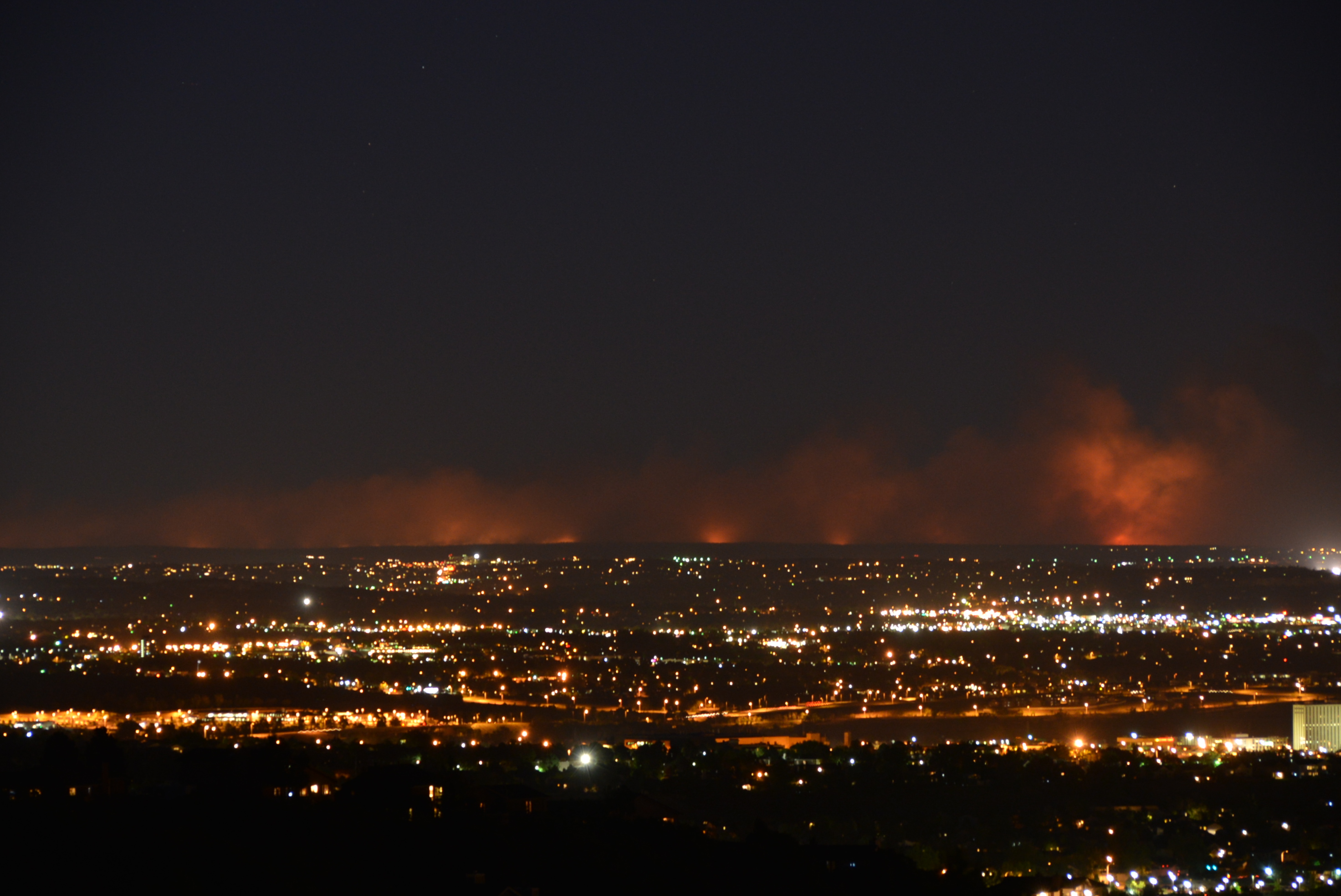
At 1:00 p.m. on June 11, 2013, the first 911 call came in from Black Forest, a wooded community of scattered homes and ponderosa pines north of Colorado Springs. Within hours, record-setting heat and fierce winds had transformed a fire near Highway 83 and Shoup Road into a wall of flame racing through the trees. By the time it was over, the Black Forest Fire had become the most destructive wildfire Colorado had ever seen, a record that would stand for eight years.
Tinderbox Conditions
The National Weather Service had issued a red flag warning that Tuesday, and the conditions justified the alarm. Record heat baked the Front Range, drying out the ponderosa forest that gave Black Forest its name. When the fire ignited in the early afternoon, high winds drove the flames across hundreds of acres before most residents even knew it had started. The El Paso County Sheriff's office quickly ordered evacuations covering 13,000 homes and 38,000 people. Three shelters opened, including the Elbert County Fairgrounds, which accepted not just people but also pets and large animals, a practical necessity in a community where many residents kept horses and livestock.
A Massive Response
By June 13, 457 firefighters were working the fireline, supported by the Colorado Air National Guard, fire suppression teams from Fort Carson and the U.S. Air Force Academy, and military aviation assets. Three UH-60 Black Hawk and three CH-47 Chinook helicopters from the 4th Combat Aviation Brigade launched on short notice to drop water on the advancing flames. A C-130 Hercules from the 302nd Airlift Wing deployed its Modular Airborne Firefighting System, releasing retardant across the burning forest. U.S. Northern Command coordinated additional federal support. The response was enormous, yet the fire kept growing.
Homes Reduced to Ash
Within two days of ignition, the Black Forest Fire surpassed the previous year's Waldo Canyon Fire as the most destructive in state history. Sheriff Terry Maketa reported 360 homes lost by the morning of June 13. By the next day, that number climbed to 419, then 473 on June 15. On June 16, the sheriff's office released a detailed accounting: 483 homes totally destroyed, 17 partially damaged, and 3,633 left standing. Two people lost their lives. Drawing on lessons learned from Waldo Canyon, the sheriff's office published a publicly accessible list of affected homes that was updated in real time, giving displaced residents information without requiring them to return to dangerous ground.
The Long Road to Containment
Rain and cloud cover on the evening of June 14 gave firefighters their first real break, pushing containment to 30 percent. By June 15, the fire was 55 percent contained. A day later, 65 percent. On June 20, Sheriff Maketa announced full containment. Residents were allowed to return to most areas that morning, though a small zone around Darr Circle and Falcon Drive remained closed due to an ongoing investigation. The final assessment, completed by the El Paso County Assessor's office in early July, tallied 486 homes destroyed and 37 damaged, with total damage of 5,444,052. Authorities stated that the fire's cause was not natural, executing search warrants and conducting interviews as the investigation continued.
A Record That Did Not Last
For eight years, the Black Forest Fire held its grim distinction as the most destructive wildfire in Colorado history. Then on December 30, 2021, the Marshall Fire swept through Boulder County, destroying over 1,000 homes in Superior and Louisville. Colorado's Front Range, a strip of development pressed against the eastern edge of the Rocky Mountains, remains one of the most fire-prone urban interfaces in the American West. The blackened scars in the Black Forest have slowly greened over, and homes have been rebuilt, but the memory of those ten days in June persists as a warning of what drought, heat, and wind can unleash on communities nestled among the trees.
From the Air
The Black Forest area lies at approximately 39.02N, 104.75W, on a wooded plateau north of Colorado Springs. From the air, the fire's former perimeter is visible as a patchwork of regrowth among mature ponderosa stands. Highway 83 runs north-south through the community. The U.S. Air Force Academy sits to the southwest. Nearest airports: Colorado Springs Municipal (KCOS) 15nm south, Meadow Lake (KFLY) 8nm southwest, Denver International (KDEN) 50nm north.