Black's Beach
To reach Black's Beach, you descend three hundred feet of crumbling sandstone cliff on a path that requires concentration. The beach at the bottom is clothing-optional. It has been, formally or informally, since the mid-1970s, when San Diego county briefly allowed public nudity there and made it — for a short time — the only legally sanctioned nude beach on public land in the United States. The county reversed the ordinance. The nudity largely continued.
Below the Bluffs
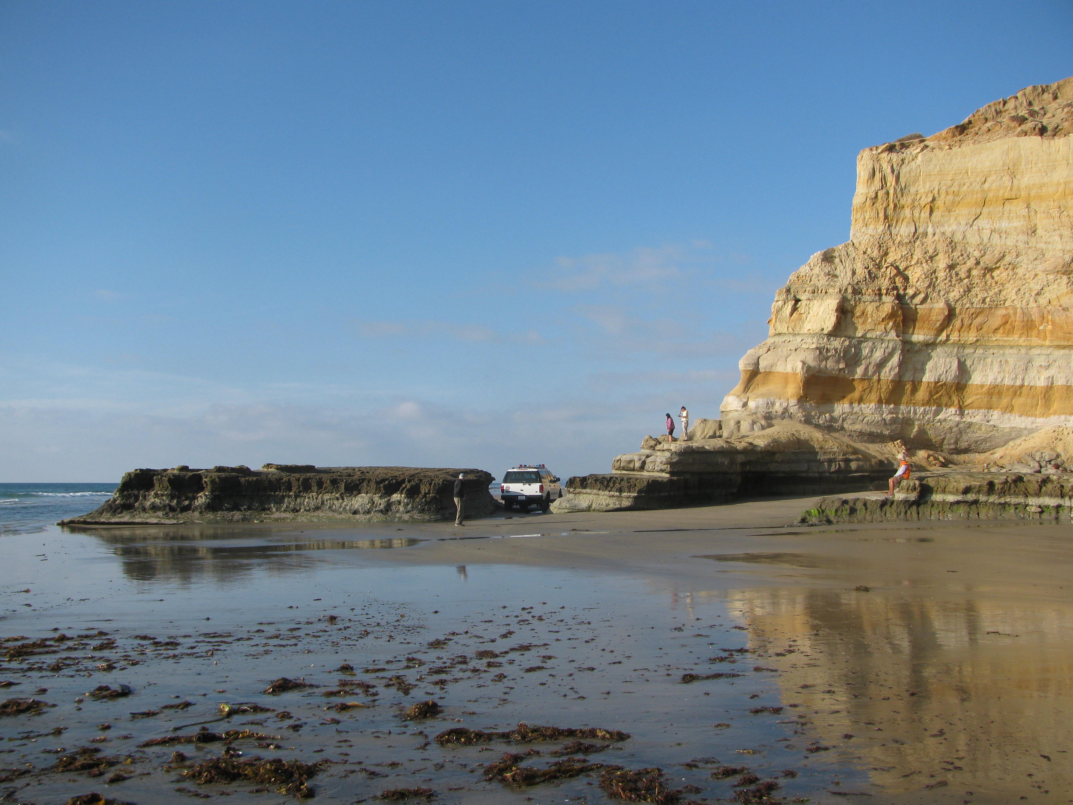
Black's Beach occupies a narrow strip of sand at the base of the Torrey Pines bluffs, a coastal escarpment of crumbling sandstone that rises steeply from the Pacific and contains some of the most erosion-prone geology on the California coast. The bluffs are layered — pale yellows and oranges and umbers — and they shed material constantly. The access trail, a steep cut in the cliff face, requires careful footing even in dry conditions and becomes genuinely dangerous when wet. The beach itself runs about a mile, flanked by the Torrey Pines State Natural Reserve to the north and the Scripps Institution of Oceanography to the south. Because it is difficult to reach and not visible from the road, it has a quality of isolation unusual for a beach within city limits.
The Water Below the Canyon
What makes Black's Beach exceptional as a surf break, aside from its remoteness, is Scripps Canyon — one of the largest submarine canyons on the California coast, its head reaching to within a few hundred yards of the shoreline. Deep water close to shore produces waves with unusual power and speed. The canyon funnels swells directly onto the beach in a way that flat-bottomed seafloor cannot replicate. The result is surf that is often heavy and unpredictable — a beach break shaped by underwater topography invisible from the surface. Experienced surfers who know the canyon respect what it can produce. The same cold, nutrient-rich upwelling that feeds the kelp forests visible offshore also flows from the canyon's depth.
Legal Status and Informal Practice
In the mid-1970s, San Diego County enacted an ordinance permitting nudity at Black's Beach, creating the first public nude beach on government land in the United States. The experiment was short-lived — the ordinance was repealed following legal challenges — but the beach's culture as a nude space was already established. Today the beach is officially clothing-optional on the portion below the Torrey Pines Gliderport; nudity is technically prohibited on the southern section that falls within Torrey Pines State Reserve. In practice, the boundary is not strictly enforced and the beach has remained de facto clothing-optional for five decades. The LGBTQ+ community has long been a significant presence, particularly at the southern end of the beach.
The Cliff and the Context
The Torrey Pines bluffs above Black's Beach are geologically young and actively eroding. The sandstone that forms the cliffs was deposited roughly 45 to 55 million years ago as a river delta environment; it is not particularly durable, and the cliffs retreat measurably every year. The Torrey Pines Gliderport, at the top of the bluff, takes advantage of the reliable onshore winds that rise up the cliff face — hang gliders and paragliders launch from the edge and soar above the beach and the kelp beds offshore. From the gliderport, the view encompasses the beach below, the submarine canyon's influence on the wave patterns, and the long coastal strip from La Jolla to Del Mar. Looking down, the tiny figures on the sand are far below and very small against the expanse of the Pacific.
From the Air
Located at 32.893°N, 117.254°W at the base of the Torrey Pines bluffs, between the Torrey Pines Gliderport above and the Pacific Ocean below. The bluffs are clearly visible from the air as a dramatic coastal escarpment. The Scripps Institution of Oceanography campus lies 1.5 miles to the south. Torrey Pines State Natural Reserve and the golf courses along the mesa top are the primary aerial landmarks. San Diego International Airport (KSAN) lies approximately 12 miles to the south-southeast.