Bolsón de Mapimí
Every river that enters the Bolson de Mapimi dies here. The Nazas flows north from the Sierra Madre Occidental. The Aguanaval drains central Zacatecas. Both terminate in the southern reaches of this 129,000-square-kilometer basin, where they once fed shallow lakes that are now usually dry. This is an endorheic basin -- a closed system with no outlet to the sea -- and it occupies the center-north of the Mexican Plateau like a geographic black hole, pulling water and history inward. Bounded by the Sierra Madre Occidental to the west, the Rio Grande basin to the north, and the Sierra Madre Oriental to the east, the Bolson spreads across four Mexican states: Durango, Coahuila, Chihuahua, and Zacatecas.
Where the Desert Begins
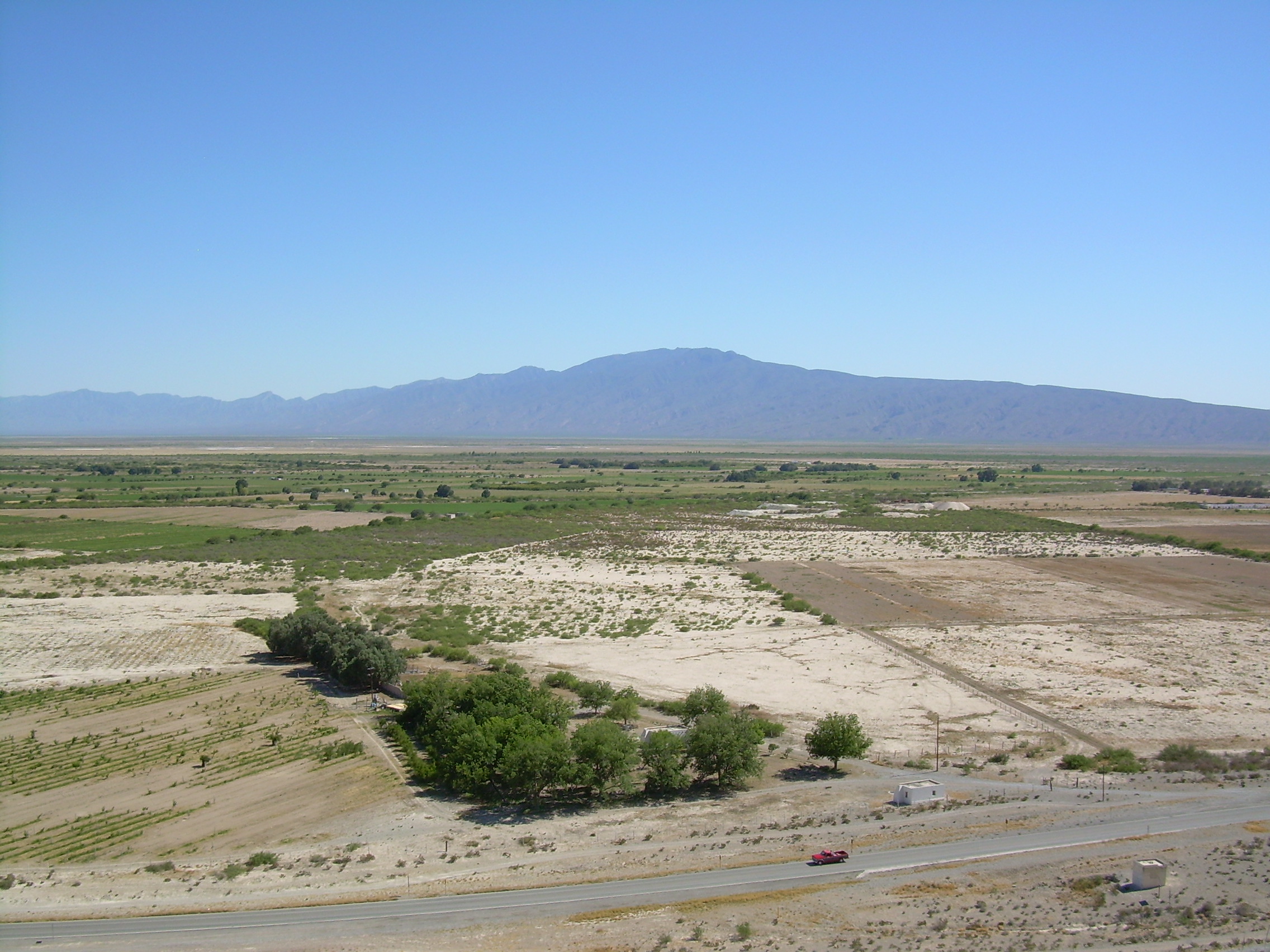
The Bolson de Mapimi is the southernmost extension of the Chihuahuan Desert, and it looks the part. Desert plains stretch between low mountain ranges, most topping out at around 1,200 meters, with the Los Alamitos range reaching 1,984 meters near the basin's center. The average elevation is 900 meters, and precipitation arrives mostly in summer, falling unevenly and insufficiently. Temperatures in Torreon, the largest city in the basin with a metropolitan area of nearly 1.5 million people, average scorching in June and mild in December, with freezes common in winter. Most of the basin is empty. Settlements cluster around mines and wherever irrigation wrests agriculture from the aridity. The Comarca Lagunera, centered on Torreon, is the exception -- an island of industrial and agricultural activity in a landscape that otherwise discourages both.
First Peoples of the Basin
Before the Spanish arrived, the Bolson belonged to the Toboso, a nomadic people about whom frustratingly little is known. In the northern reaches lived the Chisos, culturally similar and equally elusive in the historical record. Spanish penetration began in the 1590s, driven by Jesuit missionaries, slave traders, and Tlaxcalan settlers whom the colonial government incentivized with land grants and tax exemptions to help pacify the frontier and resolve the Chichimeca War. The relationship between colonizers and the basin's inhabitants was immediately violent. The Toboso and Chisos raided Spanish settlements and fought organized campaigns against them in 1644, 1667, and 1684. By the early eighteenth century, most had been absorbed into the Spanish population through intermarriage and assimilation, their distinct cultures surviving only in fragments of the colonial archive.
Comanche Highway
In the 1840s and 1850s, the Bolson became something it had never been before: a staging ground for invasion. Comanche war parties from Texas gathered at the basin's well-watered locations, consolidated forces that often numbered hundreds of warriors, and struck out in every direction on devastating raids against mines and ranches. The basin's emptiness, which had always limited settlement, became a strategic asset for raiders who needed space to maneuver and places to regroup beyond the reach of Mexican authorities. During this same period, much of the Bolson fell within the staggering boundaries of the Sanchez Navarro ranch, possibly the largest private landholding in the Americas. The family's attempt to control an area this vast while under assault from Comanche raiders was an exercise in futility that lasted until the 1860s, when the Mexican government expropriated their holdings.
A Basin Without Exit
The defining fact of the Bolson de Mapimi is hydrological: nothing leaves. The Nazas and Aguanaval rivers pour their seasonal flows into the southern basin, where the water collects, evaporates, or seeps underground. The lakes that once formed in the Comarca Lagunera have largely disappeared, drained by the agricultural demands of a modern metropolitan area. From the air, the basin reads as a vast brown amphitheater ringed by mountain ranges -- the Sierra del Carmen and Sierra Madre Oriental to the east, the Sierra Madre Occidental to the west -- with Torreon's urban sprawl as an improbable green-and-gray concentration in the south. At its southern edge, the basin blurs into another endorheic system called Llanos El Salado. The greater basin extends north all the way to the Rio Grande, encompassing terrain that shares the Bolson's climate and character even where its drainage eventually reaches the Gulf of Mexico. It is a landscape defined by what it holds rather than what it releases.
From the Air
Coordinates: 27.50°N, 103.50°W (approximate center). The Bolson de Mapimi spans over 320 km in each direction across parts of Durango, Coahuila, Chihuahua, and Zacatecas. From cruising altitude, the basin appears as a vast expanse of desert plains punctuated by low mountain ranges. Torreon (MMTC/TRC) at the southern edge is the major airport. The Comarca Lagunera urban-agricultural area around Torreon contrasts sharply with the empty desert to the north. The Mapimi Biosphere Reserve and the famous Mapimi Silent Zone are within the basin.