Boring
The slogan says it all: 'The Most Exciting Place to Live.' Boring, Oregon - population 8,000 - has embraced its name with a humor that turned geographic accident into international recognition. The town is twinned with Dull, Scotland (population 85) and allied with Bland Shire, Australia, forming the 'League of Extraordinary Communities' that capitalizes on what might otherwise be a marketing handicap. The name actually honors William H. Boring, a Union veteran who settled here after the Civil War and donated the land for the first school. But the wordplay has become the point, visitors arriving to buy 'Boring & Dull' merchandise and photograph the signs that announce this most unexciting of exciting places.
A Name Worth Celebrating
Since 2012, when Boring and Dull formalized their sister-city relationship, the communities have played their names for maximum publicity. The partnership brought Scottish visitors to Oregon and Oregon visitors to Scotland, generating news coverage that neither place could have attracted on its own merits. Bland Shire, a former gold mining and farming area in New South Wales, joined the alliance later, completing a trifecta of toponymic understatement.
The Boring Community Planning Organization sells commemorative merchandise - t-shirts, mugs, items branded with both towns' names. A raffle offers trips to Dull, Scotland, though the journey requires commitment: Dull is a tiny settlement in Perth and Kinross County, a former seventh-century monastery site by the River Tay, population under 100. The humor works because both places embrace it, neither pretending to be something they're not, both finding value in the unexpected gift of an unpromising name.
The Boring Volcanic Field
The name 'Boring' has a second significance in Oregon geology. The Boring Lava Field, named for this community, describes the volcanic province that dots northwest Oregon and southwest Washington with cinder cones and lava flows. The eruptions occurred over the past 2.6 million years, some as recently as 57,000 years ago. The landforms they created - including Prune Hill in Camas and various cones throughout the Portland area - shape the terrain of the region.
The geological naming predates the tourism angle, geologists in the early 20th century designating the volcanic field for the town where they conducted initial studies. It's an irony that a place named for a person named Boring became synonymous with both volcanic activity and the absence of excitement - the name working overtime in the English language, carrying meanings that William H. Boring never anticipated when he donated that acre for the school.
Gateway to Mount Hood
Boring sits on US-26, the Mount Hood Highway that connects Portland to the ski areas and alpine recreation on Oregon's highest peak. The road passes through Gresham and Boring before continuing through Sandy and into the mountains. For travelers heading to Government Camp, Timberline, or Mount Hood Meadows, Boring marks the transition from Portland's eastern suburbs to the foothills of the Cascades.
The Portland Traction Company once ran rail lines from Portland to Boring, the junction established in 1903 when timber drove the local economy. The rail lines are gone, mostly converted to trails, but the route remains visible in the corridor that follows US-26 through the foothills. The timber industry has faded; the economy now depends on the commuters who live here and work in Portland, the travelers who pass through on their way to the mountain, and the curious who stop specifically because of what the signs say.
Unincorporated Character
Boring is unincorporated, governed by Clackamas County rather than its own municipal structure. This status is common for small communities in Oregon, places too small for the overhead of city government but too populated to be merely rural. The result is a community defined by its identity rather than its boundaries, existing as a place name and a planning area without the formal structures that incorporation would require.
The 8,000 residents have access to Portland's amenities without living in the city proper, the trade-offs familiar to exurban communities everywhere. There's no public transit - as one guide puts it, 'There is no public transport in this Boring town' - but the highway provides connection to Gresham and Portland beyond. The community maintains its identity through events, the merchandise sales, and the simple fact of the name that travelers notice as they pass through on their way to somewhere else.
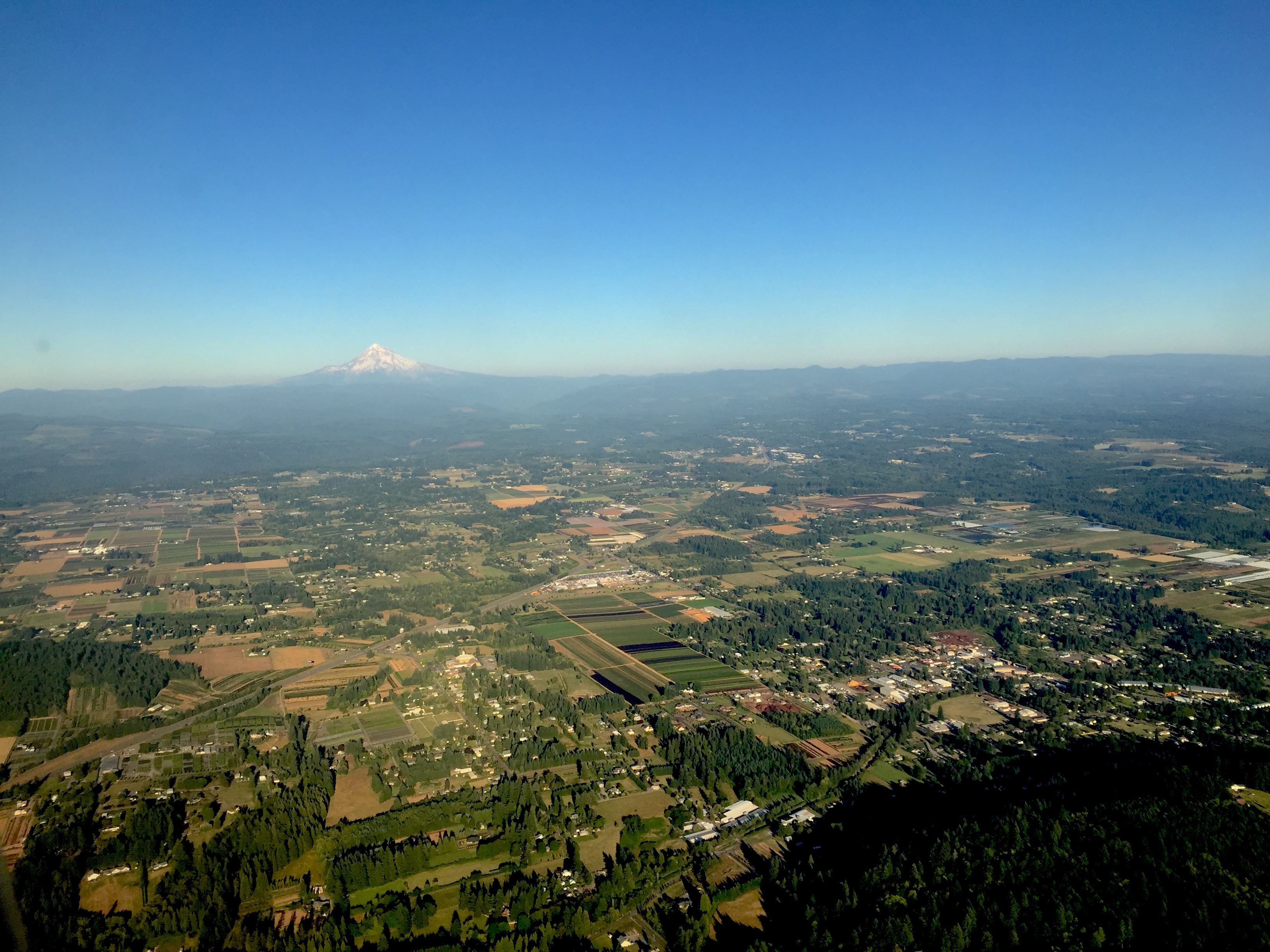
From the Air
Located at 45.43N, 122.37W in Clackamas County, Oregon, approximately 20 miles southeast of downtown Portland. Boring sits along US-26, the Mount Hood Highway, between Gresham to the west and Sandy to the east. The community is visible as a developed area in the agricultural and suburban transition zone east of Portland. Mount Hood is visible to the east. The terrain is rolling foothills, part of the western Cascade foothills. Damascus is immediately south. The route continues east to Government Camp and Mount Hood.