Bougainville Island
During the last ice age, you could have walked from the top of Buka to the Nggela Islands without getting your feet wet. Sea levels hundreds of meters below today's tied Bougainville and its neighbors into a single landmass that geographers now call Greater Bougainville. The people who first settled it came that way, or very close to it. Stone tools and food residue in Kilu Cave on Buka Island date back roughly 28,000 years - among the oldest evidence of human life anywhere in the Pacific. By the time European navigators stumbled onto the island in the eighteenth century, its people had already been Bougainvilleans for a thousand generations.
Geology and Smoke
Bougainville is the exposed crest of a submarine volcanic arc that runs northwest from the main Solomon Islands chain. Its spine is a line of peaks, some still active, some long quiet. Mount Balbi rises 2,685 meters at the northern end - higher than any mountain on the Australian mainland - and is considered an active volcano with fumaroles and sulphurous vents still breathing. Just south of Balbi in the Emperor Range sits Billy Mitchell, dormant since the late 1500s, its caldera now a cold lake. Further south, Mount Bagana steams almost constantly, a pyroclastic cone whose gas plume can be seen for dozens of kilometers on a clear day. The 2013 magnitude 6.4 earthquake centered south of Panguna was a reminder that the island sits astride active faults. None of this is static geography. Bougainville is still being built.
Three Language Families
Linguists have counted more than twenty indigenous languages on Bougainville, arranged in three families that do not share a common ancestor. Along the northern coasts and on Buka, Austronesian languages like Halia, Nehan, and Tinputz link Bougainvilleans to a vast Pacific family that reaches to Madagascar and Easter Island. In the north-central and southern interior, the North Bougainville languages - Rotokas, Eivo, Keriaka - and the South Bougainville family - Nasioi, Motuna, Nagovisi - descend from older Papuan stock unrelated to Austronesian. Rotokas is famous among linguists for having one of the smallest phoneme inventories in the world. These differences map onto the island's history of waves of settlement: the earliest Melanesian arrivals, then the Austronesian navigators who reached the coasts in the second millennium BCE bringing pigs, chickens, and obsidian. Most Bougainvilleans now speak Tok Pisin as a lingua franca alongside their first language, but the deep diversity remains.
A Jungle That Closed Over War
Bougainville's forests are part of the Solomon Islands rain forests ecoregion - tropical rainforest climate, the driest month still reliably wet, mean temperature hovering at 27 degrees Celsius year-round. Canopy species reach 40 meters. The understory swarms with orchids, ferns, and the crown pigeons and kingfishers that make Bougainville one of the birding destinations of the Pacific. This is also the jungle that, during World War II, swallowed Japanese garrisons still holding out in 1945 and that, during the civil war of 1988 to 1998, hid the Bougainville Revolutionary Army from every search the PNG military mounted. Saltwater crocodiles inhabit the major river systems. The Jaba River, downstream from the abandoned Panguna copper mine, still shows the pale discoloration of the heavy metals that prompted the uprising. The United Nations Environment Programme has offered to facilitate a cleanup, a process still more promised than started.
The Mine and Its Shadow
In the 1960s, Australian geologists working in the Crown Prince Range above the Jaba Valley found one of the largest copper deposits on Earth - an estimated billion tonnes of ore with 12 million ounces of gold threaded through it. Rio Tinto's subsidiary Bougainville Copper Ltd opened the Panguna mine in 1972, and at its peak it was the largest open-cut mine in the world. The photograph every Bougainvillean knows: a stepped pit so deep that looking into it feels like looking down into something geological rather than made. The mine generated enormous wealth for PNG and Rio Tinto. The Nasioi landowners whose ancestors were buried in that mountain received a royalty that worked out to a fraction of a percent of revenues. In 1988, Francis Ona and his cousins blew up the pylons that powered the mine, and production has never resumed. The pit is now slowly filling with rain, a toxic blue lake that locals and scientists alike watch with uncertain feelings.
Toward 2027
In the 2019 independence referendum, Bougainvilleans voted overwhelmingly - 98.31 percent on the full-independence option - to become their own country. Papua New Guinea's parliament has not yet ratified the result, but a 2021 agreement between PNG and the Autonomous Bougainville Government set a target of independence by 2027. The low-lying Tulun Islands northeast of Buka - the Carteret atolls - give the island an urgent modern concern: rising seas are pushing their Polynesian-descended inhabitants onto the main island as climate refugees. The Bagana volcano keeps venting. The dugongs still graze the shallow reefs. Buka market still sells fish-on-a-stick to ferry passengers. One of the Pacific's oldest inhabited places is still remaking itself, as it has done in unbroken succession since the people in Kilu Cave first worked a piece of obsidian into a blade.
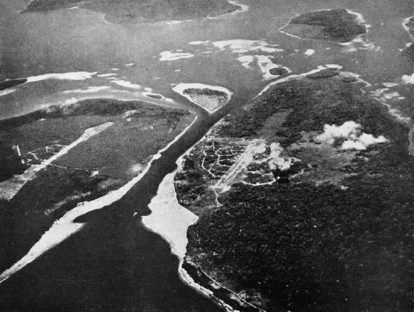
From the Air
Located at 6.24S, 155.38E. Bougainville Island appears from altitude as an elongated, green-spined landmass about 200 kilometers long, oriented northwest to southeast. Mount Balbi in the north is often cloud-capped at 2,685 meters. Bagana's steam plume is a useful visual landmark in clear weather. Nearest airports: Buka Airport (AYBK) in the north, Aropa Airport (AYIQ) at Arawa on the east coast. Tropical rainforest climate with frequent afternoon convection.