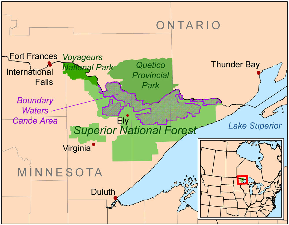
Boundary Waters: A Million Acres of Silence
The Boundary Waters Canoe Area Wilderness is democracy's experiment in silence. One million acres straddling the Minnesota-Ontario border, containing 1,200 miles of canoe routes connecting over 1,000 lakes. Motors are banned on most waters. Entry requires permits. Visitors paddle and portage as the Ojibwe and voyageurs did - carrying canoes between lakes on paths worn into granite by centuries of travelers. It's the most visited wilderness in America, yet manages to feel empty: the permit system disperses paddlers across a labyrinth so complex that solitude finds everyone eventually. At night, loons call across still water. Wolves howl. The Milky Way blazes overhead, undiminished by light pollution. Silence is the primary resource, carefully managed and genuinely wild.
The Landscape
The Boundary Waters occupy the southern edge of the Canadian Shield, where billion-year-old granite meets boreal forest. Glaciers scraped the landscape 10,000 years ago, leaving behind scoured rock basins that filled with water - the thousand lakes that make canoe travel possible. The portage trails connect watersheds, often following routes used for thousands of years. The forest is mixed: pine, birch, spruce, fir, depending on soil and fire history. The lakes are cold and clear, stained tea-brown by tannins. The landscape feels ancient because it is: bedrock exposed, forest recovering from the last ice age, water finding its way slowly toward Hudson Bay.
The Tradition
The Ojibwe traveled these waters for centuries before Europeans arrived. French-Canadian voyageurs followed, paddling 36-foot freight canoes loaded with furs and trade goods, portaging on trails still used today. The logging era of the late 1800s threatened the forest; the conservation movement that followed made the Boundary Waters one of America's first protected wildernesses. Restrictions accumulated: motors banned progressively, mining prohibited, logging eliminated. The current system - entry permits, group size limits, fire regulations - balances access with preservation. Over 150,000 visitors enter annually, yet the wilderness absorbs them, maintains its wildness, remains somehow quiet.
The Experience
A Boundary Waters trip is measured in portages. Paddlers load canoes, cross lakes, then carry everything - boat, packs, gear - over trails ranging from rods to miles. The rhythm becomes meditative: paddle, portage, paddle. Campsites appear on points and islands, marked by fire grates and wilderness latrines. Loons surface near canoes; eagles circle overhead; moose browse in shallow bays. At night, the silence is profound - no motors, no roads, no light pollution. The experience is earned through effort: the portages filter out casual visitors, leaving those willing to work for wilderness. The reward is immersion in country that looks like it did before Europeans arrived.
The Threats
The Boundary Waters face ongoing threats. Proposed copper-nickel mining on the watershed's edge could introduce sulfide pollution to lakes with no buffering capacity. Climate change warms the waters, threatening cold-water fish and shifting forest composition. Invasive species - spiny water flea, Eurasian milfoil - require vigilant management. Wind storms in 1999 and 2022 flattened vast forest tracts, changing the canoe experience. The tensions between wilderness preservation and economic development remain unresolved; each generation fights the same battles. The silence is not guaranteed. It requires defense.
Visiting the Boundary Waters
The Boundary Waters Canoe Area Wilderness is located in northeastern Minnesota, accessible from Ely, Grand Marais, and Tofte. Entry permits are required May through September and quotas limit daily entries at each access point; reserve permits months in advance through Recreation.gov for popular routes. Outfitters in gateway communities rent canoes, gear, and provide shuttle services. Entry points range from easily accessible to remote. Trip length varies from overnight to weeks; route planning requires maps and portage research. The season runs May through September; bugs are brutal in June; fall brings color and cold. Canoe skills and wilderness experience improve the journey. The Quetico Provincial Park, across the border in Ontario, offers similar wilderness with separate permits.
From the Air
Located at 48.05°N, 91.50°W along the Minnesota-Ontario border. From altitude, the Boundary Waters appear as an impossible maze of lakes - water covering perhaps a third of the visible surface, separated by forested ridges and islands. The landscape is fractured, geological, the scoured granite of the Canadian Shield holding water in every depression. No roads penetrate the interior; the wilderness boundary is visible where development stops. The border with Canada is invisible - the lakes and forests continue into Quetico Provincial Park without interruption. The scale is humbling: a million acres of silence, a thousand lakes connected by portages, wilderness that absorbs 150,000 annual visitors and remains, somehow, quiet.