Braulio Carrillo National Park
The park exists because of a highway, which is the kind of irony Costa Rica has learned to live with. In the late 1970s, planners drew a road between San Jose and the Caribbean port town of Guapiles, cutting straight through some of the most pristine rainforest left in the Central Valley. The environmental backlash was immediate and effective: in 1978, Braulio Carrillo National Park was created to protect the forest the highway would bisect. Named for Costa Rica's third president, the park has since expanded four times - in 1986, 1991, 1995, and 2015 - growing to 50,000 hectares of dense jungle, cloud forest, and volcanic terrain. Two volcanoes anchor the landscape: Barva, whose peak reaches 2,906 meters, and the lower Cacho Negro. Highway 32 still runs through the middle, a narrow asphalt thread through a green wall so thick you can drive for 45 kilometers without seeing sky.
Half of Everything
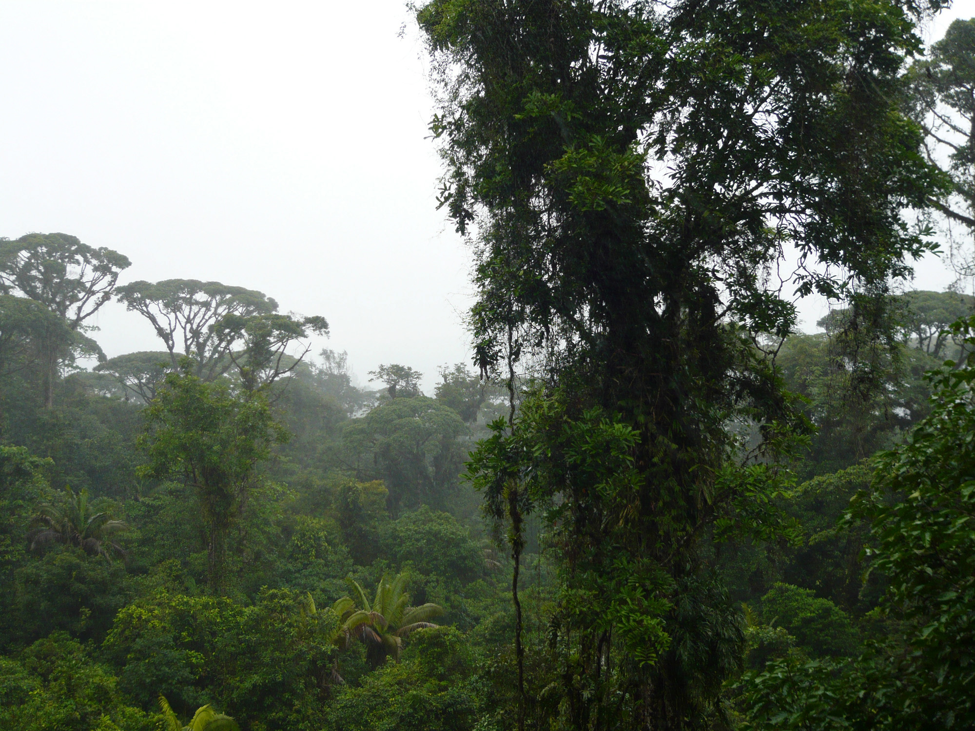
The biodiversity statistics for Braulio Carrillo read like typos. Over 6,000 plant species have been cataloged within the park boundaries. More than 515 bird species have been observed - both resident and migratory. Costa Rica, a country roughly the size of West Virginia, contains more plant and animal species than most nations ten times its size, and Braulio Carrillo holds over half of all Costa Rican species within its borders. The primary forest canopy is perpetually green - dense stands of mahogany, oak, ceiba, and caobilla. Around Volcan Barva, the composition shifts to cypress, candelillo, and white oak. Wild avocado trees grow in the cloud forest zones. The palmito, a native palm, is considered a vanishing species here. Adjacent to the park, La Selva Biological Station near Puerto Viejo de Sarapiqui conducts research that draws scientists from around the world.
The Predators and the Prey
Jaguars and pumas share the upper reaches of the food chain in Braulio Carrillo, though neither is seen often. More visible are the primates: white-faced capuchins swing through the canopy, spider monkeys navigate the upper branches, and howler monkeys announce their territories with roars that carry for kilometers through the forest. Tapirs browse the undergrowth, their heavy bodies crashing through vegetation that conceals them from all but the most patient observers. Coatimundis travel in bands, noses to the ground. Sloths hang motionless for hours, their algae-covered fur blending with the mossy branches. On the forest floor, the brilliantly colored poison dart frogs are beautiful and lethal - their skin secretes toxins potent enough that indigenous peoples used them to tip blowgun darts. The fer-de-lance, locally called the terciopelo, accounts for nearly half of all snakebite cases in Costa Rica and hunts actively along the trails.
Flash of Green and Gold
Birdwatchers come to Braulio Carrillo hoping for one sighting above all others: the resplendent quetzal. This iridescent bird, sacred to the Maya and Aztecs, breeds in the cloud forest canopy, its emerald plumage and impossibly long tail streamers visible to those with good timing and a steady pair of binoculars. Parrots, tanagers, and hummingbirds are far more common, their calls forming the ambient soundtrack of any trail hike. The aerial tram - a cable car that lifts visitors above the jungle floor and into the canopy - offers the best chance for a quetzal sighting without the physical toll of a backcountry trek. From the tram, the park reveals itself in vertical layers: the dark forest floor, the mid-story tangle of vines and bromeliads, the sunlit canopy where most of the avian life concentrates, and the open sky where raptors circle.
Two Ways In
Most visitors enter at Quebrada Gonzalez, the main park entrance along Highway 32, about 25 kilometers from San Jose. Rangers provide maps and information, and three marked hiking trails loop along the Rio Quebrada Gonzalez and the smaller Rio Sucio, whose waters run copper-colored from volcanic minerals. The park is open daily from 8 AM to 3:30 PM, 365 days a year. The second access point, at Volcan Barva, is another experience entirely. Badly marked dirt roads in what the Wikivoyage guide diplomatically calls 'pitiful condition' require a serious 4WD vehicle. The reward is remoteness: four trails reach distances of up to 10 kilometers through landscapes that feel genuinely untouched. Camping is permitted near the Barva entrance, and local guides run multi-day backcountry treks for those willing to commit to the jungle on its own terms. No restaurants, no stores, no cell service. Just forest, water, and whatever you carried in.
From the Air
Located at 10.16N, 83.97W northeast of San Jose in the Central Valley of Costa Rica. The park's 50,000 hectares of unbroken canopy are clearly visible from altitude as a vast green mass bisected by Highway 32 (Carr. Braulio Carrillo). Volcan Barva (2,906m) and Cacho Negro are the two volcanic peaks within park boundaries. Juan Santamaria International Airport (MROC/SJO) is approximately 25km to the southwest. The park stretches from roughly 25km to 70km northeast of San Jose along the highway corridor. From the air, look for the dramatic transition from developed Central Valley farmland to unbroken jungle canopy. The Rio Sucio's distinctive copper-colored water may be visible where it crosses near the highway.