Brazzaville
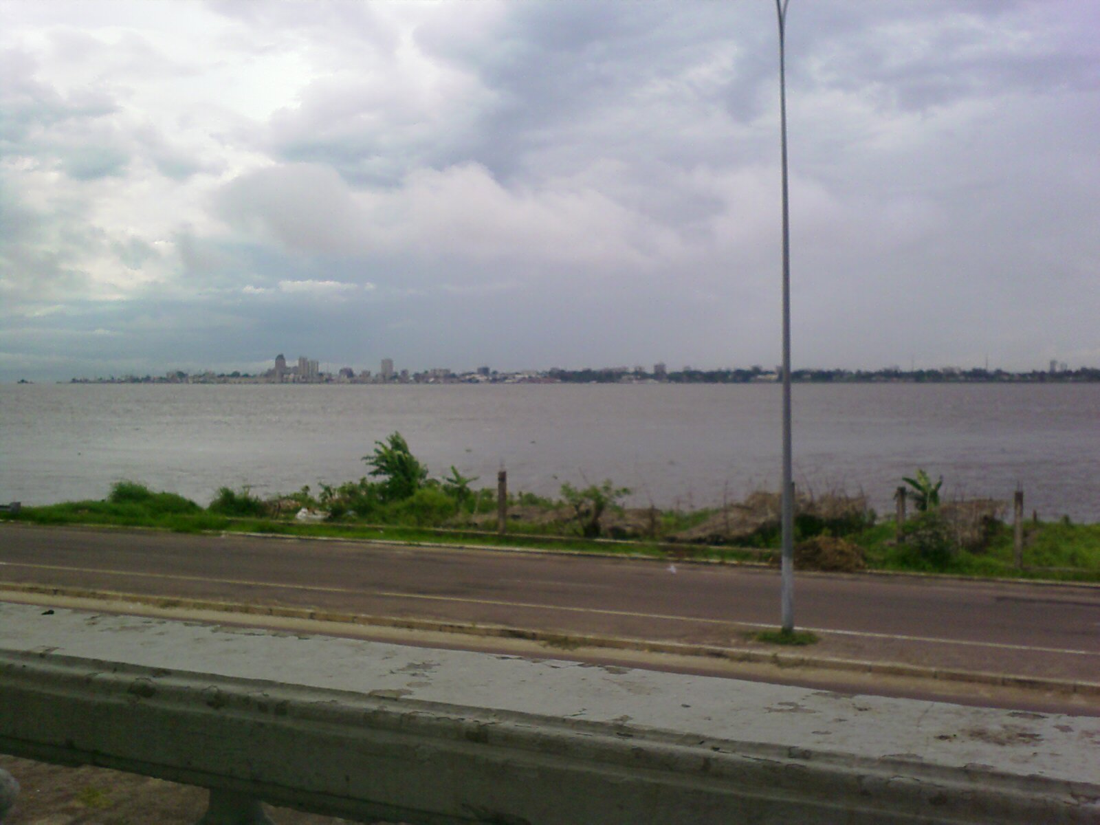
Stand at the Mami Wata restaurant on the riverbank and you can see Kinshasa. Not as a distant smudge on the horizon but as a fully legible city -- buildings, traffic, life -- separated by roughly four kilometers of brown, fast-moving water. Brazzaville and Kinshasa are the world's closest pair of national capitals, facing each other across the Congo River like siblings who grew up in different houses. One was raised by France, the other by Belgium. There is, surprisingly, no bridge between them. To cross roughly four kilometers of river, you take a ferry or a flight. This small geographical fact -- two cities of millions, visible to each other, connected only by boat -- captures something essential about central Africa: proximity does not guarantee connection.
A City Named for an Explorer
Brazzaville takes its name from Pierre Savorgnan de Brazza, the Italian-born French explorer who established treaties with local leaders along the Congo River in the 1880s, claiming the northern bank for France. While Leopold II's agents took the southern bank through violence and coercion, de Brazza's approach relied more on diplomacy -- though the colonial system that followed was no less exploitative. The city became the administrative capital of French Equatorial Africa in 1910, governing a federation that stretched from the Atlantic coast to the borders of Sudan. During World War II, Brazzaville gained unexpected importance when nearly all of French Equatorial Africa rallied to Charles de Gaulle's Free French Forces in August 1940, making the city the strategic center of Free French operations in Africa. Felix Eboue, installed as Governor-General, oversaw a territory that provided both moral legitimacy and material support to the Allied cause while metropolitan France remained under Vichy control.
Between Two Wars
Brazzaville was a relatively well-developed and thriving city before the civil war that began in 1997 tore through the Republic of Congo. The conflict left infrastructure damaged and the economy battered. Recovery has been uneven. The city remains the country's financial and administrative center, but visitors encounter a place where grand ambitions and practical limitations coexist in every block. Rail services link Brazzaville with the seaside city of Pointe-Noire via the CFCO railway, though the express train La Gazelle, introduced in 2012, still takes a grueling 15 hours to make the journey. The railway station sits at Place de la Liberte, a name that carries different weight depending on which decade of Congolese history you are thinking about. Many of the city's restaurants and hotels are run by Lebanese immigrants who form a significant part of the commercial fabric.
The Neighborhoods That Tell the Story
Brazzaville's character lives in its quartiers. Poto-Poto, the West African quarter, is home to the famous Poto Poto Painting School, one of the oldest art schools in central Africa, where local artists produce vibrant works that have gained international recognition. The market of Poto-Poto is a sensory immersion -- textiles, produce, noise, and the particular energy of a West African trading district transplanted to the Congo Basin. Bacongo, another distinctive neighborhood, comes alive after dark with plastic-chaired bars spilling onto sidewalks and street food vendors working their grills. Moungali rounds out the trio of neighborhoods that visitors navigate most. The Marche du Plateau, near the BDEAC headquarters, offers crafts from across the region alongside the paintings and copper work found at shops like Tala Na Miso. Bargaining is not optional; it is the social contract of commerce here.
Expensive, Resilient, Alive
Brazzaville is startlingly expensive. Visitors describe prices running at four times those in developed countries for basic goods. The two major supermarkets, Casino and Park N Shop, stock imported products at steep markups, while local markets like Marche de la Plaine offer fresh fruits and vegetables at more reasonable prices if you are willing to negotiate. Street food runs to beignets, manioc, and egg sandwiches during the day, with meat on sticks appearing after dark. Beer -- Primus, N'Gok, Mutzig -- is a social institution, though a bottle in a restaurant will cost more than most visitors expect. Beyond the costs, the city rewards patience. Les Rapides in Djoue, a Ramsar-designated wetland site along the Congo River west of town, shelters endangered birds. The river itself remains the city's defining feature and its most practical transport corridor. From the water, Brazzaville looks exactly like what it is: a capital that has survived more history than most cities twice its size, still rebuilding, still insisting on being here.
From the Air
Located at 4.27S, 15.27E on the northern bank of the Congo River. Best observed from 3,000-6,000 feet AGL, where the twin capitals of Brazzaville and Kinshasa are both visible separated by the river. Nearest airport is Maya-Maya Airport (ICAO: FCBB), located in the city center. Kinshasa's N'Djili International Airport (FZAA) lies across the river to the southeast. The Congo River is unmistakable from altitude -- wide, brown, and dotted with islands between the two cities.