Bridal Veil Falls
There is a place in the Columbia River Gorge where water once stopped falling. For years during the logging boom, Bridal Veil Creek ran dry, and the graceful cascade that gave its name to an entire community simply ceased to exist. The sawmills upstream had claimed every drop. Today, that water has returned, tumbling in two distinct tiers over ancient basalt cliffs, the mist catching light in ways that earned the falls its name long before any bride walked down any aisle. From above, a 1914 bridge carries the Historic Columbia River Highway directly over the cascade, one of only a handful of bridges in Oregon where drivers pass directly atop a waterfall. Below the highway, in the remnants of a ghost town, a tiny post office still operates, its sole purpose now romantic rather than commercial. Couples from across the country mail their wedding invitations here, just to have them stamped with that singular postmark: Bridal Veil, Oregon.
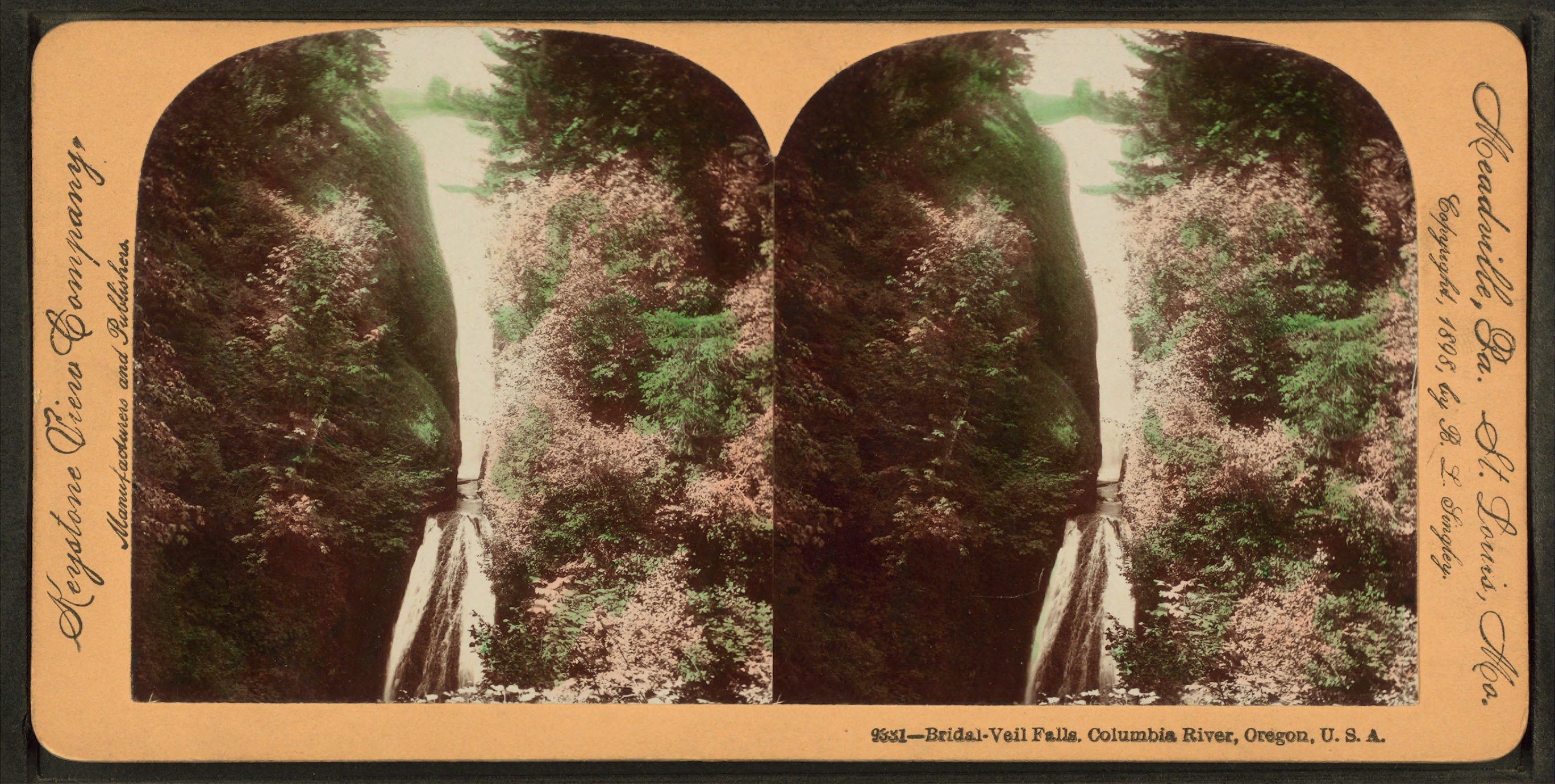
Water from the Mountain
Underground springs high on Larch Mountain feed Bridal Veil Creek year-round, their flow augmented by snowmelt in spring and rainfall through the wet Oregon months. This constant water source creates a waterfall that drops in two major steps, the upper and lower falls separated by a zone of softer, more easily eroded basalt. A massive boulder, long ago detached from the cliff face, now rests in the pool at the base, a reminder of the geological forces still shaping this landscape. When the water runs high, the two cascades blend into a continuous veil of white, the namesake effect that early settlers found so evocative.
The Years of Silence
Before the logging industry arrived, this stretch of Bridal Veil Creek had flowed uninterrupted for millennia. The Bridal Veil Falls Timber Company changed that. As sawmills proliferated upstream, the water that had sustained the falls was diverted, consumed, and wasted. The creek dried up. The waterfall vanished. For a time, visitors to the Columbia River Gorge would have found only silent, dry rock where water had once cascaded. It was only after logging operations ceased that the springs reasserted themselves, the creek found its course again, and the falls returned to their former beauty.
Industry and Memory
The community of Bridal Veil was once a thriving mill town, home to workers and their families. Paper mills came first, then lumber operations. In 1937, the Kraft company purchased the mill site and began manufacturing cheese boxes, a surprisingly prosaic product for such a dramatic setting. During World War II, those same facilities pivoted to producing wooden ammunition boxes for the war effort. The mill changed hands in the 1960s, fell silent, reopened as a resaw operation in 1974, and finally closed for good in 1988. Today, Bridal Veil is largely a ghost town east of the waterfall, its industrial past visible only in scattered remnants and historical records.
A Bridge of Remarkable Design
The Bridal Veil Falls Bridge represents an engineering curiosity from the early automotive age. Built in 1914 as part of the Historic Columbia River Highway, this reinforced-concrete span sits directly above the falls, allowing travelers to cross the waterfall itself. What makes the bridge unique is its structural design: the solid railings function as continuous beams, while the transverse deck support members serve as deck girders. This inverted approach to bridge construction earned the structure a place on the National Register of Historic Places. Today, drivers passing overhead experience something rare in American infrastructure: a road that bridges not a river or a valley, but a waterfall in active cascade.
Love Letters from a Ghost Town
The post office at Bridal Veil remains operational for one endearing reason. Couples planning weddings discovered that they could mail their invitations from this tiny Oregon outpost and receive the romantic postmark in return. It has become a small tradition, a way to mark the beginning of a marriage with a stamp from a place named for the veil a bride wears. The post office processes these requests from across the country, a peculiar commerce in sentiment sustained by the poetic coincidence of a waterfall's name.
From the Air
Bridal Veil Falls sits at coordinates 45.5548N, 122.1809W in the Columbia River Gorge at approximately 100 feet elevation. The falls are visible from the air as a white cascade against dark basalt cliffs, with the Historic Columbia River Highway bridge crossing directly overhead. Nearest airports include Portland International (KPDX, 25nm west) and Troutdale Airport (KTTD, 15nm west). The falls lie within the waterfall corridor of the Gorge, alongside several other major cascades visible from altitude.