Brooks Peninsula Provincial Park
Most of Vancouver Island was buried under ice during the last glaciation. Brooks Peninsula was not. While kilometers-thick glaciers ground the surrounding landscape into new shapes, the peaks of what is now called the Refugium Range stood above the frozen tide, sheltering plants and ecosystems that had existed since before the ice arrived. Today those same peaks -- Klaskish at 963 meters, Nunatak at 930, Doom at 787 -- still harbor species found nowhere else on the island, living relics of a world that everywhere else was scraped clean and started over.
The Land the Ice Forgot
Brooks Peninsula juts 20 kilometers into the Pacific Ocean from Vancouver Island's northwest coast, a fist of rock and old-growth forest punching into open water. The geology here is different from the rest of the island -- literally, structurally different -- because the peninsula's higher elevations escaped the glacial reshaping that transformed everything around them. The result is a biological refugium, a place where ancient plant communities survived the Ice Age in isolation. Botanists have found rare species on these slopes that exist in no other location, making the Refugium Range one of the most scientifically significant alpine areas in British Columbia. The peninsula's 51,631 hectares encompass a dramatic range of terrain: long fjords cut deep into the coastline, sandy beaches open to Pacific swells, and interior forests so dense and seldom-explored that much of the park remains effectively unmapped.
A Name Returned
The park's full name tells a story of recognition. Established in 1986 as a recreation area, it was upgraded to a Class A Provincial Park in 1995, with the 22,851-hectare Brooks-Nasparti area added to protect entire watersheds draining into Johnson Lagoon, Nasparti Inlet, and the Power River basin. In 2009, the park was formally renamed to include its Indigenous name: M̥uqʷin. By 2018, under the guidance of the Che:k'tles7et'h' peoples, it became M̥uqʷin/Brooks Peninsula Provincial Park. The park lies within the traditional territories of the Kyuquot/Cheklesahht and Quatsino First Nations. Battle Bay, in the southern portion of the park, carries its name honestly -- many battles were fought at this location as peoples competed to control an area rich in marine and forest resources. First Nations reserves adjacent to the park's southern boundary remain active communities, not recreational sites.
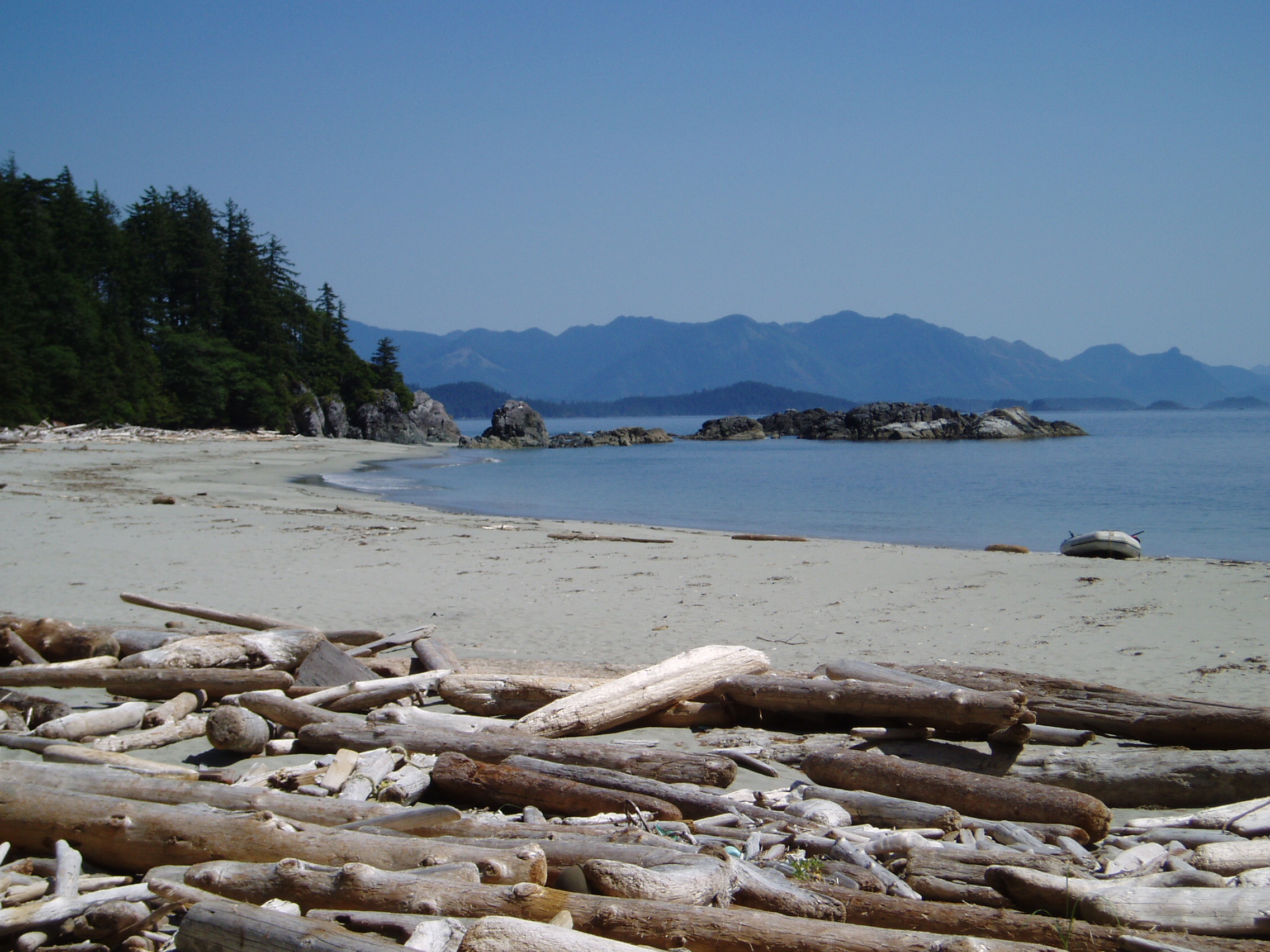
The Wild Edge
There are no trails here. No facilities, no campgrounds, no visitor centers. Brooks Peninsula is entirely undeveloped, and reaching it requires a boat or float plane -- the nearest settlement, Port Alice, lies 20 kilometers to the northeast. Camping is permitted anywhere in the park, but the word 'permitted' carries an asterisk the size of the peninsula itself: the remoteness, the lack of any infrastructure, and the raw Pacific weather make any visit an expedition rather than a trip. The surrounding waters, however, draw sea kayakers willing to accept the conditions. Paddling along the peninsula's varied coastline, with its sheltered inlets and exposed headlands, ranks among the finest kayaking in British Columbia. Nearby Solander Island, visible from the peninsula's western tip, is an Ecological Reserve where all access is prohibited -- a reminder that even in this remote corner, some wildness is considered too fragile for any human footprint.
Old Growth and Open Ocean
The forests that blanket Brooks Peninsula belong to the Coastal Western Hemlock biogeoclimatic zone, and many of them qualify as true old growth -- trees that have stood for centuries in soil that was never scraped to bedrock by glacial advance. The park protects pristine estuaries where rivers meet saltwater, supporting high waterfowl populations and productive fisheries. The biodiversity values associated with these old-growth forests are among the highest on the island, a direct consequence of the peninsula's glacial history. What the ice spared, time enriched. The Brooks-Nasparti addition ensures that entire watersheds are protected from headwaters to tidewater, preserving the ecological connections that sustain this landscape. From the air, the peninsula appears as a dark green promontory thrust into the grey Pacific, its ridgelines rising to the sub-peak of Snowsaddle Mountain at 1,143 meters -- the highest point in the park, and one of the ancient summits that stood above the ice when everything else was buried.
From the Air
Located at 50.14°N, 127.78°W on Vancouver Island's exposed northwest coast. The peninsula is unmistakable from the air -- a broad, forested promontory jutting 20 km into the Pacific. The Refugium Range peaks (highest point 1,143 m) are visible at cruising altitude. Nearest airports: Port Hardy (CYZT) approximately 70 km northeast, Campbell River (CYBL) approximately 200 km southeast. Expect low cloud and rain; this is one of the wettest coastlines in British Columbia. Best viewed from 3,000-5,000 feet on a clear day, approaching from the northeast over Quatsino Sound.