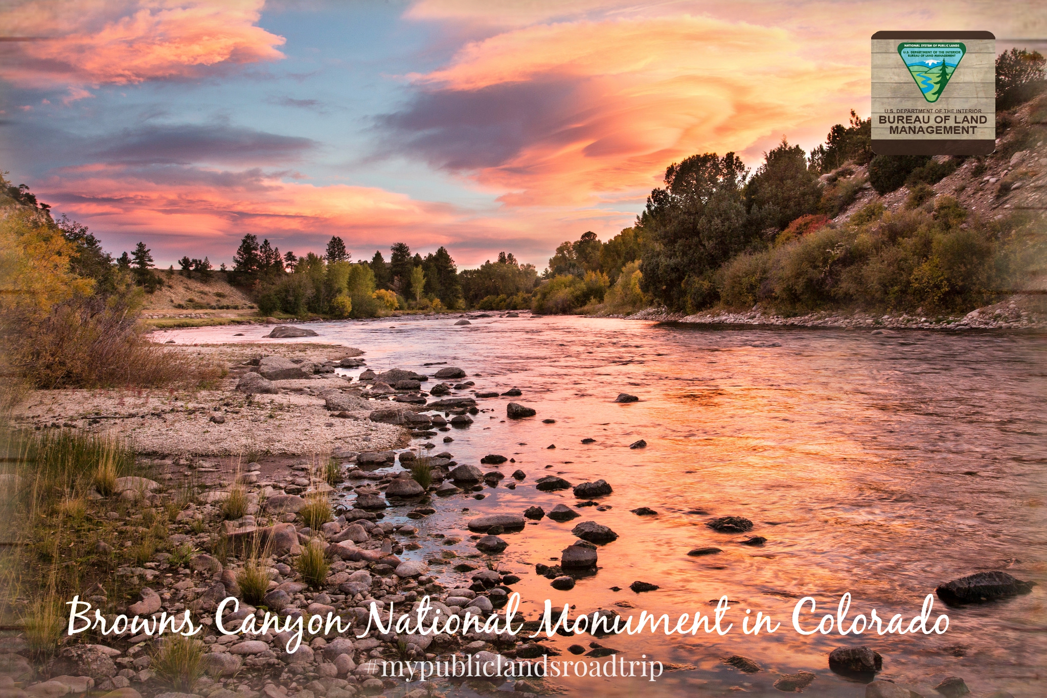
Browns Canyon National Monument
For decades, the Arkansas River kept a secret in plain sight. Between the mountain towns of Buena Vista and Salida in central Colorado, the river cuts through a granite gorge where walls rise hundreds of feet and the water churns through rapids that draw more rafters than any other stretch of whitewater in the United States. Browns Canyon was already the country's most popular rafting destination long before President Barack Obama signed the proclamation on February 19, 2015, that made it a national monument under the Antiquities Act. The designation simply caught up with what the river already knew.
A Canyon Fought For
Protection for Browns Canyon did not come easily. The effort began in 1976, when the Bureau of Land Management proposed protecting the canyon for its primitive values and initiated a review for wilderness designation. The Colorado Wilderness Act of 1991, introduced by Representatives Wayne Allard and Dan Schaefer, would have included Browns Canyon among hundreds of thousands of acres of new wilderness statewide, but the bill never made it out of committee. In 2005, Joel Hefley and six other Colorado lawmakers tried again with the Browns Canyon Wilderness Act, with a companion Senate bill from Wayne Allard. That legislation failed after the National Rifle Association opposed it, claiming wilderness designation would restrict hunting in the canyon. Mark Udall and Michael Bennet made another attempt in 2013, proposing national monument status, but their bill also stalled. It took a presidential proclamation to finally protect the canyon, nearly four decades after the first proposal.
Where the River Rules
The Arkansas River is the defining feature of Browns Canyon. The river carves through ancient granite, creating a gorge where rapids echo off towering rock walls and ponderosa pines cling to the slopes above. This stretch draws rafters and kayakers from across the country, making it the most popular whitewater destination in the United States. But the canyon is more than its rapids. Anglers work the calmer pools for trout. Hikers explore trails winding through the uplands above the river corridor. The monument spans approximately 21,600 acres, jointly managed by the Bureau of Land Management and the United States Forest Service. The White House stated that the designation would honor valid and existing rights while withdrawing the area from future mineral leasing.
Dark Skies and Deep Time
In December 2024, Browns Canyon National Monument earned certification as an International Dark Sky Park from DarkSky International, recognizing its exceptional stargazing conditions. Far from major light pollution and at high elevation in the heart of the Rockies, the canyon offers views of the Milky Way that remind visitors how much of the night sky most Americans never see. The geology here tells a story measured in deep time, with exposed ancient rock forming the canyon walls that the Arkansas River continues to shape. The monument preserves not just the landscape visible by day but the quality of the darkness above it, a resource increasingly rare in the modern American West.
Two Towns and a River Between
Browns Canyon sits between two Colorado mountain towns that serve as gateways to the monument. Buena Vista to the north and Salida to the south are small communities with deep roots in the Arkansas River valley. Both have built their identities around outdoor recreation, their main streets lined with outfitters and breweries that cater to the rafters, climbers, and mountain bikers who pour through each summer. The Arkansas River connects them, flowing south through the canyon in a corridor that feels wild and remote. The monument designation brought national attention to a stretch of river and rock that locals had fought to protect for decades, and that rafters had been running for even longer.
From the Air
Located at 38.61N, 106.06W in Chaffee County, Colorado, between Buena Vista and Salida along the Arkansas River. The canyon is visible as a deep cut in the terrain with the river threading through granite walls. Best viewed at 5,000-8,000 feet AGL. Nearest airports: Harriet Alexander Field (KANK) in Salida approximately 15nm south. The Collegiate Peaks and Sawatch Range form the western backdrop.