BTS Skytrain
The formal name runs to twenty-three syllables in Thai, a royal mouthful honoring King Bhumibol Adulyadej's sixth-cycle birthday. Bangkokians ignore it entirely. They call the elevated railway the BTS, or simply the Skytrain, and what it did to their city in 1999 still registers as one of the most dramatic urban transformations in Southeast Asia. Before it opened, Bangkok's traffic was legendary for the wrong reasons: a gridlocked sprawl where commuters routinely spent three or four hours a day in cars that barely moved. The Skytrain did not eliminate traffic. But it lifted millions of daily journeys above it, and in doing so changed the city's center of gravity.
A Decade of False Starts
Plans for mass transit in Bangkok began in the early 1980s, but the path to completion was anything but straight. The first serious attempt modeled itself on Vancouver's SkyTrain, using technology from the Canadian firm SNC-Lavalin. Political interference killed the Lavalin concession in June 1992, even as Bangkok's congestion worsened by the year. The government pivoted to building more roads and expressways, a strategy that only encouraged more cars. Another attempt, the Bangkok Elevated Road and Train System, was abandoned in 1998 with barely fourteen percent of the work completed. Foundations and a viaduct built for the Lavalin project on the Phra Pok Klao Bridge sat unused for decades before being converted into a sky park in 2020. It took a new approach, championed by Deputy Governor Captain Kritsada Arunwong na Ayutthaya and financed by entrepreneur Keeree Kanjanapas through his Bangkok Transit System Corporation, to finally break the cycle of stalled plans.
Steel Spine Through the Capital
The system that opened on 5 December 1999 ran along two lines, the Sukhumvit and the Silom, intersecting at Siam station in the commercial heart of Bangkok. Today those two lines have grown into a network of 62 stations stretching across 70 kilometers, joined by the Gold Line people mover that connects to the Iconsiam shopping complex on the Chao Phraya River. The Sukhumvit Line reaches north to Khu Khot and southeast to Kheha. The Silom Line threads through the central business district along Silom and Sathon Roads, linking National Stadium to Bang Wa. At Siam station, where all routes converge, the platforms fill with the particular choreography of a busy transit hub: commuters streaming between connecting trains, tourists orienting themselves against the skyline, food vendors working the margins.
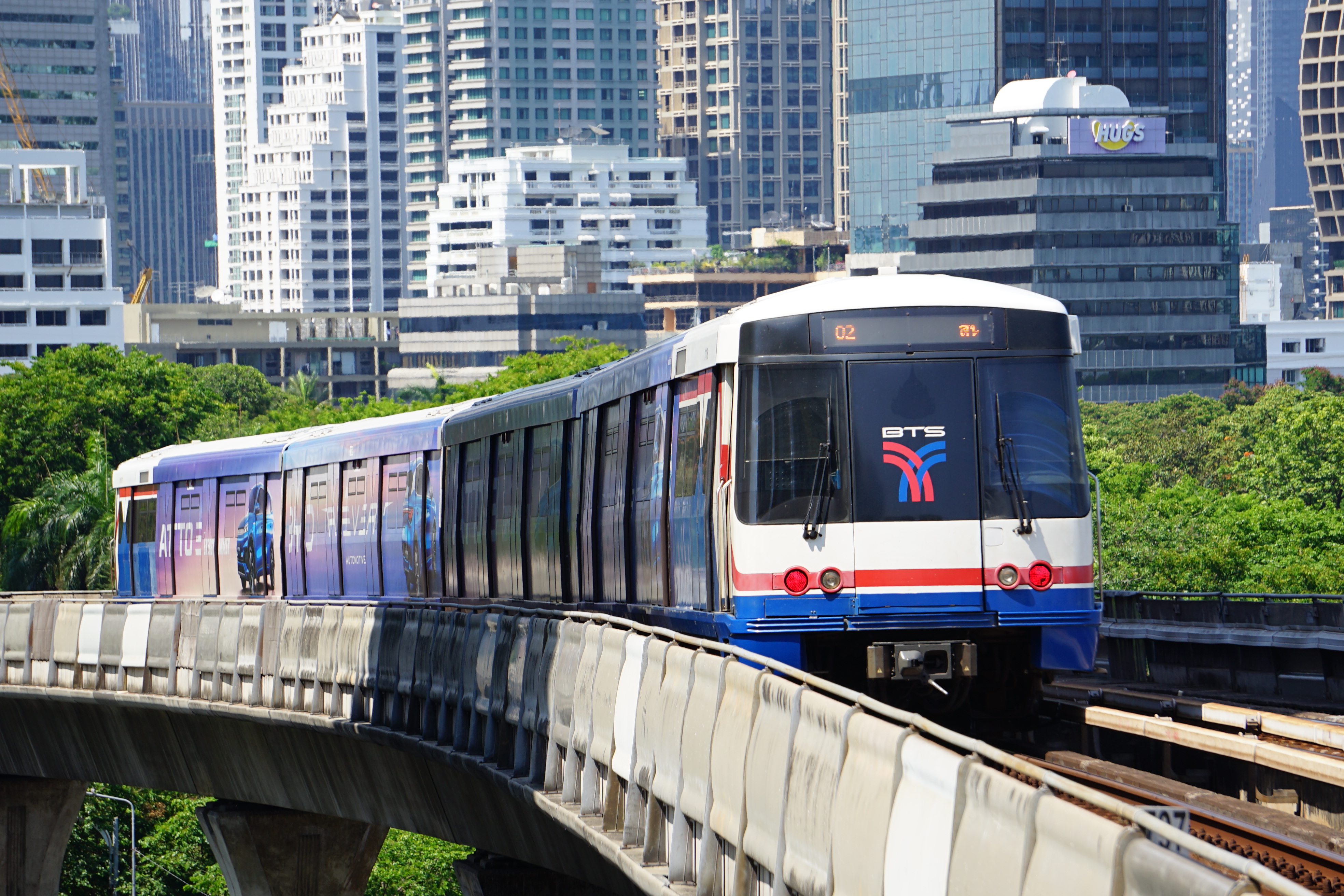
The View from Above
Riding the Skytrain is a different experience of Bangkok than fighting through it at street level. From the elevated platforms, roughly three stories up, the city unfolds as a layered panorama. Glass-and-steel towers cluster around stations that have become real estate magnets. Below the tracks, the street-level Bangkok of vendor carts, tuk-tuks, and motorcycle taxis continues at its own pace, a different city moving at a different speed. The air-conditioned cars offer relief from heat that regularly pushes past 35 degrees Celsius, and the ride itself is quick: end to end on the Sukhumvit Line takes about an hour, covering a distance that can take three times as long by road during peak hours. The system carries roughly 800,000 passengers daily, a number that has pushed it toward capacity and fueled ongoing expansion plans.
A System Still Growing
The BTS does not exist in isolation. Bangkok's rapid transit network now includes the underground MRT lines, the Airport Rail Link to Suvarnabhumi, and the SRT Red Lines operated by the State Railway of Thailand. Together they form a web that is still far from complete; Bangkok remains a city where vast neighborhoods rely entirely on roads, and where the gap between areas with rail access and those without shapes property values, commute times, and quality of life. Extensions continue to push the network outward, chasing the city's sprawl. The concession under which the BTS operates, granted by the Bangkok Metropolitan Administration to BTS Group Holdings, has itself been a source of political tension, with debates over fare structures, profit sharing, and who ultimately benefits from the system's success. For all the complexity, the daily reality for most riders is simpler: the Skytrain goes where the roads cannot, and it gets there on time.
From the Air
The BTS Skytrain network is centered near Siam station at approximately 13.74N, 100.53E. The elevated guideway is visible from the air as a continuous concrete ribbon threading through central Bangkok's high-rise core. Don Mueang International Airport (VTBD/DMK) lies 20 km north; Suvarnabhumi Airport (VTBS/BKK) is 30 km east. At low altitude, the distinctive stations with their canopied platforms are identifiable along Sukhumvit and Silom roads.