
Bù Gia Mập National Park
The name Bù Gia Mập belongs to a language that most visitors will never speak. It marks a corner of Vietnam's Central Highlands that has always been on the edge of things — the edge of the upland plateau where it breaks toward the lowlands, the edge of the country where Bình Phước province meets Cambodia, the edge of what science has managed to document. When Prime Minister Phan Văn Khải declared it a national park on November 27, 2002, elevating it from a conservation area, the park's avifauna was still largely unstudied. Two decades later, it remains one of Vietnam's less-surveyed wilderness areas — which is also, in a sense, what makes it interesting.
Where the Highlands End
Bù Gia Mập covers 26,032 hectares of forest in the southern reaches of Vietnam's Central Highlands, a region that forms a broad, elevated plateau before descending into the Mekong lowlands to the south and southwest. The park's highest point reaches 700 meters above sea level — modest by the standards of the northern Highlands but significant enough to support a different ecology than the surrounding agricultural land. The buffer zone adds another 15,200 hectares of transitional habitat around the core, giving the park's wildlife meaningful room to range. Multiple river systems feed through the park, including the Dak Huyet and Dak Sam rivers, whose headwaters drain the forested slopes before flowing south toward the Cambodian border.
Water and Power
The rivers of Bù Gia Mập do more than sustain the forest's biodiversity. The headwaters of the Thac Mo and Can Don hydroelectric projects both originate within the park's boundaries, making the forest a direct source of energy for the surrounding region. This gives the park's watershed protection function an economic dimension that conservation arguments alone sometimes lack: healthy forest means consistent river flow, which means reliable power generation. The Thac Mo facility on the Be River downstream is among the larger hydroelectric stations in southern Vietnam, a visible reminder that the trees standing in Bù Gia Mập serve functions that extend far beyond the park boundary.
Birds in an Unstudied Sky
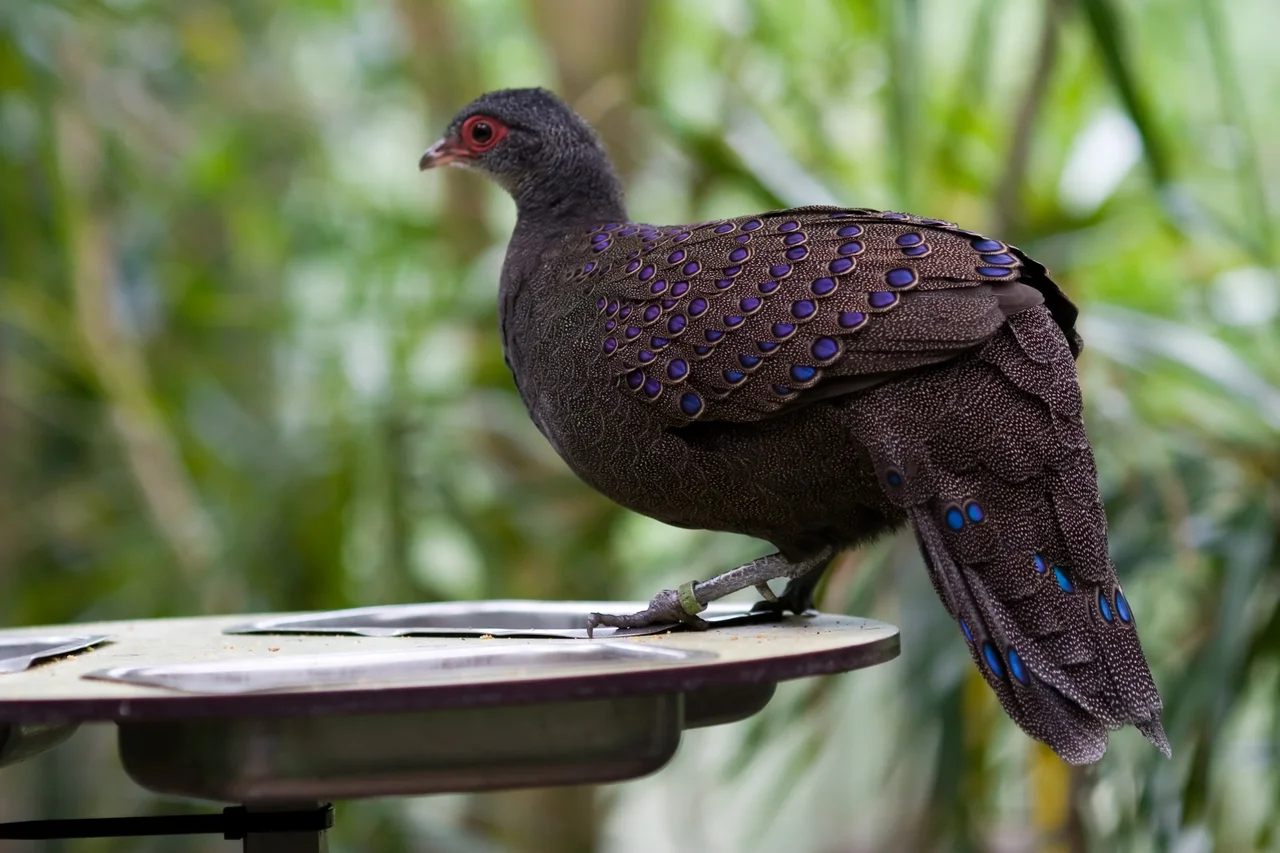
BirdLife Indochina has identified Bù Gia Mập as important habitat, and the evidence is compelling even without comprehensive surveys. Germain's peacock pheasant — a species with iridescent blue-green plumage and distinctive ocellated tail feathers, endemic to the forests of Cambodia and southern Vietnam — has been documented here with strong confidence. The orange-necked partridge, a shy ground-dwelling bird of lowland and hill forest, also finds ideal conditions in the park's dense understory. Both species are indicators of intact tropical forest; their presence suggests that Bù Gia Mập's core zone has remained ecologically functional. What else remains undocumented in the canopy and undergrowth is a genuinely open question.
Gibbons at the Edge
The park is also home to yellow-cheeked gibbons — Nomascus gabriellae — acrobatic primates whose loud morning calls carry across the forest canopy at dawn. Like all gibbons, they are sensitive to forest fragmentation; they need continuous canopy to move through and avoid coming to the ground where predators threaten. Their presence in Bù Gia Mập is an encouraging sign of forest connectivity, but it also underscores the park's vulnerability. The land surrounding it has seen significant agricultural conversion, and the buffer zone that separates the national park from that pressure is not always impermeable. Protecting the gibbons means protecting the corridors they need to survive.
Still Being Discovered
In the decades since its establishment, Bù Gia Mập has received relatively little scientific attention compared to Vietnam's more famous parks like Cát Tiên or Phong Nha-Kẻ Bàng. That obscurity may be its most important current characteristic. Areas that have not been comprehensively surveyed routinely surprise researchers who finally look closely — undocumented species, unstudied ecological relationships, populations of threatened animals larger or smaller than assumed. Bù Gia Mập sits at the junction of several biogeographic zones, where the Central Highlands ecosystem meets the lowland forests of the south, a configuration that often produces high biodiversity. Whatever remains to be found here has been waiting, quietly, at the edge of the highlands.
From the Air
Bù Gia Mập National Park is centered at approximately 12.22°N, 107.15°E in Bình Phước province, near the Cambodian border to the northwest. From the air at 5,000–8,000 feet, the park appears as a distinct patch of dark-green highland forest contrasting with the patchwork of farms and rubber plantations that have replaced most of the surrounding vegetation. The Dak Huyet and Dak Sam river drainages are visible as darker lines of riparian vegetation threading through the park. The nearest airport with regular service is Buôn Ma Thuột Airport (BMV), approximately 130 km to the northeast. Phnom Penh International Airport (PNH) in Cambodia lies roughly 200 km to the northwest.
Nearby Stories
- Battle of Phuước Long 13 km away
- Duc Lap Camp 26 km away
- Battle of Ap Gu 35 km away
- Tà Đùng National Park 38 km away
- Buôn Đôn 50 km away
- Battle of Tong Le Chon 70 km away
- Sambor Dam 71 km away
- Đình Lạc Giao 110 km away