Burcht
The village is called Burcht, which in modern Dutch means fortress or castle, and almost everyone who hears the name assumes there must once have been one here on the left bank of the Scheldt opposite Antwerp. There wasn't - at least not in the way the word suggests. The name actually comes from burgipja, an Old Germanic word for birch, the tree that grows abundantly in the sandy soil of the Waasland. The misunderstanding is forgivable. The site itself is so old that the truth has been buried under centuries of accumulated meaning.
From Birches to Polders
People have lived in this corner of the Waasland since at least the late Neolithic, roughly 2200 to 1800 BC, and Roman occupation has left its traces in the wider region. For most of the early Middle Ages, the landscape around Burcht was wet woodland broken by small clearings - more swamp than village. That began to change in the second half of the 11th century, when a rising population pushed the inhabitants to clear the forests between settlements and lay out shared fields, worked under a three-course crop rotation and called kouters. The raised paths that crossed the wetlands hardened into dikes. By the 14th century, the first polders were producing crops where there had once been standing water. The Scheldt was no longer a frontier; it was a working partner.
A Title That Kept Changing Hands
On 15 April 1281, Count Gwijde van Dampierre of Flanders granted manorial rights over Zwijndrecht and Burcht to Nikolaas van Kets, and the title settled into the family's possession for more than 160 years. After 1445 it passed by sale and inheritance through the Vilains and into the van Montmorency family - the same family that produced Philip de Montmorency, Count of Horn, who would be executed in Brussels in 1568 alongside Lamoral of Egmont in one of the opening cruelties of the Eighty Years War. Financial pressure forced Filips to sell the rights to the Vier Leden, a consortium of four Flemish cities: Bruges, Ghent, Ypres, and the Brugse Vrije. They lost the title to the Spanish crown in 1585 during the war, recovered it, defaulted on a repair loan, lost it again to a creditor named Jan van Hove, and finally auctioned it in 1621 to an Italian businessman, Jacomo Antonio Carenna. In 1666 Carenna split his estate between his two sons, and Burcht and Zwijndrecht became separate villages. They would not be reunited until 1977.
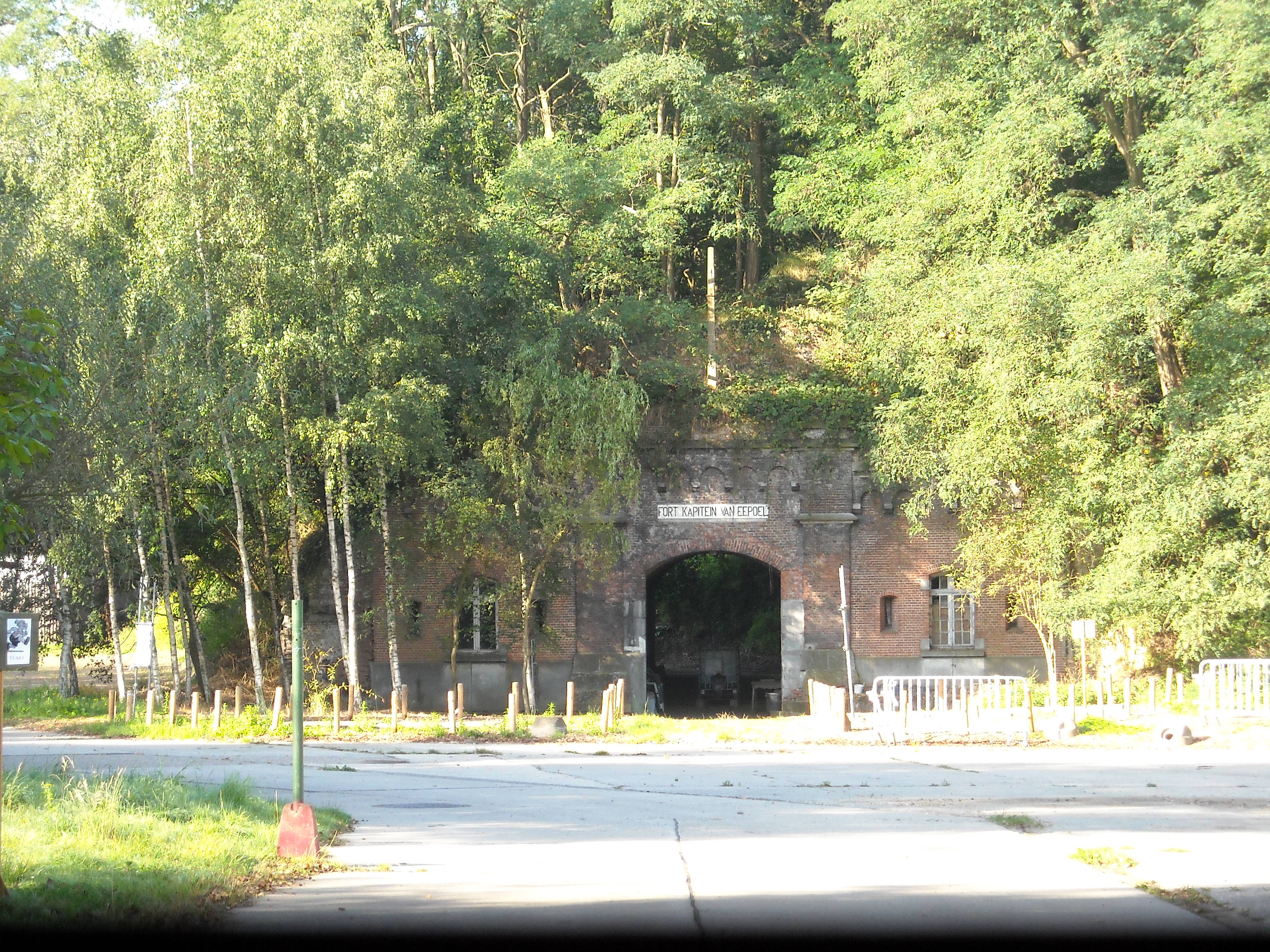
Guano, Linoleum, and a Battalion of Engineers
Burcht spent most of its history as farmland. That changed in the middle of the 19th century. The fertile fields of Borgerweert, the riverside section of the village, were buried under slurry dredged from the Scheldt to provide foundations for new factories. The industries that moved in tell a story by themselves: a guano factory processing imported seabird droppings into fertilizer, a linoleum factory, a cement plant, a pot-and-pan works, a lard processing plant. The Ytong plant, making aerated concrete building blocks, still operates here. So does the Lt. Thoumsin military base, which houses the 11th Battalion of Engineers of the Belgian Army. The village that took its name from birch trees is now mostly concrete and industry, and a country that was once part of East Flanders has been a piece of the Province of Antwerp since 1923.
The Wars That Came to a Small Place
Burcht's role in the First World War was the role of every small Belgian town near a fortress line. The villagers were drafted into reinforcing the forts of Zwijndrecht and Kruibeke. Houses were blown up to clear sightlines. Farmers gave up their horses and carts. After the German occupation began in October 1914, eighty young men from Burcht and Zwijndrecht died on the front, and one hundred eighty-one civilians were taken to Germany as forced labor. Eight of the deportees never returned. In May 1940 the second occupation began with a botched demolition: Belgian troops tried to blow the two tunnels under the Scheldt to keep the Germans from crossing easily, but the charges in the pedestrian tunnel only partly detonated. The fighting that followed in the streets of Zwijndrecht killed sixteen German soldiers, twenty-nine Belgian soldiers, and thirty-two civilians, two of them from Burcht. Liberation came in September 1944, but the war was not finished with the village. Between 25 October 1944 and 28 March 1945, seventy-six V-1 and V-2 rockets fell on Zwijndrecht-Burcht, aimed at the Port of Antwerp and falling short. Fourteen residents of Burcht were killed. Fifty houses were destroyed completely, and more than two hundred fifty were badly damaged.
From the Air
Burcht lies at 51.2017 N, 4.3456 E, on the left bank of the Scheldt directly opposite the southern reaches of central Antwerp. The 15th-16th century Sint Martinus church and the 1659 rectory remain the visible historic core; the Ytong concrete works and the industrial zone along the riverbank dominate the modern skyline. The Liefkenshoek rail tunnel and the older Sint-Anna pedestrian tunnel pass underneath the river nearby. Antwerp International (EBAW) sits about 7 km east; Brussels Airport (EBBR) is roughly 40 km southeast. From cruising altitude the Scheldt's broad curve and the densely industrial left-bank port complex make orientation easy.