Burdaard
More than ten thousand ships and boats pass through Burdaard every year, threading the Dokkumer Ee canal that splits this Frisian village neatly in two. The numbers feel implausible for a place of barely 1,200 residents, until you stand on the bridge and watch a yacht slip by where, two and a half centuries ago, a person could safely wade across. Burdaard is one of the rare villages on the Elfstedentocht skating route the racers visit twice in a single loop, the canal carrying them out and bringing them back. The water has shaped almost everything here, including, more recently, a statue.
Living on a Mound
Long before the canal arrived, people built up. Burdaard is a terp village, anchored on artificial mounds raised against the North Sea before drainage and dikes made such things less essential. Excavations at one of the smaller surviving terps, the Terp van Kolkhuizen, turned up tiny shells in the soil layers below the oldest construction, dated to roughly 500 BC. That gives the settlement a continuous human presence of two and a half thousand years. The oldest written mention of the place comes from 945 in a document from the Princely Abbey of Fulda, where the name appears as Breitenfurt. Over the centuries spellings drifted - Berdawerd, Birdauwert, Birdawerth, Berdaerdt, Birdavert, Bierdauwert - until Napoleonic standardization fixed it as Birdaard, and the Frisian-language form Burdaard finally became official in 1999.
The Canal That Made Everything
The Dokkumer Ee was probably dug in the thirteenth century, joining two older natural rivers into a single corridor between Leeuwarden and Dokkum. The local Cistercian monastery, Klaarkamp Abbey, may have helped organise the work; the order had a knack for engineering remote landscapes into productivity. The canal silted up before long. In 1506 it was dredged again, with the abbey involved a second time. In 1646 a towpath was laid down the northern bank for trekschuiten, the horse-drawn passenger boats that carried Dutch travellers in a slow, steady glide between cities, and one of the small toll houses serving them sat in Burdaard. By 1777 traffic had grown so heavy that the canal had to be deepened once more. That was the year the wading stopped and the village got its first bridge. The town stretched out along the water in a long thin line, growing house by house away from its original mound.
Butter Wars and a Cooperative
In the 1890s the Netherlands was losing the butter trade. Until the previous decade Dutch butter had been the English breakfast standard; then quality slipped, additives crept in, and Denmark took the market. By 1890 the Danes were shipping five times as much butter to England as the Dutch were. The response came as a wave of small cooperative factories rising in dairy villages across the country. Burdaard's Concordia, founded in 1897 by local farmers, was one of them, following slightly later than its neighbours in Marrum and Bartlehiem. Concordia ran until 1965, when its owners merged into larger cooperatives, and the buildings were torn down a few decades later to make room for houses. The factory is gone but the pattern of cooperative farming it represented still defines the surrounding countryside.
The Swimmer in the Harbour
In August 2018 the long-distance swimmer Maarten van der Weijden tried to swim the entire 200-kilometre Elfstedentocht route to raise money for cancer research. He swam day and night through the same canal cities the skaters race past in winter. The cold and exhaustion eventually beat him in Burdaard, where he climbed out short of the finish. The Netherlands watched and donated anyway; the campaign brought in more than five million euros. In June 2019 the village unveiled a statue of him in its harbour, sculpted by a local artist. Burdaard had simply been the place where the swim ended. Residents made it the place where the gesture is remembered.
What Stays Standing
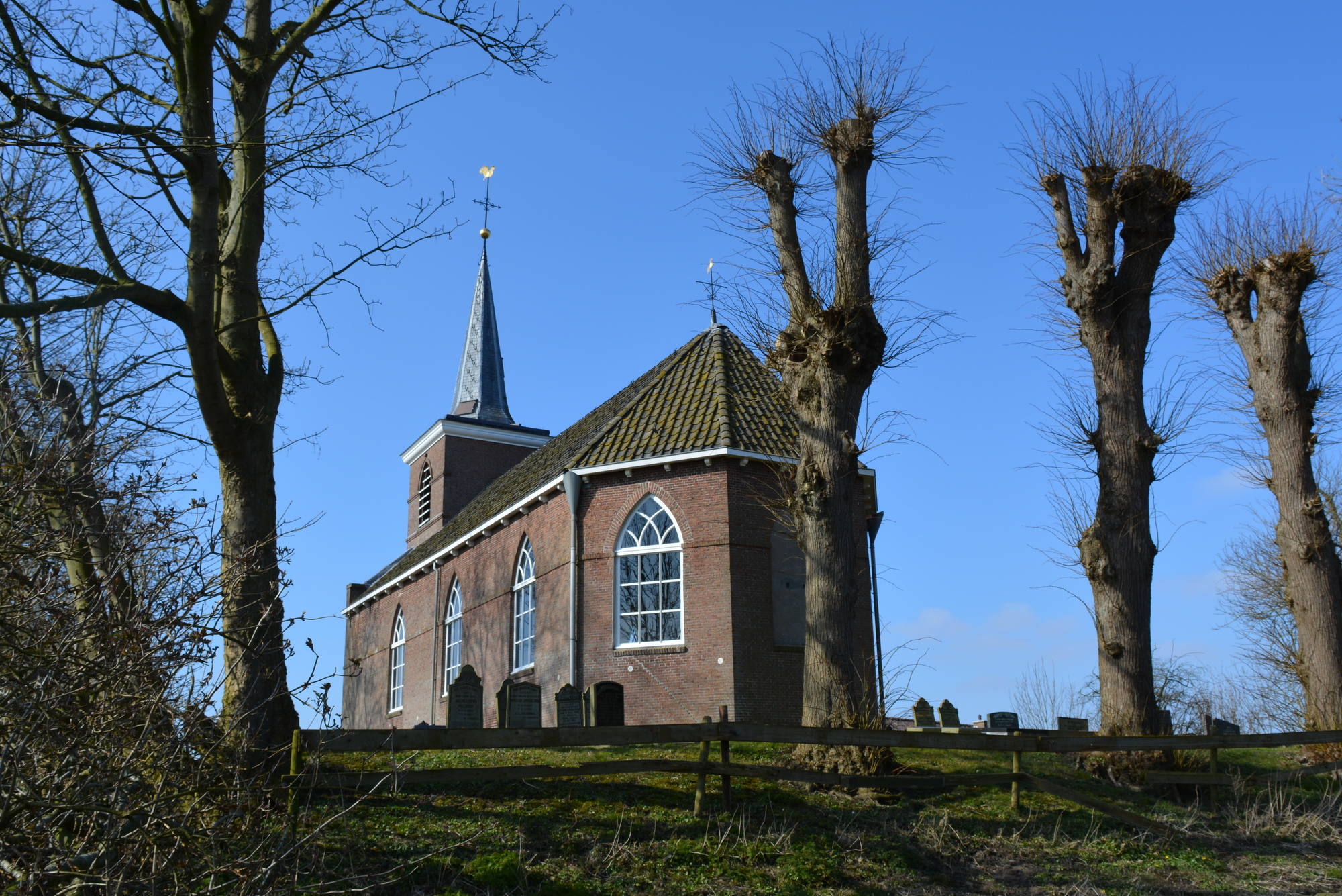
The historical core of the village now sits inside a designated conservation area, with several national heritage listings - including the Hervormde Kerk, built in 1851 on the site of an older medieval church, its bell cast by Jacob Noteman back in 1638. Tucked into one of the old houses is the Ruurd Wiersma Hùs, dedicated to a self-taught naïve painter who lived in Burdaard from 1904 to 1980 and decorated nearly every surface of his own home. The four walls of his former living room carry his murals of the four seasons. Two windmills still mark the village skyline: De Zwaluw, the Swallow, and the smaller De Olifant, the Elephant. The canal still carries its boats. The terps still rise, gently, above the polder.
From the Air
Located at 53.29°N, 5.88°E in the polder country of Noardeast-Fryslân. From 2,000-3,000 ft AGL, the Dokkumer Ee canal traces a clean line southwest to northeast between Leeuwarden and Dokkum, with Burdaard easily picked out where the village straddles the water. Look for the silhouettes of De Zwaluw and De Olifant windmills. Nearest airports: Leeuwarden Air Base (EHLW) about 12 km southwest and Drachten Airfield (EHDR) about 25 km south. The Wadden Sea coast lies just 10 km north - expect changeable maritime weather and brisk westerlies.