Burren and Cliffs of Moher Geopark
The Burren looks like a mistake. Where the rest of Ireland is famously, relentlessly green, this corner of County Clare is grey -- thousands of hectares of bare limestone pavement stretching to the Atlantic, cracked into geometric blocks called clints and grikes by millennia of rain dissolving rock. Cromwell's surveyor reportedly dismissed it as a land with "not enough water to drown a man, not enough timber to hang him, not enough earth to bury him." What he missed -- what most people miss at first glance -- is that the Burren's apparent emptiness is an illusion. Between the cracks, Mediterranean and Arctic wildflowers grow side by side, a botanical anomaly found nowhere else on Earth. Underground, vast cave systems hold stalactites among the world's largest. And at the coast, the Cliffs of Moher drop 200 metres straight into the Atlantic in a wall of sandstone and shale.
Three Hundred Million Years of Sedimentation
The rocks beneath the Burren began forming during the Carboniferous period, roughly 340 million years ago, when this part of Ireland lay near the equator beneath a warm tropical sea. Layer upon layer of limestone, sandstone, and siltstone accumulated from the shells and skeletons of marine organisms. Ice ages carved the landscape into the glaciated karst terrain visible today -- a surface that looks barren but functions as a vast natural sponge, channeling rainwater underground through fissures and caves. The Aillwee Cave system and Doolin Cave showcase this hidden world; Doolin contains one of the longest free-hanging stalactites in the world, a formation that has been growing, one mineral-laden droplet at a time, for tens of thousands of years.
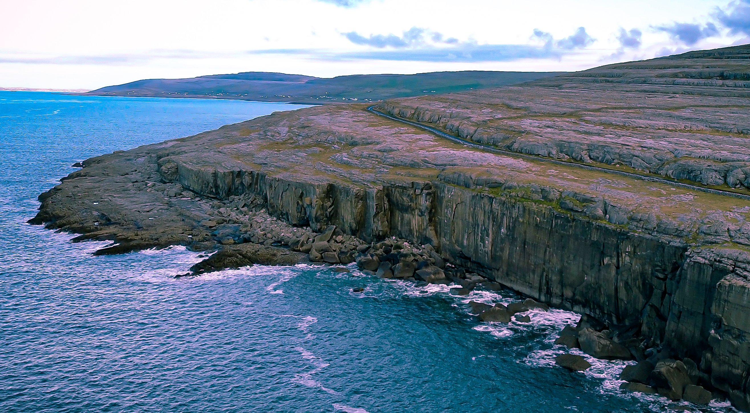
The Vertical Edge
The Cliffs of Moher are a different kind of spectacle. Where the Burren is horizontal and subtle, the cliffs are vertical and overwhelming -- sandstone and shale sea walls that rise over 200 metres at their highest point and extend for roughly eight kilometres along the Clare coastline. They are among the most visited natural attractions in Ireland, drawing over a million visitors per year to stand at the edge and look down at the Atlantic hammering the base of the cliffs. Seabirds -- puffins, guillemots, razorbills -- nest in the cliff faces by the thousands, using ledges that no human could reach. The cliffs face west into the prevailing wind, and on stormy days spray rises higher than the clifftop walkways.
Where Flowers Break the Rules
The Burren's strangest feature is botanical. Arctic-alpine plants like mountain avens grow alongside Mediterranean species like dense-flowered orchids, a combination that exists nowhere else. The limestone retains enough heat to support warmth-loving species, while the exposed altitude and Atlantic winds create conditions cold enough for plants normally found in Scandinavia or the Alps. This bizarre coexistence has drawn botanists since the seventeenth century and remains imperfectly understood. The region also supports rich archaeological remains: dolmens, ring forts, early Christian churches, and high crosses dot the landscape, evidence that humans have found ways to live on this difficult terrain for at least six thousand years.
Geopark and the Community
The Burren and Cliffs of Moher became a UNESCO Global Geopark in 2011, one of only three in Ireland. The designation grew from a mid-2000s community initiative to manage visitor impact on the fragile karst landscape, led by Clare County Council with support from the Geological Survey of Ireland. Twenty focal geosites have been designated, chosen for geological interest and accessibility, each monitored for littering, graffiti, and damage. The geopark won the National Geographic World Legacy Award for Destination Leadership in 2016. Since 2015, it has been twinned with China's Stone Forest geopark in Yunnan -- two karst landscapes on opposite sides of the planet, separated by ten thousand kilometres and three hundred million years of geological history, yet shaped by the same fundamental process of water dissolving rock.
From the Air
The Burren and Cliffs of Moher Geopark is centred at approximately 52.94N, 9.47W in County Clare, Ireland. From the air, the Burren is unmistakable: a vast expanse of grey-white limestone pavement that contrasts sharply with the surrounding green farmland. The Cliffs of Moher run along the western coast, a dramatic vertical wall visible from considerable altitude. Shannon Airport (EINN) is approximately 40 km to the south. Best viewed at 3,000-6,000 feet for the full geological panorama. O'Brien's Tower on the clifftop is a useful visual landmark.