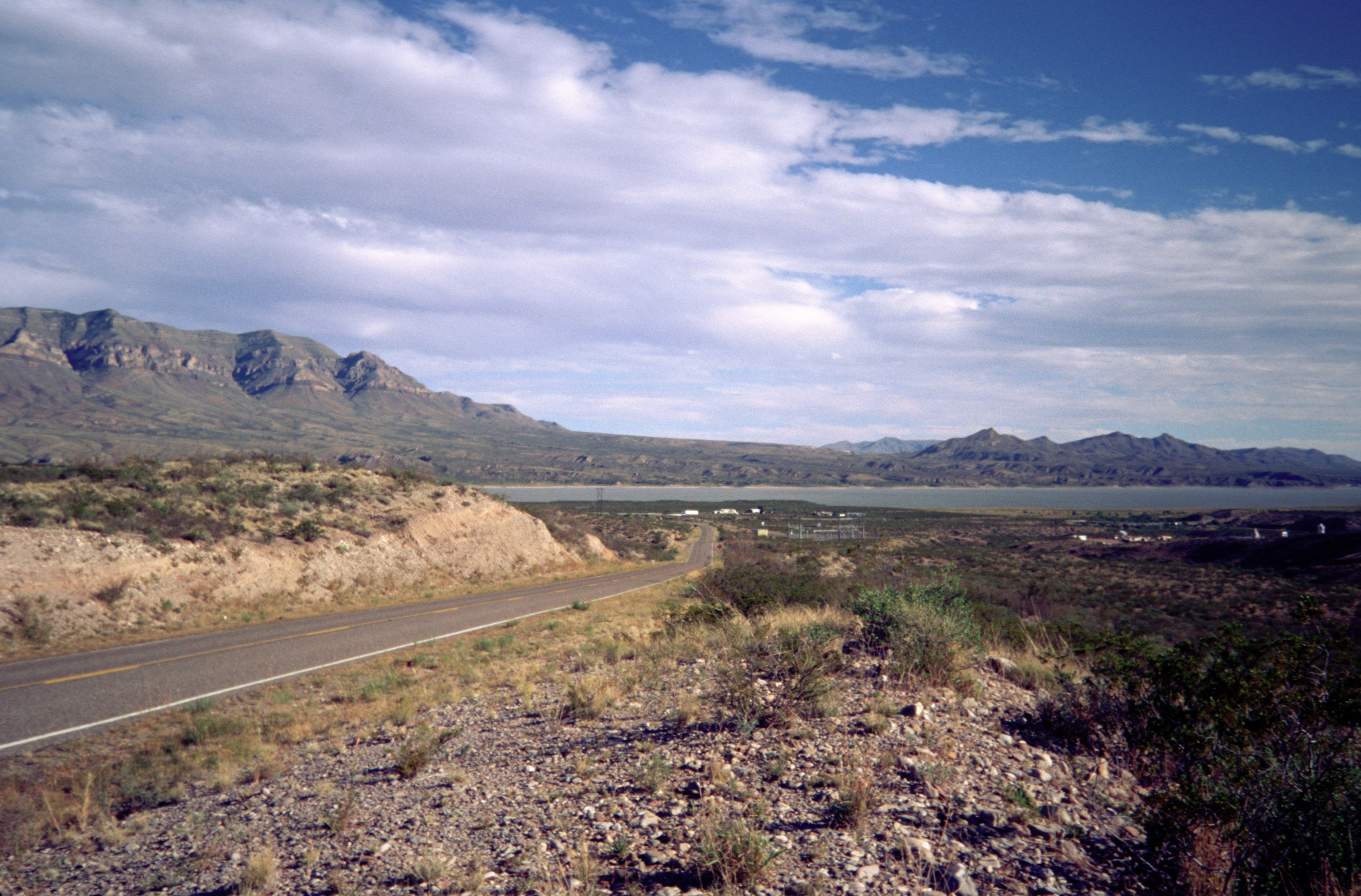
Caballo Mountains
Spanish settlers named them for horses, those wild mustangs that once roamed the Rio Grande valley, but the Caballo Mountains hold something far more ancient than any legend. Here, exposed in bands of rust and ochre striping the mountainsides, lies the most complete geological record in New Mexico. From Precambrian granite formed before complex life existed to volcanic basalts just nine million years old, these rocks tell a story that spans nearly every chapter of Earth's history. The mountains rise abruptly from the desert floor east of the Rio Grande, their rugged profile visible for miles across the Jornada del Muerto, that infamous "Journey of the Dead" that tested Spanish colonizers and travelers for centuries.
Written in Stone
Geologists speak of the Caballo Mountains with a reverence usually reserved for far more famous formations. The range exposes rock from the Precambrian era through nearly every period of the Phanerozoic eon, missing only the Triassic and Jurassic. This makes the Caballos essentially unique in the state, a natural textbook where students can trace the transformation of an ancient seabed into volcanic highlands. The mountains themselves began rising during the late Oligocene, roughly 25 million years ago, thrust upward by the same tectonic forces creating the Rio Grande Rift. Explosive rhyolitic eruptions from cauldrons in the nearby Organ and Dona Ana Mountains blanketed the region in ash between 36 and 35 million years ago. Walk these slopes and you walk through deep time.
A Thirsty Landscape
The Caballo Mountains impose harsh terms on everything that lives here. No perennial streams flow through the range, and precipitation vanishes almost as quickly as it falls, evaporating into the dry air, running off the steep slopes, or soaking into the rocky ground. The west face drops precipitously toward the Rio Grande through a maze of short, steep canyons, each less than three miles long. The eastern slopes tell a different story, draining into draws that wind for over 25 miles before reaching any permanent water. Jornada Draw on the northeast side never reaches the Rio Grande at all, its waters disappearing into an endorheic basin that has no outlet. In this world of extremes, water management becomes the central challenge of survival.
Desert Survivors
Despite the harsh conditions, the Caballo Mountains support a thriving Chihuahuan desert ecosystem. Creosote bush and honey mesquite dominate the lower slopes, their roots reaching deep for moisture. Soaptree yucca stands sentinel on the hillsides, while four-winged saltbush clusters in the alkaline soils of the washes. Black grama and blue grama grasses weave between the shrubs. Mountain lions patrol the heights, their presence felt more than seen. Golden eagles soar on thermals rising from the sun-baked rock, hunting the black-tailed jackrabbits and kangaroo rats that emerge at dusk. Roadrunners dash between the creosote, and the distinctive buzz of western diamondback rattlesnakes warns hikers to watch their step.
Prospectors and Persistence
The first prospectors arrived around 1883, drawn by rumors of precious metals hidden in these ancient rocks. Several mines opened in the early 1900s, pulling copper, vanadium, lead, and gold from the ground. The Northern Red Hills yielded fluorspar; Palomas Gap produced a medley of metals; the Southern Caballos gave up gold, barite, and manganese. Yet the total value of copper, silver, gold, and lead extracted before 1952 never exceeded $200,000. The mountains proved too stubborn, their riches too scattered. Today, fluorspar remains the primary mineral extracted, found in Precambrian granite and jasperized dolomite formed over 400 million years ago. The mines stand as monuments to human persistence against geological indifference.
Between Worlds
The Caballo Mountains occupy a landscape of paradoxes. Timber Mountain reaches 7,565 feet, rising with over 3,400 feet of topographic prominence above the surrounding basin. The range stretches 32 miles from north to south but rarely exceeds six miles in width. To the west lies Caballo Lake and the life-giving waters of the Rio Grande. To the east sprawls the Jornada del Muerto, a 90-mile stretch of desert that offered no water and little shade to those who crossed it. Truth or Consequences sits nearby, a town whose very name speaks to the peculiar character of this region. The Caballos stand between these worlds, ancient and enduring, their story etched in every stratum of exposed rock.
From the Air
The Caballo Mountains (32.96N, 107.23W) rise prominently between the Rio Grande and Jornada del Muerto in south-central New Mexico. Timber Mountain reaches 7,565 feet MSL. The range runs north-south for approximately 32 miles. Caballo Lake and I-25 provide reference points along the western margin. Nearest airports include Truth or Consequences Municipal (KTCS) approximately 15nm northwest. The terrain is rugged with steep western faces. Expect turbulence near ridgelines, especially during afternoon heating. Best viewed from 9,000-10,000 feet MSL on the western approach.