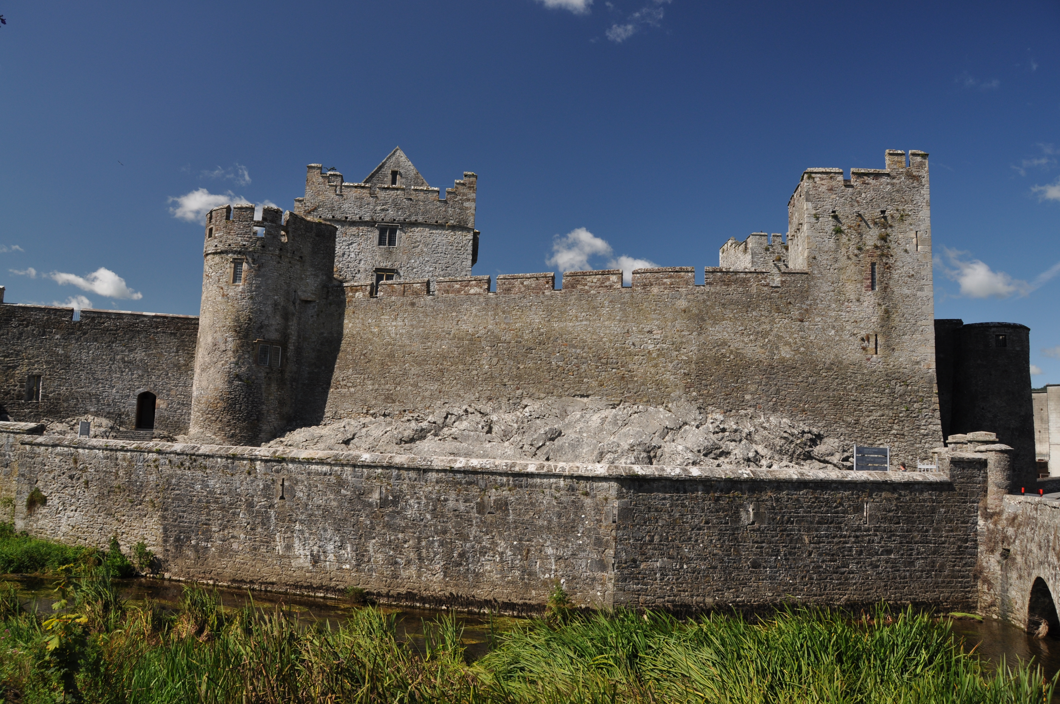
Cahir Castle
In 1650, Oliver Cromwell arrived at Cahir Castle with the full might of his army -- and the garrison surrendered without a single shot being fired. It was not the first time the castle had yielded, nor would the moment define it. What defines Cahir Castle is persistence: built in 1142 on a rocky island in the River Suir, it stands in the center of its County Tipperary town as one of the largest and best-preserved castles in all of Ireland, a fortress that has absorbed every century's violence and simply refused to disappear.
From Stone Fort to Norman Stronghold
Before the castle, there was a cathair -- an Irish stone fort that gave both the castle and the town their name. Conchobar Ua Briain, King of Thomond, began construction in 1142, positioning it to oppose Norman expansion northward from Ardfinnan Castle, four miles to the south. The core structure took shape in the 13th century under the O'Brien family, built in two distinct phases separated by roughly two hundred years. In the late 14th century, the castle passed to the powerful Butler dynasty, who enlarged and remodelled it over the next three centuries. Lady Margaret Butler, born around 1454 or 1465 at Kilkenny Castle to the Butler Earl of Ormond, married Sir William Boleyn and became the paternal grandmother of Anne Boleyn, the ill-fated second wife of Henry VIII.
Siege, Murder, and Surrender
Unlike their Anglican kinsmen, the Cahir branch of the Butler family sided with Catholic Ireland during the Elizabethan wars. In 1599, the Earl of Essex captured the castle after a three-day siege, placing it under Sir Charles Blount's command. Lord Cahir soon joined the Earl of Tyrone in rebellion and was attainted for treason, though he later received a full pardon. The castle walls witnessed darker things too: in 1627, Cahir's son-in-law Lord Dunboyne murdered his cousin James Prendergast inside the castle during a dispute over inheritance. He was tried and acquitted. During the Irish Confederate Wars of the 1640s, the castle was besieged twice more -- first surrendering to Murrough O'Brien after the Battle of Knocknanauss in 1647, then yielding bloodlessly to Cromwell in 1650.
The Treaty at Cahir
Perhaps the most consequential event at Cahir came not through siege but through negotiation. In March 1653, as resistance to Cromwell's conquest was collapsing, Irish commander Edmund O'Dwyer met English Colonel Jerome Sankey at the castle. They agreed a treaty for the surrender of Irish forces across County Tipperary and County Waterford, signed two weeks later. It was an ending that carried the weight of an era: centuries of Gaelic and Old English resistance to English control effectively concluded within these walls. By 1961, when the last Lord Cahir died, the castle had become state property and was declared a National Monument, now managed by the Office of Public Works.
Hollywood's Medieval Set
Cahir's extraordinary preservation has made it irresistible to filmmakers seeking an authentic medieval backdrop. John Boorman filmed battle scenes for Excalibur here in 1981. The castle later appeared in the television series The Tudors, the 2019 film The Green Knight, and Ridley Scott's The Last Duel in 2020, when Matt Damon, Jodie Comer, and Adam Driver were spotted on location. The castle's Great Hall, partly rebuilt in 1840 after the structure fell into ruin in the late 18th century, provides visitors with a sense of the scale at which the Butlers once lived. Walking through, you can trace the layers: 12th-century foundations, 15th-century modifications, 19th-century restoration, and 21st-century visitors following a path that eight hundred years of Irish history carved.
From the Air
Located at 52.37N, 7.93W in County Tipperary, on an island in the River Suir. The castle is clearly visible in the center of Cahir town. Nearest airports: Waterford (EIWF) approximately 60 km east, Kerry (EIKY) approximately 90 km southwest. Best viewed below 2,500 ft AGL. The River Suir and the Galtee Mountains to the south provide visual context.