Calf Canyon/Hermits Peak Fire: When the Government Started New Mexico's Worst Wildfire
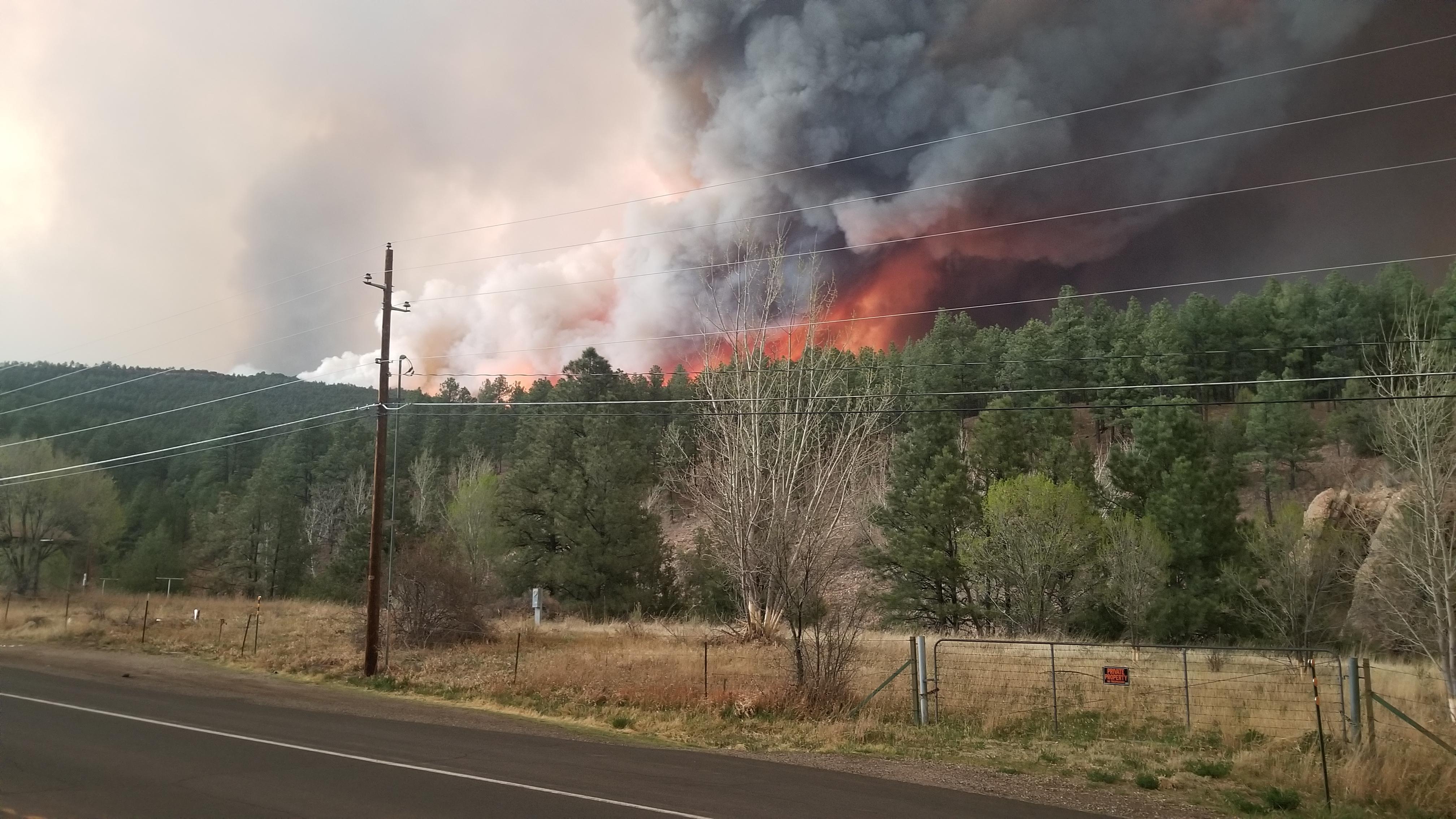
The fire that the U.S. Forest Service started on April 6, 2022, was supposed to be routine. The Las Dispensas prescribed burn in the Santa Fe National Forest was a standard fuel-reduction project, the kind agencies conduct thousands of times each year to prevent exactly the catastrophe that followed. But afternoon winds carried embers beyond the burn boundary, and within hours the controlled fire had a new name: the Hermits Peak Fire. Three days later, a separate blaze ignited from improperly extinguished burn piles left over from January. By April 22, hurricane-force winds merged the two fires into a single inferno that would burn across 341,735 acres of the southern Sangre de Cristo Mountains, becoming the largest and most destructive wildfire in New Mexico history.
A Perfect Storm of Drought and Wind
The spring of 2022 was one of New Mexico's top ten warmest on record and its sixth-driest. The American Southwest was deep into a historically severe megadrought that had persisted since roughly 2000, leaving forests parched and primed to burn. When the Hermits Peak Fire escaped its boundary on April 6, crews initially kept it manageable - by April 19, it covered 7,573 acres and was 91% contained. Then came the Calf Canyon Fire on April 9, sparked by smoldering pile burns the Forest Service had left from months earlier. On April 22, a red flag warning brought winds of 60 to 74 miles per hour. The two fires exploded to the northeast, crowning through treetops and throwing embers miles ahead. By the next morning, they had merged into a single footprint of over 42,000 acres.
Fire That Made Its Own Weather
Between April 29 and May 4, the combined blaze grew by more than 10,000 acres a day. An unprecedented week of severe fire weather beginning May 7 pushed the northern flank outward relentlessly. The fire generated pyrocumulus and pyrocumulonimbus clouds that reached tens of thousands of feet into the atmosphere, essentially creating its own thunderstorms minus the rain. By the time it was declared 100% contained on August 21, the fire stretched roughly 45 miles north to south and 20 miles east to west. It surpassed the 2012 Whitewater-Baldy Complex fire to become New Mexico's largest wildfire ever. At least 903 structures were destroyed, including several hundred homes, and 85 more were damaged.
Burning Down a Way of Life
The toll extended far beyond acreage and structures. Rob Martinez, New Mexico's state historian, said the blaze had burned down a way of life that lasted hundreds of years. The fire swept through rural Hispanic communities in San Miguel and Mora Counties whose roots stretch back centuries to when the region was the northern frontier of the Spanish Empire in the Americas. Hispanic residents make up roughly 80% of the population in both counties. Families lost homesteads that had been in continuous occupation for generations. The town of Las Vegas, New Mexico came within 20 days of running out of clean water after the fire compromised its watershed, and the only long-term solution proposed was replacing the entire water filtration system at a potential cost of 00 million.
The Government Pays
The political fallout was swift. Governor Michelle Lujan Grisham demanded restitution from the federal government, declaring the Forest Service needed to be held accountable. Congresswoman Teresa Leger Fernandez wrote that she was shocked that the Forest Service would perform a prescribed burn during these conditions. President Biden declared a major disaster on May 4 and visited New Mexico on June 11, announcing the U.S. Government would cover 100% of the costs. The USDA directed over 33 million toward recovery. On September 30, 2022, Biden signed the Hermits Peak Fire Assistance Act into law, establishing a FEMA-administered claims office. Yet relief proved slow, as FEMA procedures designed for floods and hurricanes were poorly adapted for wildfire recovery.
Scars on the Sangre de Cristos
From the air, the fire's legacy is unmistakable. The southern Sangre de Cristo Mountains bear a massive burn scar visible across three counties: San Miguel, Mora, and Taos. The fire forced the closure of the entire Pecos/Las Vegas Ranger District of the Santa Fe National Forest and five state parks. At the height of the fire season, three of New Mexico's five national forests were shut down entirely. The 2022 Calf Canyon/Hermits Peak Fire stands as a cautionary tale about prescribed burning in drought conditions, a reminder that the same tool meant to prevent catastrophe can cause one. For the families of the Sangre de Cristos, it marked the end of a world that had been quietly enduring for four hundred years.
From the Air
Located at 35.76N, 105.50W in the southern Sangre de Cristo Mountains of northern New Mexico. The burn scar is visible from cruising altitude, stretching approximately 45 miles north-south and 20 miles east-west across San Miguel, Mora, and Taos counties. Nearby airports include Las Vegas Municipal Airport (KLVS) and Santa Fe Regional Airport (KSAF). The terrain is mountainous with elevations from 6,000 to over 13,000 feet.